Estimated Value: $332,000 - $375,000
3
Beds
2
Baths
1,628
Sq Ft
$213/Sq Ft
Est. Value
About This Home
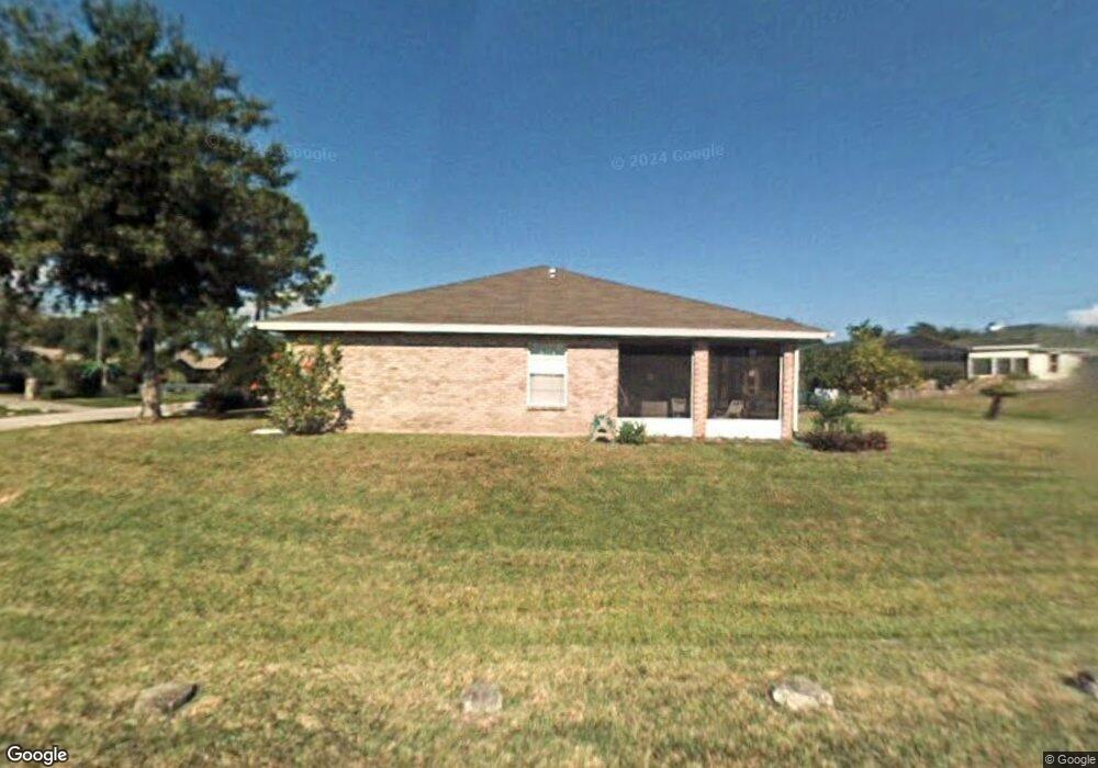
This home is located at 6715 Cedar Ave, Cocoa, FL 32927 and is currently estimated at $346,622, approximately $212 per square foot. 6715 Cedar Ave is a home located in Brevard County with nearby schools including Enterprise Elementary School, Space Coast Junior/Senior High School, and Sculptor Charter School.
Ownership History
Date
Name
Owned For
Owner Type
Purchase Details
Closed on
Mar 18, 2005
Sold by
Linxwiler Wesley L and Linxwiler Dorothy L
Bought by
Hannon Kathleen M
Current Estimated Value
Home Financials for this Owner
Home Financials are based on the most recent Mortgage that was taken out on this home.
Original Mortgage
$124,000
Outstanding Balance
$62,573
Interest Rate
5.54%
Estimated Equity
$284,049
Create a Home Valuation Report for This Property
The Home Valuation Report is an in-depth analysis detailing your home's value as well as a comparison with similar homes in the area
Home Values in the Area
Average Home Value in this Area
Purchase History
| Date | Buyer | Sale Price | Title Company |
|---|---|---|---|
| Hannon Kathleen M | $205,000 | Liberty Title |
Source: Public Records
Mortgage History
| Date | Status | Borrower | Loan Amount |
|---|---|---|---|
| Open | Hannon Kathleen M | $124,000 |
Source: Public Records
Tax History
| Year | Tax Paid | Tax Assessment Tax Assessment Total Assessment is a certain percentage of the fair market value that is determined by local assessors to be the total taxable value of land and additions on the property. | Land | Improvement |
|---|---|---|---|---|
| 2025 | $1,415 | $103,040 | -- | -- |
| 2024 | $1,345 | $100,140 | -- | -- |
| 2023 | $1,345 | $94,670 | $0 | $0 |
| 2022 | $1,253 | $91,920 | $0 | $0 |
| 2021 | $1,248 | $89,250 | $0 | $0 |
| 2020 | $1,184 | $88,020 | $0 | $0 |
| 2019 | $1,119 | $86,050 | $0 | $0 |
| 2018 | $1,110 | $84,450 | $0 | $0 |
| 2017 | $1,100 | $82,720 | $0 | $0 |
| 2016 | $1,099 | $81,020 | $18,000 | $63,020 |
| 2015 | $1,108 | $80,460 | $15,000 | $65,460 |
| 2014 | $1,108 | $79,830 | $11,000 | $68,830 |
Source: Public Records
Map
Nearby Homes
- 6760 Cairo Rd
- 6815 Bryant Rd
- 6615 Dock Ave
- 7065 Hundred Acre Dr
- 5555 Brandon St
- 6581 Bancroft Ave
- 6450 Ember Ave
- 00 Unknown
- 5095 Hogan Place
- 6990 Bryant Rd
- 5155 Mayflower St
- 6481 La Brea Ave
- 5165 Patricia St
- 5075 Carter St
- 6620 Grissom Pkwy
- 6438 Hudson Rd
- 5080 Mayflower St
- 5715 Fairbridge St
- 0000 Grissom Pkwy
- 7230 Venus Ave
Your Personal Tour Guide
Ask me questions while you tour the home.