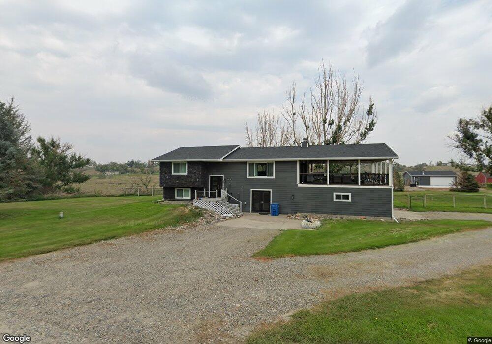
6715 Pinto Dr Shepherd, MT 59079
Estimated Value: $439,000 - $485,000
About This Home
This home is located at 6715 Pinto Dr, Shepherd, MT 59079 and is currently estimated at $467,169, approximately $196 per square foot. 6715 Pinto Dr is a home located in Yellowstone County with nearby schools including Shepherd Elementary School, Shepherd Middle School, and Shepherd High School.
Ownership History
We collect this data history from publicly available records. To have your information removed, we recommend requesting removal directly through your county’s website.
Purchase Details
Purchase History
We collect this data history from publicly available records. To have your information removed, we recommend requesting removal directly through your county’s website.
| Date | Buyer | Sale Price | Title Company |
|---|---|---|---|
| -- | -- |
Tax History
We collect this data history from publicly available records. To have your information removed, we recommend requesting removal directly through your county’s website.
| Year | Tax Paid | Tax Assessment Tax Assessment Total Assessment is a certain percentage of the fair market value that is determined by local assessors to be the total taxable value of land and additions on the property. | Land | Improvement |
|---|---|---|---|---|
| 2025 | $3,147 | $447,300 | $68,328 | $378,972 |
| 2024 | $3,147 | $363,700 | $55,245 | $308,455 |
| 2023 | $3,202 | $363,700 | $55,245 | $308,455 |
| 2022 | $2,758 | $293,300 | $0 | $0 |
| 2021 | $2,886 | $293,300 | $0 | $0 |
| 2020 | $2,711 | $265,500 | $0 | $0 |
| 2019 | $2,250 | $265,500 | $0 | $0 |
| 2018 | $2,086 | $230,600 | $0 | $0 |
| 2017 | $1,846 | $230,600 | $0 | $0 |
| 2016 | $2,028 | $238,900 | $0 | $0 |
| 2015 | $2,018 | $238,900 | $0 | $0 |
| 2014 | $1,668 | $105,364 | $0 | $0 |
Map
- 7851 Spear Dr
- 8730 Razor Creek Dr
- 6770 Eagle Bend Blvd
- 7340 Wild Game Trail
- 7420 Whitetail Run
- 6108 Kirby Rd
- 8230 Shepherd Rd
- 5524 Haynes Rd
- 8020 Wade St
- 5213 Shepherd Acton Rd
- 7104 Shepherd Rd
- 5430 Cerkoney Ln
- 6513 Frey Rd
- 9705 Shepherd Rd
- 6139 Linck Cir
- 0 Shepherd Road Lot Shepherd Rd
- 0 Shepherd Road Lot 2a Shepherd Rd
- 527 W D Rd
- 1679 Jute St
- 1650 Nahmis Ave
Ask me questions while you tour the home.