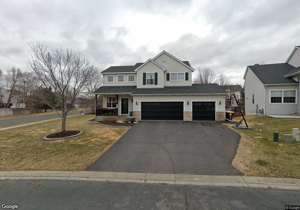
6718 Danbury Curve Shakopee, MN 55379
Estimated Value: $462,000 - $501,000
4
Beds
4
Baths
1,954
Sq Ft
$251/Sq Ft
Est. Value
About This Home
This home is located at 6718 Danbury Curve, Shakopee, MN 55379 and is currently estimated at $490,598, approximately $251 per square foot. 6718 Danbury Curve is a home located in Scott County with nearby schools including Red Oak Elementary School, Shakopee West Middle School, and Shakopee Senior High School.
Ownership History
Date
Name
Owned For
Owner Type
Purchase Details
Closed on
Sep 25, 2018
Sold by
Lee Eric A and Clevenger Lee Yumiko J
Bought by
Hamilton Haron Mary and Horan Mark
Current Estimated Value
Home Financials for this Owner
Home Financials are based on the most recent Mortgage that was taken out on this home.
Original Mortgage
$346,114
Outstanding Balance
$303,425
Interest Rate
4.75%
Mortgage Type
FHA
Estimated Equity
$187,173
Purchase Details
Closed on
Jun 30, 2004
Sold by
Ertz John T
Bought by
Lee Eric A and Lee Clevenger Yumiko J
Create a Home Valuation Report for This Property
The Home Valuation Report is an in-depth analysis detailing your home's value as well as a comparison with similar homes in the area
Home Values in the Area
Average Home Value in this Area
Purchase History
| Date | Buyer | Sale Price | Title Company |
|---|---|---|---|
| Hamilton Haron Mary | $352,500 | None Available | |
| Lee Eric A | $300,000 | -- |
Source: Public Records
Mortgage History
| Date | Status | Borrower | Loan Amount |
|---|---|---|---|
| Open | Hamilton Haron Mary | $346,114 |
Source: Public Records
Tax History Compared to Growth
Tax History
| Year | Tax Paid | Tax Assessment Tax Assessment Total Assessment is a certain percentage of the fair market value that is determined by local assessors to be the total taxable value of land and additions on the property. | Land | Improvement |
|---|---|---|---|---|
| 2025 | $4,624 | $451,800 | $155,700 | $296,100 |
| 2024 | $4,632 | $444,800 | $152,600 | $292,200 |
| 2023 | $4,666 | $433,400 | $148,200 | $285,200 |
| 2022 | $4,516 | $429,300 | $142,500 | $286,800 |
| 2021 | $3,902 | $359,800 | $119,100 | $240,700 |
| 2020 | $3,766 | $341,400 | $99,300 | $242,100 |
| 2019 | $3,572 | $294,300 | $92,100 | $202,200 |
| 2018 | $4,030 | $0 | $0 | $0 |
| 2016 | $3,920 | $0 | $0 | $0 |
| 2014 | -- | $0 | $0 | $0 |
Source: Public Records
Map
Nearby Homes
- 6869 Falmouth Curve
- 7287 Falmouth Curve
- 7263 Falmouth Curve
- 1463 Ashbourne Cir
- 7379 Devin Ln
- 1789 Windsor Dr S
- 1515 Yorkshire Ln
- 1411 Yorkshire Ln
- 7584 Derby Ln
- 7432 Whitehall Rd
- 1782 Switchgrass Cir
- 1683 Riverside Dr
- 1728 Riverside Dr
- 8439 Grove Place
- 2015 Brookview St
- Sheridan & Sheridan C Plan at Whispering Waters
- Preston I & II Plan at Whispering Waters
- Newport Plan at Whispering Waters
- Morgan Plan at Whispering Waters
- Mackenzie Plan at Whispering Waters
- 6708 Danbury Curve
- 6781 Carlisle Curve
- 6751 Carlisle Curve
- 6741 Carlisle Curve
- 6698 Danbury Curve
- 6740 Greenbriar Curve
- 6721 Carlisle Curve
- 6792 Greenbriar Curve
- 6688 Danbury Curve
- 6844 Greenbriar Curve
- 6701 Carlisle Curve
- 6896 Greenbriar Curve
- 6671 Danbury Curve
- 6948 Greenbriar Curve
- 6691 Carlisle Curve
- 6678 Danbury Curve
- 6778 Carlisle Curve
- 6788 Carlisle Curve
- 6768 Carlisle Curve
- 6671 Carlisle Curve