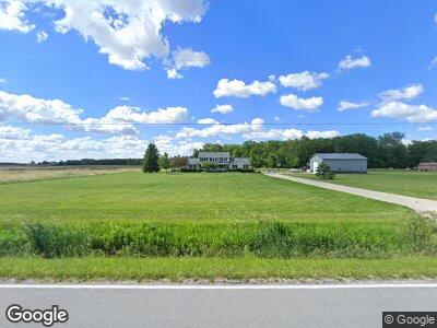
6719 Cygnet Rd Bloomdale, OH 44817
Estimated Value: $278,000 - $597,000
4
Beds
3
Baths
2,700
Sq Ft
$164/Sq Ft
Est. Value
About This Home
This home is located at 6719 Cygnet Rd, Bloomdale, OH 44817 and is currently estimated at $443,396, approximately $164 per square foot. 6719 Cygnet Rd is a home located in Wood County with nearby schools including Elmwood Elementary School, Elmwood Middle School, and Elmwood High School.
Ownership History
Date
Name
Owned For
Owner Type
Purchase Details
Closed on
Apr 16, 1998
Sold by
Bresler Phillip and Bresler Deanna
Bought by
Weiss Scott R and Weiss Christie Dale
Current Estimated Value
Create a Home Valuation Report for This Property
The Home Valuation Report is an in-depth analysis detailing your home's value as well as a comparison with similar homes in the area
Home Values in the Area
Average Home Value in this Area
Purchase History
| Date | Buyer | Sale Price | Title Company |
|---|---|---|---|
| Weiss Scott R | $4,000 | -- |
Source: Public Records
Mortgage History
| Date | Status | Borrower | Loan Amount |
|---|---|---|---|
| Open | Weiss Scott R | $230,000 | |
| Closed | Weiss Scott R | $50,000 | |
| Closed | Weiss Scott R | $7,000 | |
| Closed | Weiss Scott R | $225,000 | |
| Closed | Weiss Scott R | $10,000 | |
| Closed | Weiss Scott R | $232,000 | |
| Closed | Weiss Scott R | $30,000 | |
| Closed | Weiss Scott R | $175,000 | |
| Closed | Weiss Scott R | $175,000 | |
| Closed | Weiss Scott R | $27,000 | |
| Closed | Weiss Scott R | $168,000 |
Source: Public Records
Tax History Compared to Growth
Tax History
| Year | Tax Paid | Tax Assessment Tax Assessment Total Assessment is a certain percentage of the fair market value that is determined by local assessors to be the total taxable value of land and additions on the property. | Land | Improvement |
|---|---|---|---|---|
| 2023 | $4,746 | $124,710 | $13,970 | $110,740 |
| 2021 | $3,991 | $99,550 | $11,940 | $87,610 |
| 2020 | $3,595 | $89,080 | $11,940 | $77,140 |
| 2019 | $3,239 | $80,820 | $11,940 | $68,880 |
| 2018 | $3,239 | $80,820 | $11,940 | $68,880 |
| 2017 | $3,025 | $80,820 | $11,940 | $68,880 |
| 2016 | $2,742 | $72,940 | $10,430 | $62,510 |
| 2015 | $2,742 | $72,940 | $10,430 | $62,510 |
| 2014 | $2,903 | $72,940 | $10,430 | $62,510 |
| 2013 | $3,016 | $72,940 | $10,430 | $62,510 |
Source: Public Records
Map
Nearby Homes
- 5788 Emerson Rd
- 504 N Main St
- 7039 Bradner Rd
- 140 Lockhart Ave
- 945 W Main St
- 211 Luther St
- 16982 State Route 613
- 111 Salem St
- 372 Township Rd 236
- 8492 Us Highway 23
- 8492 Sr 23
- 2435 N Fostoria Rd
- 2435 Fostoria Rd
- 13451 Freyman Rd
- 1721 N Union St
- 1401 Van Buren St Unit U28
- 11725 Pemberville Rd
- 480 Monroe St
- 616 Hart Ave
- 440 Union Ct