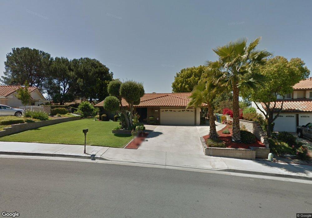
6735 Roanoak Place Riverside, CA 92506
Canyon Crest NeighborhoodEstimated Value: $740,228 - $817,000
4
Beds
3
Baths
2,175
Sq Ft
$358/Sq Ft
Est. Value
About This Home
This home is located at 6735 Roanoak Place, Riverside, CA 92506 and is currently estimated at $778,807, approximately $358 per square foot. 6735 Roanoak Place is a home located in Riverside County with nearby schools including William Howard Taft Elementary School, Amelia Earhart Middle School, and Martin Luther King Junior High School.
Ownership History
Date
Name
Owned For
Owner Type
Purchase Details
Closed on
Jan 16, 2026
Sold by
Swoboda Carole Anne
Bought by
Swoboda Family Revocable Living Trust and Swoboda
Current Estimated Value
Purchase Details
Closed on
Jan 27, 2022
Sold by
Swoboda Carole A
Bought by
Swoboda Carole A and Swoboda Robert A
Purchase Details
Closed on
Sep 14, 2015
Sold by
Swoboda Carole A
Bought by
The Swoboda Family Revocable Living Trus
Purchase Details
Closed on
Jan 16, 2002
Sold by
Swoboda Robert A
Bought by
Swoboda Carole A
Purchase Details
Closed on
Apr 27, 1999
Sold by
Yim Seong Bae and Yim Weon Bae
Bought by
Desert Financial Group
Create a Home Valuation Report for This Property
The Home Valuation Report is an in-depth analysis detailing your home's value as well as a comparison with similar homes in the area
Home Values in the Area
Average Home Value in this Area
Purchase History
| Date | Buyer | Sale Price | Title Company |
|---|---|---|---|
| Swoboda Family Revocable Living Trust | -- | None Listed On Document | |
| Swoboda Carole A | -- | None Listed On Document | |
| The Swoboda Family Revocable Living Trus | -- | None Available | |
| Swoboda Carole A | -- | First American Title Co | |
| Swoboda Carole A | -- | First American Title Co | |
| Desert Financial Group | -- | First American Title Co |
Source: Public Records
Tax History
| Year | Tax Paid | Tax Assessment Tax Assessment Total Assessment is a certain percentage of the fair market value that is determined by local assessors to be the total taxable value of land and additions on the property. | Land | Improvement |
|---|---|---|---|---|
| 2025 | $3,942 | $369,296 | $88,621 | $280,675 |
| 2023 | $3,942 | $354,958 | $85,181 | $269,777 |
| 2022 | $3,849 | $347,999 | $83,511 | $264,488 |
| 2021 | $3,800 | $341,176 | $81,874 | $259,302 |
| 2020 | $3,771 | $337,679 | $81,035 | $256,644 |
| 2019 | $3,699 | $331,059 | $79,447 | $251,612 |
| 2018 | $3,626 | $324,569 | $77,891 | $246,678 |
| 2017 | $3,561 | $318,206 | $76,364 | $241,842 |
| 2016 | $3,331 | $311,967 | $74,867 | $237,100 |
| 2015 | $3,283 | $307,284 | $73,744 | $233,540 |
| 2014 | $3,250 | $301,266 | $72,300 | $228,966 |
Source: Public Records
Map
Nearby Homes
- 6801 Rycroft Dr
- 6910 Sandtrack Rd
- 0 Via Vista Dr Unit IV25239083
- 6282 Shaker Dr
- 0 Apn#245080005 Unit IV26001513
- 3425 Arlington
- 6863 Canyon Hill Dr
- 1003 Clearwood Ave
- 1956 Middle Creek Rd
- 6204 Claridge Dr
- 6966 Ranch View Rd
- 1719 Crystal Ridge Ct
- 7007 Golden Vale Dr
- 902 Cannon Rd
- 6743 Canyon Hill Dr
- 6213 Academy Ave
- 7158 Golden Vale Dr
- 7361 Via Vista Dr
- 7282 Magnon Ct
- 7390 Corinthian Way
- 6761 Roanoak Place
- 6721 Roanoak Place
- 6724 Redlands Ct
- 6736 Redlands Ct
- 6760 Redlands Ct
- 6716 Redlands Ct
- 6787 Roanoak Place
- 6730 Roanoak Place
- 6760 Roanoak Place
- 6776 Redlands Ct
- 6656 Wilding Place
- 6788 Roanoak Place
- 6666 Wilding Place
- 1400 Tiffany Dr
- 6646 Wilding Place
- 6757 Wilding Place
- 6727 Redlands Ct
- 6708 Wilding Place
- 1420 Tiffany Dr
- 6711 Redlands Ct
Your Personal Tour Guide
Ask me questions while you tour the home.