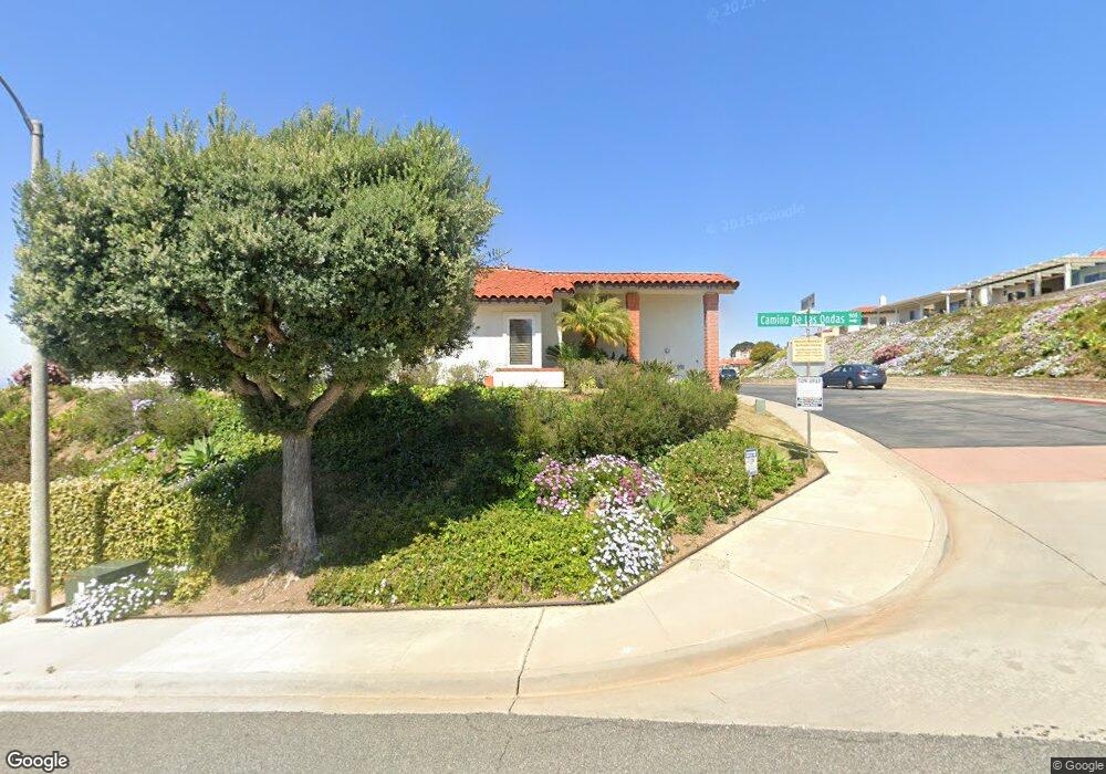
6751 Nepeta Way Carlsbad, CA 92011
Poinsettia NeighborhoodEstimated Value: $1,061,000 - $1,174,000
3
Beds
2
Baths
1,346
Sq Ft
$848/Sq Ft
Est. Value
About This Home
This home is located at 6751 Nepeta Way, Carlsbad, CA 92011 and is currently estimated at $1,141,862, approximately $848 per square foot. 6751 Nepeta Way is a home located in San Diego County with nearby schools including Pacific Rim Elementary, Aviara Oaks Middle, and Carlsbad High School.
Ownership History
Date
Name
Owned For
Owner Type
Purchase Details
Closed on
Feb 23, 2023
Sold by
Wald Philip
Bought by
Philip D Wald Revocable Living Trust
Current Estimated Value
Purchase Details
Closed on
Jan 6, 2022
Sold by
Van Wassenhove 1997 Trust
Bought by
Wald Philip
Home Financials for this Owner
Home Financials are based on the most recent Mortgage that was taken out on this home.
Original Mortgage
$550,000
Interest Rate
3.11%
Mortgage Type
New Conventional
Purchase Details
Closed on
Jul 11, 2002
Sold by
Hensen Stephen J
Bought by
Vanwassenhove Robert E and Vanwassenhove Marilyn A
Home Financials for this Owner
Home Financials are based on the most recent Mortgage that was taken out on this home.
Original Mortgage
$60,000
Interest Rate
6.69%
Purchase Details
Closed on
Nov 7, 2001
Sold by
Denny Marie K
Bought by
Denny Marie K and The Marie K Denny Revocable Trust
Create a Home Valuation Report for This Property
The Home Valuation Report is an in-depth analysis detailing your home's value as well as a comparison with similar homes in the area
Home Values in the Area
Average Home Value in this Area
Purchase History
| Date | Buyer | Sale Price | Title Company |
|---|---|---|---|
| Philip D Wald Revocable Living Trust | -- | -- | |
| Wald Philip | $929,000 | Wfg Title Insurance | |
| Vanwassenhove Robert E | $320,000 | Commonwealth Land Title Co | |
| Denny Marie K | -- | -- |
Source: Public Records
Mortgage History
| Date | Status | Borrower | Loan Amount |
|---|---|---|---|
| Previous Owner | Wald Philip | $550,000 | |
| Previous Owner | Vanwassenhove Robert E | $60,000 |
Source: Public Records
Tax History Compared to Growth
Tax History
| Year | Tax Paid | Tax Assessment Tax Assessment Total Assessment is a certain percentage of the fair market value that is determined by local assessors to be the total taxable value of land and additions on the property. | Land | Improvement |
|---|---|---|---|---|
| 2025 | $10,878 | $1,037,881 | $795,906 | $241,975 |
| 2024 | $10,878 | $1,017,531 | $780,300 | $237,231 |
| 2023 | $10,823 | $860,000 | $680,000 | $180,000 |
| 2022 | $9,379 | $860,000 | $680,000 | $180,000 |
| 2021 | $4,683 | $428,159 | $285,440 | $142,719 |
| 2020 | $4,651 | $423,770 | $282,514 | $141,256 |
| 2019 | $4,566 | $415,462 | $276,975 | $138,487 |
| 2018 | $4,373 | $407,317 | $271,545 | $135,772 |
| 2017 | $4,299 | $399,331 | $266,221 | $133,110 |
| 2016 | $4,125 | $391,501 | $261,001 | $130,500 |
| 2015 | $4,099 | $385,621 | $257,081 | $128,540 |
| 2014 | $4,030 | $378,069 | $252,046 | $126,023 |
Source: Public Records
Map
Nearby Homes
- 839 Skysail Ave
- 803 Skysail Ave
- 911 Caminito Madrigal Unit E
- 909 Caminito Madrigal Unit B
- 874 Marigold Ct
- 811 Caminito Del Sol
- 6951 Quiet Cove Dr
- 6925 Waters End Dr
- 6915 Pear Tree Dr
- 609 Saltgrass Ave
- 6550 Ponto Dr Unit 14
- 6550 Ponto Dr Unit 76
- 6550 Ponto Dr Unit 78
- 6550 Ponto Dr Unit 135
- 6550 Ponto Dr Unit 110
- 6550 Ponto Dr Unit SPC 39
- 6550 Ponto Dr Unit 5
- 7013 Lavender Way
- 6777 Lonicera St
- 7025 San Bartolo St Unit 42
- 6749 Nepeta Way
- 6753 Nepeta Way
- 6747 Nepeta Way Unit 4
- 6755 Nepeta Way
- 6757 Nepeta Way
- 6745 Nepeta Way
- 6753 Montia Ct
- 6751 Russelia Ct
- 6751 Montia Ct
- 6755 Montia Ct
- 6747 Russelia Ct
- 6759 Nepeta Way
- 6749 Montia Ct
- 6745 Russelia Ct
- 6743 Nepeta Way
- 6747 Montia Ct
- 6757 Montia Ct
- 6743 Russelia Ct
- 6757 Russelia Ct
- 6759 Montia Ct