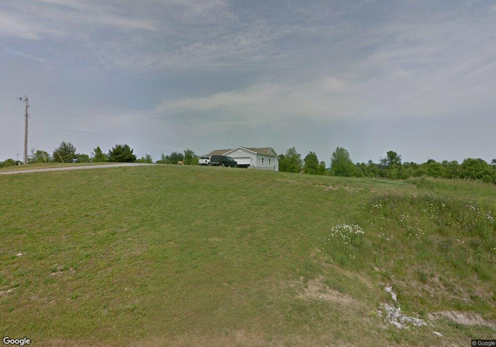
676 Eckstein Rd Crestline, OH 44827
Estimated Value: $156,000 - $231,834
3
Beds
1
Bath
1,456
Sq Ft
$140/Sq Ft
Est. Value
About This Home
This home is located at 676 Eckstein Rd, Crestline, OH 44827 and is currently estimated at $204,278, approximately $140 per square foot. 676 Eckstein Rd is a home located in Richland County with nearby schools including Stingel Elementary School, Ontario Middle School, and Ontario High School.
Ownership History
Date
Name
Owned For
Owner Type
Purchase Details
Closed on
Mar 6, 2024
Sold by
James Jeffrey and James Lisa Ann
Bought by
James Jeffrey and James Lisa Ann
Current Estimated Value
Purchase Details
Closed on
Jun 2, 1998
Sold by
Perman Donald
Bought by
Noe Rebecca L
Home Financials for this Owner
Home Financials are based on the most recent Mortgage that was taken out on this home.
Original Mortgage
$23,000
Interest Rate
7.27%
Mortgage Type
New Conventional
Create a Home Valuation Report for This Property
The Home Valuation Report is an in-depth analysis detailing your home's value as well as a comparison with similar homes in the area
Home Values in the Area
Average Home Value in this Area
Purchase History
| Date | Buyer | Sale Price | Title Company |
|---|---|---|---|
| James Jeffrey | -- | None Listed On Document | |
| Noe Rebecca L | $17,000 | -- |
Source: Public Records
Mortgage History
| Date | Status | Borrower | Loan Amount |
|---|---|---|---|
| Previous Owner | Noe Rebecca L | $23,000 |
Source: Public Records
Tax History
| Year | Tax Paid | Tax Assessment Tax Assessment Total Assessment is a certain percentage of the fair market value that is determined by local assessors to be the total taxable value of land and additions on the property. | Land | Improvement |
|---|---|---|---|---|
| 2024 | $2,726 | $55,340 | $13,820 | $41,520 |
| 2023 | $2,819 | $55,340 | $13,820 | $41,520 |
| 2022 | $2,562 | $43,310 | $12,570 | $30,740 |
| 2021 | $2,567 | $43,310 | $12,570 | $30,740 |
| 2020 | $2,741 | $43,310 | $12,570 | $30,740 |
| 2019 | $2,566 | $36,700 | $10,650 | $26,050 |
| 2018 | $2,188 | $36,700 | $10,650 | $26,050 |
| 2017 | $2,132 | $36,700 | $10,650 | $26,050 |
| 2016 | $2,110 | $35,740 | $10,330 | $25,410 |
| 2015 | $2,108 | $35,740 | $10,330 | $25,410 |
| 2014 | $2,112 | $35,740 | $10,330 | $25,410 |
| 2012 | $1,952 | $36,840 | $10,650 | $26,190 |
Source: Public Records
Map
Nearby Homes
- 4310 Snodgrass Rd
- 0 Snodgrass Rd
- 3872 Snodgrass Rd
- 3880 Horizon Dr
- 5263 Lincoln Hwy
- 3670 Pearl St
- 0 Rudy Rd
- 3560 Park Ave W
- 1689 Ohio 314
- 1689 State Route 314
- 1260 Thrush Rd
- 3320 Oakstone Dr
- 3516 Muirfield
- 3516 Muirfield Dr
- 3308 Park Ave W
- 3767 Cookton Grange Rd
- 847 S Horning Rd
- 820 South St
- 855 Bowers Rd
- 714 South St
- 749 Eckstein Rd
- 701 Eckstein Rd
- 730 Eckstein Rd
- 645 Eckstein Rd
- 739 Eckstein Rd
- 771 Eckstein Rd
- 950 Eckstein Rd
- 780 Eckstein Rd
- 535 All American Dr
- 4660 State Route 181
- 4629 State Route 181
- 4639 State Route 181
- 790 Eckstein Rd
- 4655 State Route 181
- 4565 State Route 181
- 4664 State Route 181
- 515 All American Dr
- 4653 State Route 181
- 4655 Ohio 181
- 4666 State Route 181
Your Personal Tour Guide
Ask me questions while you tour the home.