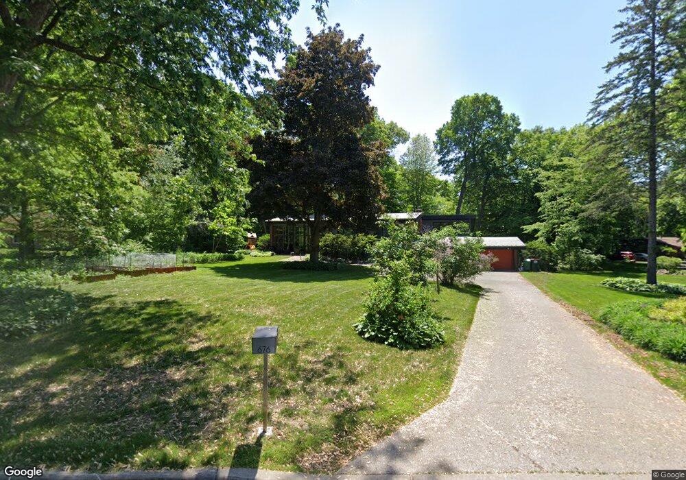
676 Maple Park Dr Saint Paul, MN 55118
Estimated Value: $738,085 - $800,000
3
Beds
3
Baths
2,210
Sq Ft
$347/Sq Ft
Est. Value
About This Home
This home is located at 676 Maple Park Dr, Saint Paul, MN 55118 and is currently estimated at $767,521, approximately $347 per square foot. 676 Maple Park Dr is a home located in Dakota County with nearby schools including Somerset Elementary School, Heritage E-STEM Magnet School, and Two Rivers High School.
Ownership History
Date
Name
Owned For
Owner Type
Purchase Details
Closed on
Jun 9, 2015
Sold by
Hasday Joseph P and Kanodia Reena
Bought by
Louis E Newman Revocable Trust and Eilberg Amy B
Current Estimated Value
Purchase Details
Closed on
Oct 3, 2003
Sold by
Gorton James G and Gorton Kristen F
Bought by
Gourik Christopher D and Gourik Devee J
Purchase Details
Closed on
May 29, 2002
Sold by
Nisita Maurizio and Nisita Laura
Bought by
Gorten James G and Gorten Kristen F
Create a Home Valuation Report for This Property
The Home Valuation Report is an in-depth analysis detailing your home's value as well as a comparison with similar homes in the area
Home Values in the Area
Average Home Value in this Area
Purchase History
| Date | Buyer | Sale Price | Title Company |
|---|---|---|---|
| Louis E Newman Revocable Trust | $610,000 | Home Title Inc | |
| Gourik Christopher D | $535,000 | -- | |
| Gorten James G | $440,000 | -- |
Source: Public Records
Tax History Compared to Growth
Tax History
| Year | Tax Paid | Tax Assessment Tax Assessment Total Assessment is a certain percentage of the fair market value that is determined by local assessors to be the total taxable value of land and additions on the property. | Land | Improvement |
|---|---|---|---|---|
| 2024 | $7,070 | $732,200 | $265,900 | $466,300 |
| 2023 | $6,712 | $716,200 | $259,900 | $456,300 |
| 2022 | $6,526 | $717,300 | $259,300 | $458,000 |
| 2021 | $6,694 | $626,100 | $225,500 | $400,600 |
| 2020 | $6,352 | $632,500 | $214,700 | $417,800 |
| 2019 | $6,157 | $585,900 | $204,500 | $381,400 |
| 2018 | $5,579 | $546,200 | $191,100 | $355,100 |
| 2017 | $5,475 | $518,800 | $182,000 | $336,800 |
| 2016 | $5,133 | $495,500 | $173,300 | $322,200 |
| 2015 | $4,821 | $468,600 | $173,300 | $295,300 |
| 2014 | -- | $424,100 | $163,500 | $260,600 |
| 2013 | -- | $388,623 | $157,856 | $230,767 |
Source: Public Records
Map
Nearby Homes
- 679 Maple Park Dr
- 13XX Clement St
- 648 Sunset Ln
- 625 Ivy Falls Ave
- 1174 Dodd Rd
- 1330 Wachtler Ave
- 1164 Dodd Rd
- 1328 Riverside Ln
- 8 Dorset Rd
- 1320 Riverside Ln Unit 303
- 1320 Riverside Ln Unit 112
- 1000 Winston Cir
- 606 Sutcliff Cir
- 1172 Ottawa Ave
- 421 Ruby Dr
- 967 Cherokee Ave
- 600 Wentworth Ave
- 955 Cherokee Ave
- 1513 Smith Ave S
- 685 Hidden Creek Trail
- 670 Maple Park Dr
- 667 Ivy Falls Ct
- 680 Maple Park Dr
- 684 Maple Park Dr
- 661 Ivy Falls Ct
- 1165 Sylvandale Rd
- 675 Ivy Falls Ct
- 664 Maple Park Dr
- 669 Maple Park Dr
- 1205 Sylvandale Rd
- 689 Maple Park Dr
- 694 Maple Park Dr
- 1198 Falls View Ct
- 663 Maple Park Dr
- 680 Arcadia Dr
- 688 Arcadia Dr
- 1231 Sylvandale Rd
- 662 Ivy Falls Ct
- 1220 Sylvandale Rd
- 1200 Sylvandale Rd