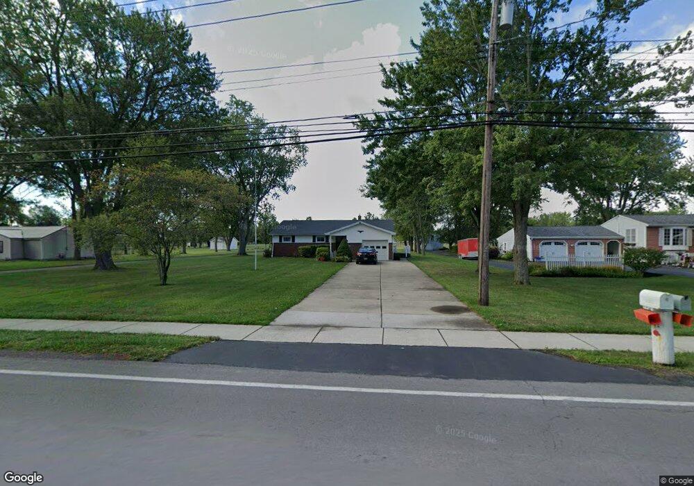
6762 E High St Lockport, NY 14094
Estimated Value: $224,000 - $251,950
3
Beds
1
Bath
1,297
Sq Ft
$189/Sq Ft
Est. Value
About This Home
This home is located at 6762 E High St, Lockport, NY 14094 and is currently estimated at $244,488, approximately $188 per square foot. 6762 E High St is a home located in Niagara County with nearby schools including Aaron Mossell Junior High School, Lockport High School, and DeSales Catholic School.
Ownership History
Date
Name
Owned For
Owner Type
Purchase Details
Closed on
Feb 9, 2018
Sold by
Winters Charles L and Walker Carol
Bought by
Walker Troy A
Current Estimated Value
Home Financials for this Owner
Home Financials are based on the most recent Mortgage that was taken out on this home.
Original Mortgage
$62,000
Outstanding Balance
$52,508
Interest Rate
3.99%
Mortgage Type
New Conventional
Estimated Equity
$191,980
Purchase Details
Closed on
Jun 5, 2014
Sold by
Winters Charles W
Bought by
Winter Charles L and Walker Carol
Purchase Details
Closed on
Apr 17, 2007
Sold by
Winters Charles
Bought by
Winters Charles and Winters Winters
Purchase Details
Closed on
Nov 29, 2004
Sold by
Winters Chas
Bought by
Winters Charles
Purchase Details
Closed on
Nov 8, 2004
Sold by
Winters Chas
Bought by
Winters Charles
Create a Home Valuation Report for This Property
The Home Valuation Report is an in-depth analysis detailing your home's value as well as a comparison with similar homes in the area
Home Values in the Area
Average Home Value in this Area
Purchase History
| Date | Buyer | Sale Price | Title Company |
|---|---|---|---|
| Walker Troy A | $105,000 | -- | |
| Winter Charles L | -- | None Available | |
| Winters Charles | -- | Gregory Pope | |
| Winters Charles | -- | Henrik Hansen | |
| Winters Charles | -- | Henrik Hansen |
Source: Public Records
Mortgage History
| Date | Status | Borrower | Loan Amount |
|---|---|---|---|
| Open | Walker Troy A | $62,000 |
Source: Public Records
Tax History
| Year | Tax Paid | Tax Assessment Tax Assessment Total Assessment is a certain percentage of the fair market value that is determined by local assessors to be the total taxable value of land and additions on the property. | Land | Improvement |
|---|---|---|---|---|
| 2024 | $6,023 | $225,600 | $24,500 | $201,100 |
| 2023 | $5,327 | $199,000 | $24,500 | $174,500 |
| 2022 | $5,295 | $181,000 | $24,500 | $156,500 |
| 2021 | $5,163 | $139,500 | $24,500 | $115,000 |
| 2020 | $4,596 | $139,500 | $24,500 | $115,000 |
| 2019 | $2,240 | $135,000 | $24,500 | $110,500 |
| 2018 | $3,744 | $105,500 | $24,500 | $81,000 |
| 2017 | $2,240 | $105,500 | $24,500 | $81,000 |
| 2016 | $2,378 | $102,500 | $24,500 | $78,000 |
| 2015 | -- | $102,500 | $24,500 | $78,000 |
| 2014 | -- | $102,500 | $23,500 | $79,000 |
Source: Public Records
Map
Nearby Homes
- 6761 E High St
- 6836 E High St
- 1 The Common
- 6954 Academy Ln
- 50 Briarwood Dr
- VL Akron Rd Lot #3
- 7052 E High St
- 84 Davison Ct
- 1000 Ernest Rd
- 76 Elizabeth Dr
- 168 Continental Dr
- 100 Pennsylvania Ave
- 92 Lindhurst Dr
- 120 Autumnvale Dr
- 13 Standish Rd
- 7003 James Francis
- 7043 James Francis
- 7045 James Francis
- 603 Walnut St
- 18 Hoover Pkwy
- 6758 E High St
- 6770 E High St
- 6752 E High St
- 6765 E High St
- 6769 E High St
- 6748 E High St
- 6755 E High St
- 6776 E High St
- 6744 E High St
- 6784 E High St
- 6747 E High St
- 6788 E High St
- 5203 Magnolia Dr Unit B
- 5203A Magnolia Dr
- 5203 Magnolia Dr Unit A
- 5203A Magnolia Dr Unit A
- 5201A Magnolia Dr
- 5201B Magnolia Dr
- 5203B Magnolia Dr
- 6741 E High St
Your Personal Tour Guide
Ask me questions while you tour the home.