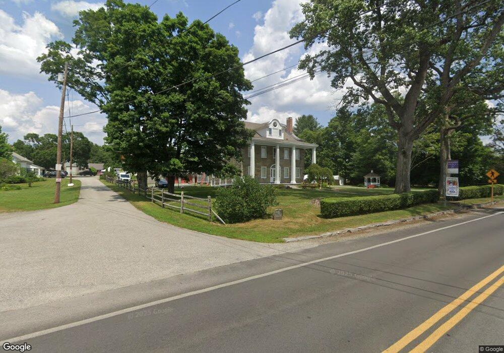
677 Great Rd Lincoln, RI 02865
Lime Rock NeighborhoodEstimated Value: $1,203,556
5
Beds
2
Baths
5,162
Sq Ft
$233/Sq Ft
Est. Value
About This Home
This home is located at 677 Great Rd, Lincoln, RI 02865 and is currently estimated at $1,203,556, approximately $233 per square foot. 677 Great Rd is a home with nearby schools including Lincoln Senior High School, Blackstone Valley Prep Upper Elementary School, and Blackstone Valley Prep Elementary School 1.
Ownership History
Date
Name
Owned For
Owner Type
Purchase Details
Closed on
Jan 9, 1996
Sold by
Mowbray Mowbray E and Mowbray Penelope
Bought by
Lincoln Rhode Island
Current Estimated Value
Purchase Details
Closed on
Dec 21, 1993
Sold by
Westbound Assoc Lp
Bought by
Fusco Michael T and Fusco Rose
Home Financials for this Owner
Home Financials are based on the most recent Mortgage that was taken out on this home.
Original Mortgage
$20,000
Interest Rate
7.03%
Create a Home Valuation Report for This Property
The Home Valuation Report is an in-depth analysis detailing your home's value as well as a comparison with similar homes in the area
Home Values in the Area
Average Home Value in this Area
Purchase History
| Date | Buyer | Sale Price | Title Company |
|---|---|---|---|
| Lincoln Rhode Island | $300,000 | -- | |
| Fusco Michael T | $47,500 | -- |
Source: Public Records
Mortgage History
| Date | Status | Borrower | Loan Amount |
|---|---|---|---|
| Previous Owner | Fusco Michael T | $20,000 |
Source: Public Records
Tax History Compared to Growth
Tax History
| Year | Tax Paid | Tax Assessment Tax Assessment Total Assessment is a certain percentage of the fair market value that is determined by local assessors to be the total taxable value of land and additions on the property. | Land | Improvement |
|---|---|---|---|---|
| 2025 | -- | $1,004,800 | $207,300 | $797,500 |
| 2024 | -- | $787,300 | $174,800 | $612,500 |
| 2023 | $0 | $787,300 | $174,800 | $612,500 |
| 2022 | $0 | $787,300 | $174,800 | $612,500 |
| 2021 | $0 | $675,900 | $118,600 | $557,300 |
| 2020 | $0 | $675,900 | $118,600 | $557,300 |
| 2018 | $0 | $597,200 | $121,800 | $475,400 |
| 2017 | $0 | $597,200 | $121,800 | $475,400 |
| 2016 | -- | $597,200 | $121,800 | $475,400 |
| 2015 | -- | $614,600 | $117,200 | $497,400 |
| 2014 | -- | $614,600 | $117,200 | $497,400 |
Source: Public Records
Map
Nearby Homes
- 1 Pat Dr
- 2 Preserved Arnold Ct
- 41 Breakneck Hill Rd Unit 41
- 4 Avenue E
- 34 Dexter Rock Rd
- 1004 Great Rd
- 7 Maria St
- 1 Ashley Dr
- 9 Burwell St
- 73 Tucker St
- 75 Kelly St
- 1796 Old Louisquisset Pike
- 1688 Old Louisquisset Pike
- 748 Lower River Rd
- 6 Streamview Dr
- 1746 Lonsdale Ave Unit 10
- 500 Mendon Rd Unit 216
- 500 Mendon Rd Unit 403
- 500 Mendon Rd Unit 302
- 500 Mendon Rd Unit 105