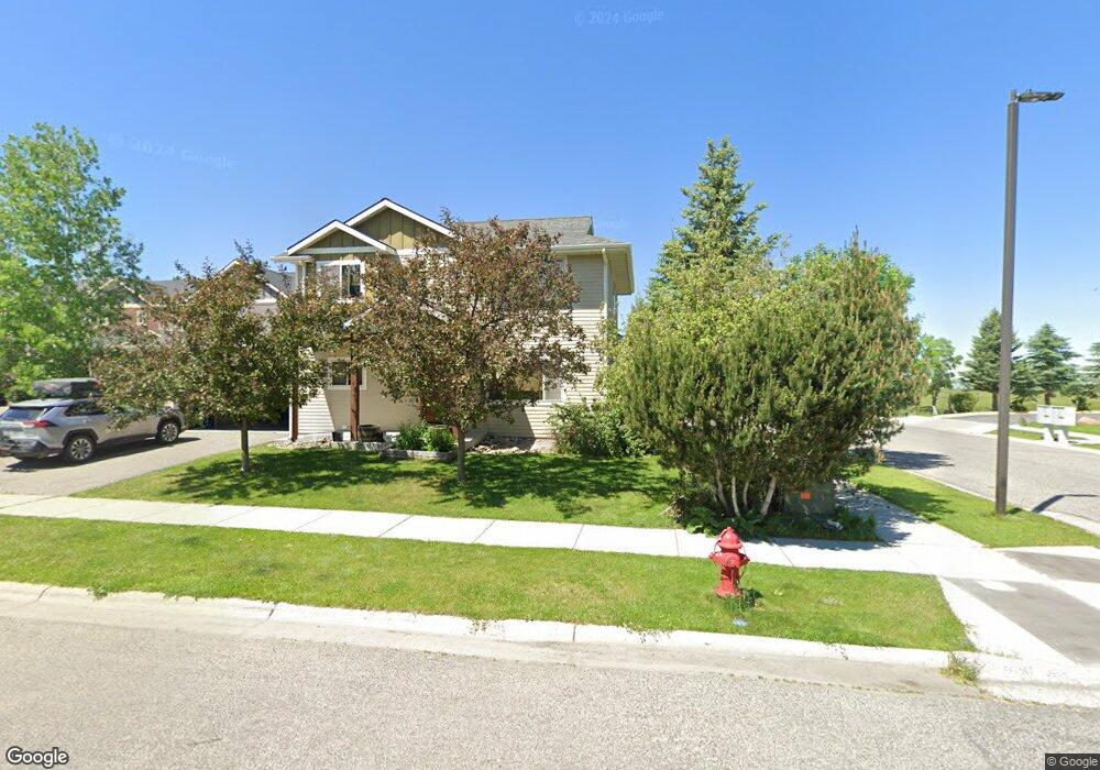
677 Westgate Ave Bozeman, MT 59718
Flanders Creek NeighborhoodEstimated Value: $512,000 - $528,000
3
Beds
3
Baths
1,728
Sq Ft
$301/Sq Ft
Est. Value
About This Home
This home is located at 677 Westgate Ave, Bozeman, MT 59718 and is currently estimated at $519,659, approximately $300 per square foot. 677 Westgate Ave is a home located in Gallatin County with nearby schools including Meadowlark Elementary School, Chief Joseph Middle School, and Gallatin High School.
Ownership History
Date
Name
Owned For
Owner Type
Purchase Details
Closed on
Apr 14, 2023
Sold by
2500 Llc
Bought by
2020 Jeffery Lee Perry Living Trust and Perry
Current Estimated Value
Purchase Details
Closed on
Feb 14, 2007
Sold by
Red Barn Properties Llc
Bought by
Reece Jerimiah and Reece Erika L
Home Financials for this Owner
Home Financials are based on the most recent Mortgage that was taken out on this home.
Original Mortgage
$112,000
Interest Rate
6.19%
Mortgage Type
Purchase Money Mortgage
Create a Home Valuation Report for This Property
The Home Valuation Report is an in-depth analysis detailing your home's value as well as a comparison with similar homes in the area
Home Values in the Area
Average Home Value in this Area
Purchase History
| Date | Buyer | Sale Price | Title Company |
|---|---|---|---|
| 2020 Jeffery Lee Perry Living Trust | -- | None Listed On Document | |
| Reece Jerimiah | -- | Stewart Title Of Bozeman |
Source: Public Records
Mortgage History
| Date | Status | Borrower | Loan Amount |
|---|---|---|---|
| Previous Owner | Reece Jerimiah | $112,000 |
Source: Public Records
Tax History
| Year | Tax Paid | Tax Assessment Tax Assessment Total Assessment is a certain percentage of the fair market value that is determined by local assessors to be the total taxable value of land and additions on the property. | Land | Improvement |
|---|---|---|---|---|
| 2025 | $2,378 | $550,800 | $0 | $0 |
| 2024 | $3,452 | $518,600 | $0 | $0 |
| 2023 | $3,341 | $539,200 | $0 | $0 |
| 2022 | $2,411 | $314,400 | $0 | $0 |
| 2021 | $2,660 | $314,400 | $0 | $0 |
| 2020 | $2,363 | $276,300 | $0 | $0 |
| 2019 | $2,417 | $276,300 | $0 | $0 |
| 2018 | $2,067 | $218,900 | $0 | $0 |
| 2017 | $2,041 | $218,900 | $0 | $0 |
| 2016 | $1,895 | $200,500 | $0 | $0 |
| 2015 | $1,897 | $200,500 | $0 | $0 |
| 2014 | $1,841 | $114,533 | $0 | $0 |
Source: Public Records
Map
Nearby Homes
- 677 Westgate Ave Unit A
- 867 Longbow Ln
- 935 Forestglen Dr Unit D
- 4526 Glenwood Dr
- 420 Herstal Way
- 5442 Annie St Unit A
- 5442 Annie St Unit B
- TBD Westgate Ave
- 5392 Delft Way
- 1015 Longbow Ln Unit C
- 1168 Saxon Way Unit A
- TBD Gooseberry Dr
- 1103 Baxter Creek Way Unit A
- 1103 Baxter Creek Way Unit B
- 1112 Longbow Ln Unit 3
- 1140 Baxter Creek Way Unit B
- TBD N Reliance Ave
- 677 Westgate Ave
- 677 Westgate Ave
- 677 Westgate Ave Unit C
- 677 Westgate Ave Unit B
- 659 Westgate Ave Unit D
- 659 Westgate Ave Unit A
- 659 Westgate Ave Unit B
- 659 Westgate Ave Unit C
- 5678 Westgate Ave
- 637 Westgate Ave
- 637 Westgate Ave
- 637 Westgate Ave
- 637 Westgate Ave
- 637 Westgate Ave Unit A
- 637 Westgate Ave Unit D
- 637 Westgate Ave Unit C
- 637 Westgate Ave Unit B
- 4809 Unit 1 Glenwood Dr
- 692 Westgate Ave
- 692 Westgate Ave Unit A
Your Personal Tour Guide
Ask me questions while you tour the home.