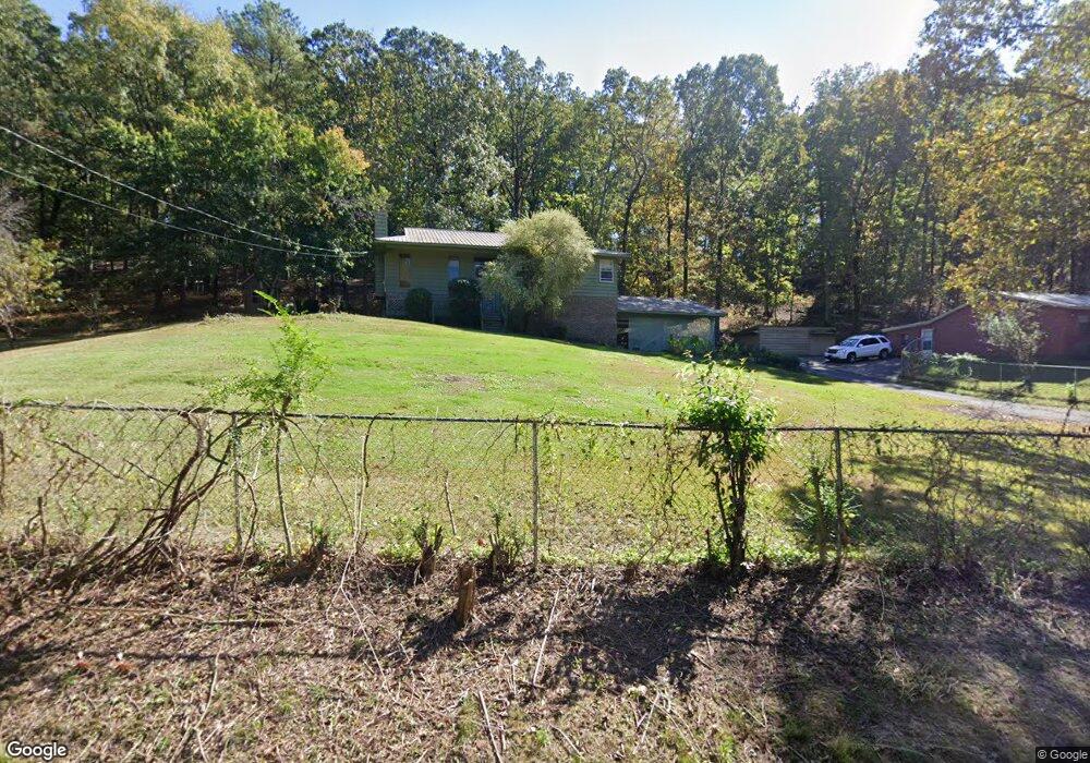
678 Camp Branch Cir Alabaster, AL 35007
Estimated Value: $272,000 - $349,215
--
Bed
1
Bath
1,831
Sq Ft
$174/Sq Ft
Est. Value
About This Home
This home is located at 678 Camp Branch Cir, Alabaster, AL 35007 and is currently estimated at $318,304, approximately $173 per square foot. 678 Camp Branch Cir is a home located in Shelby County with nearby schools including Thompson Intermediate School, Thompson Middle School, and Thompson High School.
Ownership History
Date
Name
Owned For
Owner Type
Purchase Details
Closed on
Aug 3, 2010
Sold by
Rhodes Nina A
Bought by
Rhodes James L
Current Estimated Value
Purchase Details
Closed on
Mar 22, 2004
Sold by
Horton Tommy and Horton Ruth
Bought by
Rhodes James L and Rhodes Nina A
Home Financials for this Owner
Home Financials are based on the most recent Mortgage that was taken out on this home.
Original Mortgage
$170,000
Interest Rate
5.62%
Mortgage Type
VA
Purchase Details
Closed on
May 27, 2003
Sold by
Horton Ruth
Bought by
Horton Tommy and Horton Ruth
Purchase Details
Closed on
Jan 5, 2000
Sold by
Horton Tommy and Horton Ruth
Bought by
Horton Ruth
Purchase Details
Closed on
Feb 20, 1998
Sold by
Mullins Brenda Sue Carter and Mullins James William
Bought by
Key Foster D and Key Tina A
Home Financials for this Owner
Home Financials are based on the most recent Mortgage that was taken out on this home.
Original Mortgage
$115,000
Interest Rate
6.89%
Create a Home Valuation Report for This Property
The Home Valuation Report is an in-depth analysis detailing your home's value as well as a comparison with similar homes in the area
Home Values in the Area
Average Home Value in this Area
Purchase History
| Date | Buyer | Sale Price | Title Company |
|---|---|---|---|
| Rhodes James L | -- | None Available | |
| Rhodes James L | $170,000 | -- | |
| Horton Tommy | $500 | -- | |
| Horton Ruth | $500 | -- | |
| Key Foster D | $115,000 | -- |
Source: Public Records
Mortgage History
| Date | Status | Borrower | Loan Amount |
|---|---|---|---|
| Previous Owner | Rhodes James L | $170,000 | |
| Previous Owner | Key Foster D | $115,000 |
Source: Public Records
Tax History Compared to Growth
Tax History
| Year | Tax Paid | Tax Assessment Tax Assessment Total Assessment is a certain percentage of the fair market value that is determined by local assessors to be the total taxable value of land and additions on the property. | Land | Improvement |
|---|---|---|---|---|
| 2024 | $1,445 | $32,840 | $0 | $0 |
| 2023 | -- | $29,680 | $0 | $0 |
| 2022 | $0 | $26,660 | $0 | $0 |
| 2021 | $0 | $24,440 | $0 | $0 |
| 2020 | $0 | $23,500 | $0 | $0 |
| 2019 | $0 | $22,580 | $0 | $0 |
| 2017 | $0 | $21,560 | $0 | $0 |
| 2015 | -- | $20,460 | $0 | $0 |
| 2014 | -- | $19,940 | $0 | $0 |
Source: Public Records
Map
Nearby Homes
- 1134 Camp Branch Cir
- 960 Camp Branch Rd
- 15 Silver Ln
- 207 Stetson Ln
- 2041 Lonesome Hen Ln
- 226 Thoroughbred Ln
- 105 Quarterhorse Ln
- 153 Shetland Trail Unit 201
- 119 Walking Horse Trace Unit 17
- 00 Deer Run Rd
- 327 Ridgeview Lake Rd
- 551 Oakmont Dr Unit 3
- 314 Highway 331
- 00 Highway 87 Unit 1
- 2 Oakmont Dr Unit 2
- 3 Oakmont Dr Unit 3
- 980 Highway 331
- 2307 Highway 331
- 303 Chestnut Ln
- 156 Lauchlin Ln
- 700 Camp Branch Cir
- 721 Camp Branch Cir
- 645 Camp Branch Cir
- 744 Camp Branch Cir
- 745 Camp Branch Cir
- 788 Camp Branch Cir
- 585 Camp Branch Cir
- 828 Camp Branch Cir
- 841 Camp Branch Cir
- 848 Camp Branch Cir
- 1134 Camp Branch Cir Unit 1
- 735 Shady Rd
- 1883 Highway 26
- 1161 Camp Branch Cir
- 1131 Camp Branch Cir
- 3 Acres On Shady Rd
- 340 Camp Branch Cir
- 330 Camp Branch Cir
- 330 Camp Branch Cir Unit 9
- 310 Camp Branch Cir Unit 8