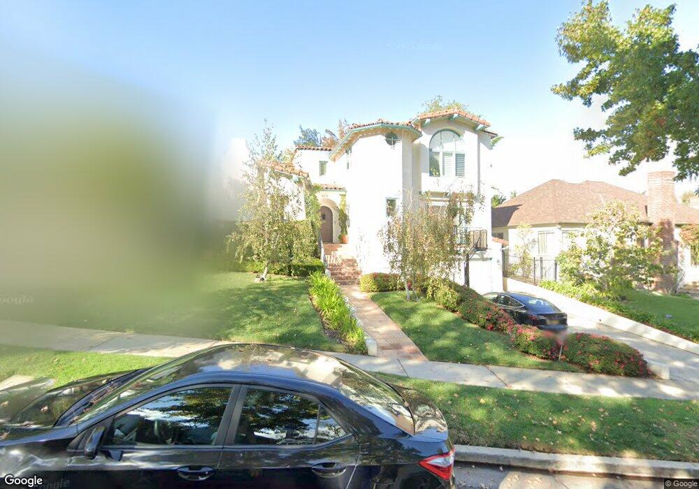
679 Loring Ave Los Angeles, CA 90024
Westwood NeighborhoodEstimated Value: $4,590,092 - $4,867,000
6
Beds
6
Baths
4,247
Sq Ft
$1,114/Sq Ft
Est. Value
About This Home
This home is located at 679 Loring Ave, Los Angeles, CA 90024 and is currently estimated at $4,730,023, approximately $1,113 per square foot. 679 Loring Ave is a home located in Los Angeles County with nearby schools including Warner Avenue Elementary, Ralph Waldo Emerson Community Charter Middle School, and University High School Charter.
Ownership History
Date
Name
Owned For
Owner Type
Purchase Details
Closed on
Dec 15, 2008
Sold by
Cutrow Allan and Cutrow Mary C
Bought by
Cutrow Allan B and Cutrow Mary Charlesworth
Current Estimated Value
Purchase Details
Closed on
Dec 3, 1993
Sold by
Landauer Jaisook Rho and Landauer Christopher Allen
Bought by
Cutrow Allan and Cutrow Mary C
Home Financials for this Owner
Home Financials are based on the most recent Mortgage that was taken out on this home.
Original Mortgage
$648,750
Interest Rate
7.2%
Create a Home Valuation Report for This Property
The Home Valuation Report is an in-depth analysis detailing your home's value as well as a comparison with similar homes in the area
Home Values in the Area
Average Home Value in this Area
Purchase History
| Date | Buyer | Sale Price | Title Company |
|---|---|---|---|
| Cutrow Allan B | -- | None Available | |
| Cutrow Allan | $865,000 | Gateway Title |
Source: Public Records
Mortgage History
| Date | Status | Borrower | Loan Amount |
|---|---|---|---|
| Closed | Cutrow Allan | $648,750 |
Source: Public Records
Tax History
| Year | Tax Paid | Tax Assessment Tax Assessment Total Assessment is a certain percentage of the fair market value that is determined by local assessors to be the total taxable value of land and additions on the property. | Land | Improvement |
|---|---|---|---|---|
| 2025 | $22,116 | $1,811,164 | $826,551 | $984,613 |
| 2024 | $21,861 | $1,775,652 | $810,345 | $965,307 |
| 2023 | $21,442 | $1,740,836 | $794,456 | $946,380 |
| 2022 | $20,453 | $1,706,703 | $778,879 | $927,824 |
| 2021 | $20,189 | $1,673,239 | $763,607 | $909,632 |
| 2020 | $20,393 | $1,656,083 | $755,778 | $900,305 |
| 2019 | $19,586 | $1,623,611 | $740,959 | $882,652 |
| 2018 | $19,420 | $1,591,777 | $726,431 | $865,346 |
| 2016 | $18,553 | $1,529,969 | $698,224 | $831,745 |
| 2015 | $18,281 | $1,506,989 | $687,737 | $819,252 |
| 2014 | $18,336 | $1,477,470 | $674,266 | $803,204 |
Source: Public Records
Map
Nearby Homes
- 751 Westholme Ave
- 740 Warner Ave
- 501 Woodruff Ave
- 10455 Lindbrook Dr
- 453 Dalehurst Ave
- 10386 Strathmore Dr
- 10445 Wilshire Blvd Unit 905
- 10445 Wilshire Blvd Unit 1204
- 10445 Wilshire Blvd Unit 703
- 10445 Wilshire Blvd Unit 1905
- 10445 Wilshire Blvd Unit 1806
- 10445 Wilshire Blvd Unit 402
- 10433 Wilshire Blvd Unit 301
- 10433 Wilshire Blvd Unit 602
- 10433 Wilshire Blvd Unit 808
- 10501 Wilshire Blvd Unit 1902
- 10501 Wilshire Blvd Unit 1701
- 10501 Wilshire Blvd Unit 1710
- 10501 Wilshire Blvd Unit 1904
- 10501 Wilshire Blvd Unit 1103
- 671 Loring Ave
- 685 Loring Ave
- 663 Loring Ave
- 691 Loring Ave
- 10530 Edgeley Place
- 10526 Edgeley Place
- 706 Thayer Ave
- 10538 Edgeley Place
- 641 Warner Ave
- 674 Loring Ave
- 697 Loring Ave
- 647 Warner Ave
- 668 Loring Ave
- 718 Thayer Ave
- 633 Warner Ave
- 662 Loring Ave
- 664 Thayer Ave
- 625 Warner Ave
- 656 Loring Ave
- 726 Thayer Ave
Your Personal Tour Guide
Ask me questions while you tour the home.