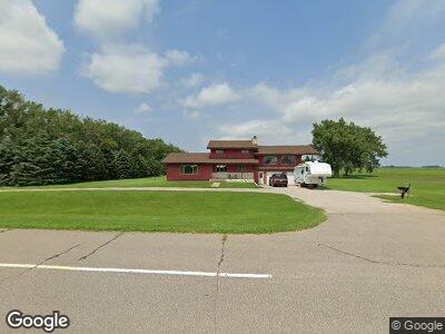
67970 State Highway 28 Johnson, MN 56236
Estimated Value: $96,000 - $265,920
1
Bed
--
Bath
2,072
Sq Ft
$99/Sq Ft
Est. Value
About This Home
This home is located at 67970 State Highway 28, Johnson, MN 56236 and is currently estimated at $204,640, approximately $98 per square foot. 67970 State Highway 28 is a home with nearby schools including Clinton-Graceville-Beardsley Elementary School and Clinton-Graceville-Beardsley Middle/High School.
Ownership History
Date
Name
Owned For
Owner Type
Purchase Details
Closed on
Apr 19, 2022
Sold by
Maanum Thomas and Maanum Karen
Bought by
Maanum Samuel and Maanum Hannah
Current Estimated Value
Home Financials for this Owner
Home Financials are based on the most recent Mortgage that was taken out on this home.
Original Mortgage
$115,000
Outstanding Balance
$108,615
Interest Rate
3.76%
Mortgage Type
New Conventional
Purchase Details
Closed on
Oct 26, 2020
Sold by
Maanum Dorothy M and Maanum R D
Bought by
Maanum Thomas and Maanum Karen
Create a Home Valuation Report for This Property
The Home Valuation Report is an in-depth analysis detailing your home's value as well as a comparison with similar homes in the area
Home Values in the Area
Average Home Value in this Area
Purchase History
| Date | Buyer | Sale Price | Title Company |
|---|---|---|---|
| Maanum Samuel | $115,000 | -- | |
| Maanum Thomas | $115,000 | -- |
Source: Public Records
Mortgage History
| Date | Status | Borrower | Loan Amount |
|---|---|---|---|
| Open | Maanum Samuel | $115,000 |
Source: Public Records
Tax History Compared to Growth
Tax History
| Year | Tax Paid | Tax Assessment Tax Assessment Total Assessment is a certain percentage of the fair market value that is determined by local assessors to be the total taxable value of land and additions on the property. | Land | Improvement |
|---|---|---|---|---|
| 2024 | $1,886 | $229,800 | $0 | $0 |
| 2023 | $1,980 | $229,700 | $0 | $0 |
| 2022 | $1,078 | $145,300 | $0 | $0 |
| 2021 | $806 | $137,800 | $0 | $0 |
| 2020 | $732 | $121,100 | $0 | $0 |
| 2019 | $786 | $112,000 | $0 | $0 |
| 2018 | $534 | $109,000 | $0 | $0 |
| 2017 | $534 | $96,300 | $0 | $0 |
| 2016 | $520 | $96,400 | $0 | $0 |
| 2015 | -- | $0 | $0 | $0 |
| 2014 | -- | $0 | $0 | $0 |
Source: Public Records
Map
Nearby Homes
- 609 2nd St W
- 201 2nd St W
- 400 1st St W
- 311 1st St E
- 204 1st St E
- 202 1st St E
- 32744 700th Ave
- 77620 300th St
- 32433 775th Ave
- TBD 110th St
- 64345 370th St
- 75833 Sunset View Rd N
- 77449 Meadowbrook Rd W
- 6392 Us Highway 75
- 29693 120th St
- 79317 355th St
- Lot 40 Lakota Island
- 114 Lakota Island
- Lot 18 Lakota Island Estates
- 158 Lakota Island Estates