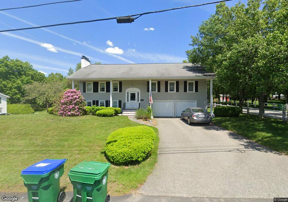
68 Phillips Brooks Rd Westwood, MA 02090
Estimated Value: $951,901 - $1,170,000
3
Beds
4
Baths
1,400
Sq Ft
$772/Sq Ft
Est. Value
About This Home
This home is located at 68 Phillips Brooks Rd, Westwood, MA 02090 and is currently estimated at $1,080,975, approximately $772 per square foot. 68 Phillips Brooks Rd is a home located in Norfolk County with nearby schools including Westwood High School, Dedham Country Day School, and Xaverian Brothers High School.
Ownership History
Date
Name
Owned For
Owner Type
Purchase Details
Closed on
Nov 23, 2011
Sold by
Feloni Michael and Feloni Elizabeth
Bought by
Feloni Michael and Feloni Elizabeth
Current Estimated Value
Home Financials for this Owner
Home Financials are based on the most recent Mortgage that was taken out on this home.
Original Mortgage
$345,000
Outstanding Balance
$35,107
Interest Rate
4.12%
Mortgage Type
Purchase Money Mortgage
Estimated Equity
$1,045,868
Purchase Details
Closed on
Mar 31, 2003
Sold by
Stone Ledge Llc
Bought by
Feloni Elizabeth and Feloni Michael
Home Financials for this Owner
Home Financials are based on the most recent Mortgage that was taken out on this home.
Original Mortgage
$400,000
Interest Rate
5.91%
Mortgage Type
Purchase Money Mortgage
Purchase Details
Closed on
May 23, 2002
Sold by
Sullivan Margaret F
Bought by
Stone Ledge Llc
Home Financials for this Owner
Home Financials are based on the most recent Mortgage that was taken out on this home.
Original Mortgage
$457,500
Interest Rate
7.01%
Mortgage Type
Purchase Money Mortgage
Create a Home Valuation Report for This Property
The Home Valuation Report is an in-depth analysis detailing your home's value as well as a comparison with similar homes in the area
Home Values in the Area
Average Home Value in this Area
Purchase History
| Date | Buyer | Sale Price | Title Company |
|---|---|---|---|
| Feloni Michael | -- | -- | |
| Feloni Elizabeth | $530,000 | -- | |
| Stone Ledge Llc | $610,000 | -- |
Source: Public Records
Mortgage History
| Date | Status | Borrower | Loan Amount |
|---|---|---|---|
| Open | Feloni Michael | $345,000 | |
| Previous Owner | Feloni Elizabeth | $400,000 | |
| Previous Owner | Stone Ledge Llc | $457,500 |
Source: Public Records
Tax History Compared to Growth
Tax History
| Year | Tax Paid | Tax Assessment Tax Assessment Total Assessment is a certain percentage of the fair market value that is determined by local assessors to be the total taxable value of land and additions on the property. | Land | Improvement |
|---|---|---|---|---|
| 2025 | $11,645 | $909,800 | $517,600 | $392,200 |
| 2024 | $10,678 | $833,600 | $492,800 | $340,800 |
| 2023 | $9,670 | $676,200 | $410,800 | $265,400 |
| 2022 | $9,255 | $624,050 | $347,400 | $276,650 |
| 2021 | $9,096 | $615,450 | $330,800 | $284,650 |
| 2020 | $8,432 | $581,100 | $330,800 | $250,300 |
| 2019 | $8,282 | $565,300 | $315,000 | $250,300 |
| 2018 | $7,704 | $510,550 | $315,000 | $195,550 |
| 2017 | $7,717 | $529,650 | $315,000 | $214,650 |
| 2016 | $7,574 | $516,650 | $315,000 | $201,650 |
| 2015 | $7,824 | $513,400 | $315,000 | $198,400 |
Source: Public Records
Map
Nearby Homes
- 102 Smith Dr
- 19 Cushing Rd
- 355 Canton St
- 290 East St
- 243 Weatherbee Dr
- 24 Overlook Ave
- 187 Vincent Rd
- 44 Willard St
- 215 Blue Hill Dr
- 11 Granite St
- 34 Cranberry Ln
- 29 S Gate St
- 298 Washington St Unit 302
- 84 Juniper Ridge Rd
- 50 Fairview St
- 16 Norwich St
- 102 Parker St
- 989 East St Unit 107
- 989 East St Unit 403
- 360 Blue Hill Dr
- 62 Phillips Brooks Rd
- 78 Phillips Brooks Rd
- 10 Currier Farm Rd
- 92 Phillips Brooks Rd
- 54 Phillips Brooks Rd
- 69 Phillips Brooks Rd
- 61 Phillips Brooks Rd
- 79 Phillips Brooks Rd
- 102 Phillips Brooks Rd
- 53 Phillips Brooks Rd
- 50 Booth Dr
- 46 Phillips Brooks Rd
- 41 Booth Dr
- 85 Phillips Brooks Rd
- 47 Phillips Brooks Rd
- 91 Phillips Brooks Rd
- 60 Strasser Ave
- 68 Strasser Ave
- 108 Phillips Brooks Rd
- 105 Phillips Brooks Rd