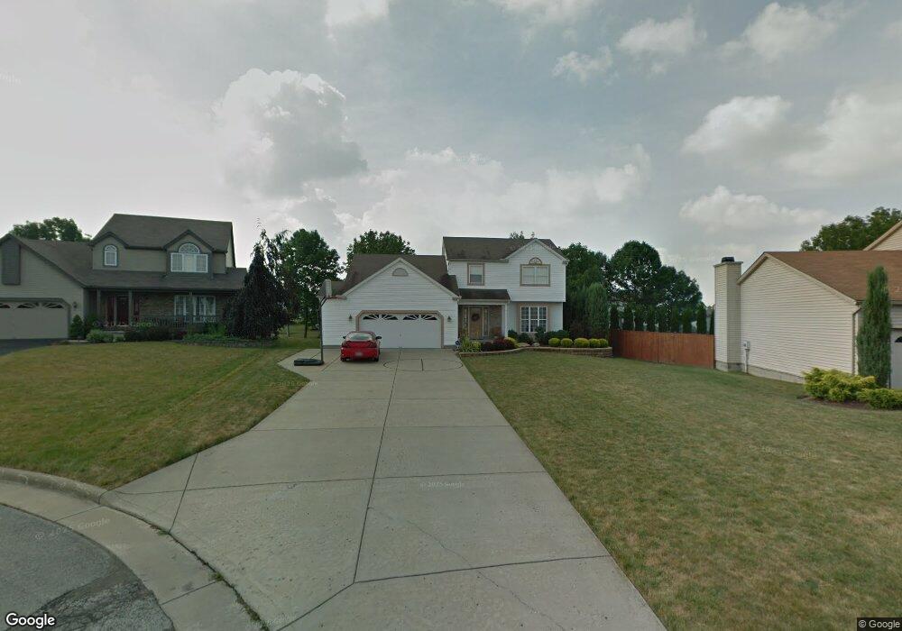
6815 Pinebrook Ct Youngstown, OH 44515
Austintown NeighborhoodEstimated Value: $315,000 - $357,000
3
Beds
3
Baths
2,010
Sq Ft
$165/Sq Ft
Est. Value
About This Home
This home is located at 6815 Pinebrook Ct, Youngstown, OH 44515 and is currently estimated at $332,393, approximately $165 per square foot. 6815 Pinebrook Ct is a home located in Mahoning County with nearby schools including Austintown Elementary School, Austintown Intermediate School, and Austintown Middle School.
Ownership History
Date
Name
Owned For
Owner Type
Purchase Details
Closed on
Dec 3, 1999
Sold by
Joe Koch Construction Inc
Bought by
Difabio Michael G and Difabio Rosemarie
Current Estimated Value
Home Financials for this Owner
Home Financials are based on the most recent Mortgage that was taken out on this home.
Original Mortgage
$121,500
Outstanding Balance
$35,137
Interest Rate
7.97%
Estimated Equity
$297,256
Purchase Details
Closed on
Aug 3, 1999
Sold by
Turner Development Ltd
Bought by
Joe Koch Construction Inc
Create a Home Valuation Report for This Property
The Home Valuation Report is an in-depth analysis detailing your home's value as well as a comparison with similar homes in the area
Home Values in the Area
Average Home Value in this Area
Purchase History
| Date | Buyer | Sale Price | Title Company |
|---|---|---|---|
| Difabio Michael G | $146,716 | -- | |
| Joe Koch Construction Inc | $18,500 | -- |
Source: Public Records
Mortgage History
| Date | Status | Borrower | Loan Amount |
|---|---|---|---|
| Open | Difabio Michael G | $121,500 |
Source: Public Records
Tax History
| Year | Tax Paid | Tax Assessment Tax Assessment Total Assessment is a certain percentage of the fair market value that is determined by local assessors to be the total taxable value of land and additions on the property. | Land | Improvement |
|---|---|---|---|---|
| 2025 | $4,581 | $92,860 | $7,620 | $85,240 |
| 2024 | $4,380 | $92,860 | $7,620 | $85,240 |
| 2023 | $4,303 | $92,860 | $7,620 | $85,240 |
| 2022 | $3,644 | $62,980 | $7,590 | $55,390 |
| 2021 | $3,647 | $62,980 | $7,590 | $55,390 |
| 2020 | $3,661 | $62,980 | $7,590 | $55,390 |
| 2019 | $3,512 | $54,770 | $6,600 | $48,170 |
| 2018 | $3,387 | $54,770 | $6,600 | $48,170 |
| 2017 | $3,329 | $54,770 | $6,600 | $48,170 |
| 2016 | $3,292 | $53,030 | $6,600 | $46,430 |
| 2015 | $3,195 | $53,030 | $6,600 | $46,430 |
| 2014 | $3,210 | $53,030 | $6,600 | $46,430 |
| 2013 | $3,177 | $53,030 | $6,600 | $46,430 |
Source: Public Records
Map
Nearby Homes
- 6581 Country Ridge Ave
- 6438 Calvary Ct
- 2998 Whispering Pines Dr
- 6919 Kirk Rd
- 3121 Meanderwood Dr
- 6948 Meander Reserve Ct
- 583 Wyndclift Cir
- 242 Wilcox Rd Unit 242
- 379 Wyndclift Place
- 4849 My Way
- 5552 Callaway Cir Unit 2
- 0 Maple Ave Unit 5190079
- 0 Maple Ave Unit 5190077
- 0 Maple Ave Unit 5190082
- 6042 Callaway Cir Unit 5
- 5664 Colgate Ave
- 5630 Stanford Ave
- 5633 London Dr
- 1556 Pimlico Dr Unit 15
- 5652 Baylor Ave
- 6819 Pinebrook Ct
- 6811 Pinebrook Ct
- 6823 Pinebrook Ct
- 2173 Woodgate St
- 2165 Woodgate St
- 2157 Woodgate St
- 6807 Pinebrook Ct
- 6827 Pinebrook Ct
- 2149 Woodgate St
- 6806 Pinebrook Ct
- 2181 Woodgate St
- 6818 Pinebrook Ct
- 6814 Pinebrook Ct
- 2141 Woodgate St
- 6831 Pinebrook Ct
- 6822 Pinebrook Ct
- 6810 Pinebrook Ct
- 2133 Woodgate St
- 6826 Pinebrook Ct
- 2189 Woodgate St
Your Personal Tour Guide
Ask me questions while you tour the home.