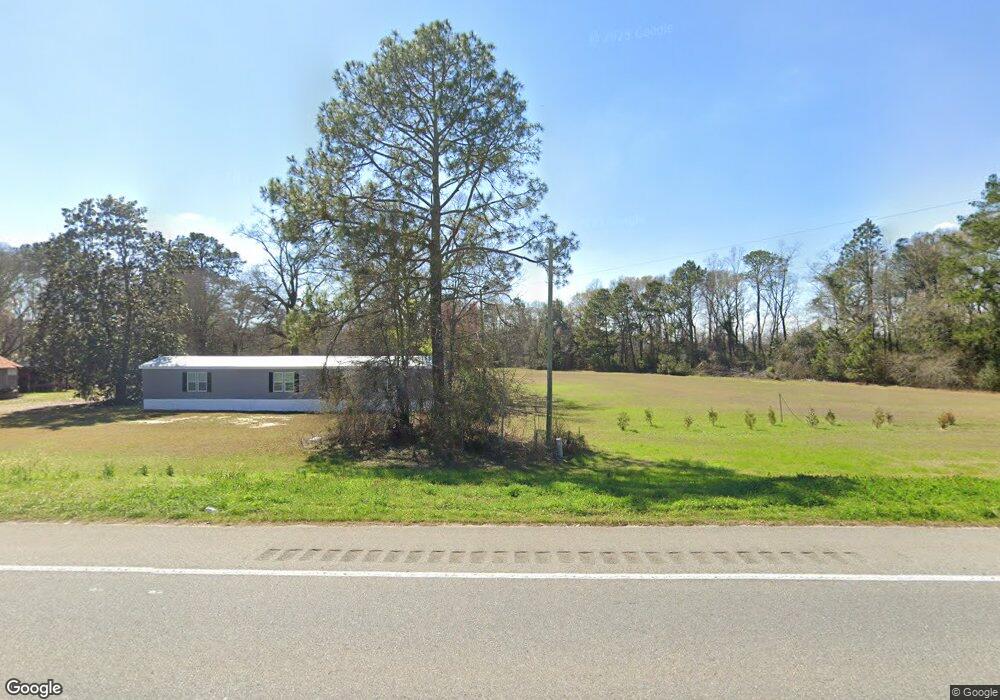
6816 Ga Highway 133 S Moultrie, GA 31788
Estimated Value: $151,000 - $254,000
--
Bed
1
Bath
1,200
Sq Ft
$169/Sq Ft
Est. Value
About This Home
This home is located at 6816 Ga Highway 133 S, Moultrie, GA 31788 and is currently estimated at $202,667, approximately $168 per square foot. 6816 Ga Highway 133 S is a home located in Colquitt County with nearby schools including Odom Elementary School, Willie J. Williams Middle School, and C.A. Gray Junior High School.
Ownership History
Date
Name
Owned For
Owner Type
Purchase Details
Closed on
Sep 15, 2025
Sold by
Parker Kathy J
Bought by
Long Janna Leigh and Nelms Jordan Rae
Current Estimated Value
Purchase Details
Closed on
Apr 17, 2023
Sold by
Parker Kathy J
Bought by
Long Jeffrey O and Long Janna L
Purchase Details
Closed on
Sep 29, 2011
Sold by
Long Janna
Bought by
Parker Kathy J
Purchase Details
Closed on
Mar 15, 2011
Sold by
Parker Kathy J
Bought by
Long Janna
Purchase Details
Closed on
May 17, 1994
Bought by
Goble Kathryn C
Purchase Details
Closed on
Apr 15, 1983
Bought by
Croft Nellie G
Create a Home Valuation Report for This Property
The Home Valuation Report is an in-depth analysis detailing your home's value as well as a comparison with similar homes in the area
Home Values in the Area
Average Home Value in this Area
Purchase History
| Date | Buyer | Sale Price | Title Company |
|---|---|---|---|
| Long Janna Leigh | $180,974 | -- | |
| Long Jeffrey O | -- | -- | |
| Parker Kathy J | -- | -- | |
| Long Janna | -- | -- | |
| Goble Kathryn C | -- | -- | |
| Croft Nellie G | -- | -- |
Source: Public Records
Tax History Compared to Growth
Tax History
| Year | Tax Paid | Tax Assessment Tax Assessment Total Assessment is a certain percentage of the fair market value that is determined by local assessors to be the total taxable value of land and additions on the property. | Land | Improvement |
|---|---|---|---|---|
| 2024 | $791 | $69,749 | $57,636 | $12,113 |
| 2023 | $723 | $71,996 | $63,406 | $8,590 |
| 2022 | $746 | $71,829 | $63,406 | $8,423 |
| 2021 | $746 | $63,494 | $54,247 | $9,247 |
| 2020 | $739 | $63,174 | $54,247 | $8,927 |
| 2019 | $1,751 | $63,713 | $54,247 | $9,466 |
| 2018 | $1,630 | $63,713 | $54,247 | $9,466 |
| 2017 | $1,463 | $53,743 | $44,277 | $9,466 |
| 2016 | $1,135 | $44,377 | $44,277 | $100 |
| 2015 | -- | $44,377 | $44,277 | $100 |
| 2014 | -- | $44,377 | $44,277 | $100 |
Source: Public Records
Map
Nearby Homes
- 0 Southerland Ave
- 410 Railroad St
- 313 Langford St
- 5808 Georgia 133
- 8774 Antioch Rd
- 0 Burton Rd Unit 23760976
- 0 Burton Rd Unit 23669194
- 1114 Cannon Rd
- 9283 Tallokas Rd Unit 54/13
- 9283 Tallokas Rd
- 277 Indian Creek Subdivision
- 0 Upper Trail Unit 913421
- 0 Upper Trail Unit 913422
- 421 Best Cir
- 693 Old Quitman Annex Rd
- 2262 Sardis Church Rd
- 182 Horseshoe Dr
- 5940 Georgia 37
- 289 Arthur Newbern Rd
- 2275 Old Coffee Rd
- 6930 Ga Highway 133 S
- 124 We Hart Rd
- 6994 Ga Highway 133 S
- 6953 Ga Highway 133 S
- 156 W East Hart Rd
- 156 We Hart Rd
- 7005 Ga Highway 133 S
- 7009 Ga Highway 133 S
- 7130 Hwy 133
- 6652 Ga Highway 133 S
- 7068 Ga Highway 133 S
- 0000 Hwy 33 (61 Acres)
- 177 We Hart Rd
- 404 We Hart Rd
- 6603 Ga Highway 133 S
- 6519 Ga Highway 133 S
- 97 acres Sawmill Rd
- 7326 Ga Highway 133 S
- 759 Sawmill Rd
- 6446 Ga Highway 133 S