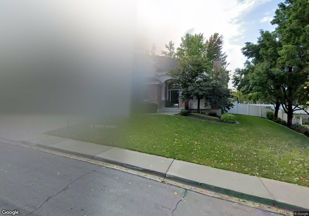
682 Cherapple Cir Orem, UT 84097
Northridge NeighborhoodEstimated Value: $803,000 - $896,000
4
Beds
3
Baths
2,784
Sq Ft
$303/Sq Ft
Est. Value
About This Home
This home is located at 682 Cherapple Cir, Orem, UT 84097 and is currently estimated at $844,359, approximately $303 per square foot. 682 Cherapple Cir is a home located in Utah County with nearby schools including Orchard Elementary School, Oak Canyon Junior High School, and Timpanogos High School.
Ownership History
Date
Name
Owned For
Owner Type
Purchase Details
Closed on
Jun 27, 2019
Sold by
Ririe R Brent and Ririe Beverly R
Bought by
Ririe Brent and Ririe Beverly R
Current Estimated Value
Purchase Details
Closed on
Jun 23, 1998
Sold by
Craig E Boyd and Michele Craig D
Bought by
Craig E Boyd and Craig Michelle D
Home Financials for this Owner
Home Financials are based on the most recent Mortgage that was taken out on this home.
Original Mortgage
$25,000
Outstanding Balance
$5,027
Interest Rate
7.11%
Estimated Equity
$839,332
Purchase Details
Closed on
May 28, 1996
Sold by
Craig Datwyler Construction Inc
Bought by
Craig E Boyd and Michele Craig D
Home Financials for this Owner
Home Financials are based on the most recent Mortgage that was taken out on this home.
Original Mortgage
$294,500
Interest Rate
7.97%
Create a Home Valuation Report for This Property
The Home Valuation Report is an in-depth analysis detailing your home's value as well as a comparison with similar homes in the area
Home Values in the Area
Average Home Value in this Area
Purchase History
| Date | Buyer | Sale Price | Title Company |
|---|---|---|---|
| Ririe Brent | -- | None Available | |
| Craig E Boyd | -- | -- | |
| Craig E Boyd | -- | -- |
Source: Public Records
Mortgage History
| Date | Status | Borrower | Loan Amount |
|---|---|---|---|
| Open | Craig E Boyd | $25,000 | |
| Previous Owner | Craig E Boyd | $294,500 |
Source: Public Records
Tax History
| Year | Tax Paid | Tax Assessment Tax Assessment Total Assessment is a certain percentage of the fair market value that is determined by local assessors to be the total taxable value of land and additions on the property. | Land | Improvement |
|---|---|---|---|---|
| 2025 | $3,176 | $447,150 | -- | -- |
| 2024 | $3,176 | $388,410 | $0 | $0 |
| 2023 | $2,940 | $386,375 | $0 | $0 |
| 2022 | $3,155 | $401,720 | $0 | $0 |
| 2021 | $2,865 | $552,500 | $193,800 | $358,700 |
| 2020 | $2,691 | $510,100 | $168,500 | $341,600 |
| 2019 | $2,302 | $453,700 | $156,700 | $297,000 |
| 2018 | $2,391 | $450,300 | $156,700 | $293,600 |
| 2017 | $2,314 | $233,420 | $0 | $0 |
| 2016 | $2,500 | $232,540 | $0 | $0 |
| 2015 | $2,486 | $218,735 | $0 | $0 |
| 2014 | $2,344 | $205,260 | $0 | $0 |
Source: Public Records
Map
Nearby Homes
- 695 E 1870 N
- 540 E Quail Rd
- 1643 N Mountain Oaks Dr
- 723 E 1450 N Unit 25
- 110 S 1320 E
- 713 E 1500 St N Unit 19
- 747 E 1500 N Unit 13
- 1480 N 430 E
- 713 E 1450 N Unit 23
- 1366 N 750 E
- 1356 N 750 E Unit 11
- 733 E 1450 N Unit 5
- 1324 N 750 E Unit 3
- 363 E 1395 N Unit 22
- 1636 N 160 E
- 1638 N 160 E
- 710 E 1280 N
- 1371 N 330 E Unit 8
- 372 E 1165 N
- 1051 E 100 N
- 682 E 1780 N
- 1757 N 710 E
- 692 Cherapple Cir
- 668 Cherapple Cir
- 683 Cherapple Cir
- 1746 N 710 E
- 1746 N 710 E Unit 8
- 654 Cherapple Cir
- 1783 High Country Dr
- 695 E 1725 N
- 1745 N 710 E
- 695 Cherapple Cir
- 698 Cherapple Cir
- 653 Cherapple Cir
- 673 E 1725 N
- 628 Cherapple Cir
- 654 Cherapple Dr
- 655 E 1725 N
- 1769 High Country Dr
- 1734 N 710 E
Your Personal Tour Guide
Ask me questions while you tour the home.