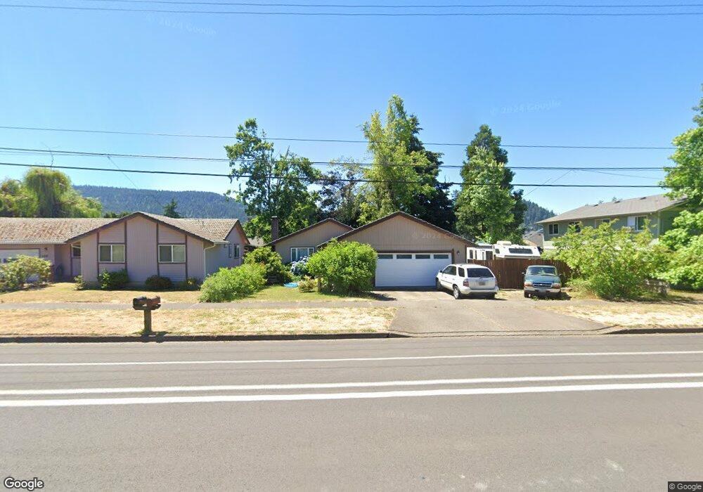
6837 Thurston Rd Springfield, OR 97478
Thurston NeighborhoodEstimated Value: $378,000 - $401,000
3
Beds
2
Baths
1,050
Sq Ft
$367/Sq Ft
Est. Value
About This Home
This home is located at 6837 Thurston Rd, Springfield, OR 97478 and is currently estimated at $384,998, approximately $366 per square foot. 6837 Thurston Rd is a home located in Lane County with nearby schools including Ridgeview Elementary School, Thurston Middle School, and Thurston High School.
Create a Home Valuation Report for This Property
The Home Valuation Report is an in-depth analysis detailing your home's value as well as a comparison with similar homes in the area
Home Values in the Area
Average Home Value in this Area
Tax History
| Year | Tax Paid | Tax Assessment Tax Assessment Total Assessment is a certain percentage of the fair market value that is determined by local assessors to be the total taxable value of land and additions on the property. | Land | Improvement |
|---|---|---|---|---|
| 2025 | $3,283 | $179,039 | -- | -- |
| 2024 | $3,230 | $173,825 | -- | -- |
| 2023 | $3,230 | $168,763 | $0 | $0 |
| 2022 | $2,992 | $163,848 | $0 | $0 |
| 2021 | $2,938 | $159,076 | $0 | $0 |
| 2020 | $2,852 | $154,443 | $0 | $0 |
| 2019 | $2,766 | $149,945 | $0 | $0 |
| 2018 | $2,608 | $141,338 | $0 | $0 |
| 2017 | $2,507 | $141,338 | $0 | $0 |
| 2016 | $2,455 | $137,221 | $0 | $0 |
| 2015 | $2,385 | $133,224 | $0 | $0 |
| 2014 | $2,349 | $129,344 | $0 | $0 |
Source: Public Records
Map
Nearby Homes
- 6898 Thurston Rd
- 7080 Thurston Rd Unit 2
- 555 66th St
- 0 71st St
- 0 Omlid Dr Unit 1 706471345
- 0 Omlid Dr Unit 11
- 0 Omlid Dr Unit 27 796722689
- 0 Omlid Dr Unit 26 256458253
- 0 Omlid Dr Unit 10
- 0 Omlid Dr Unit 3 154724851
- 0 Omlid Dr Unit 2 312357104
- 6875 B St
- 250 68th St
- 353 71st St
- 6540 B St
- 6445 B St
- 246 S 70th St
- 6964 Bluebelle Way
- 193 62nd Place
- 6451 Dogwood St
Your Personal Tour Guide
Ask me questions while you tour the home.