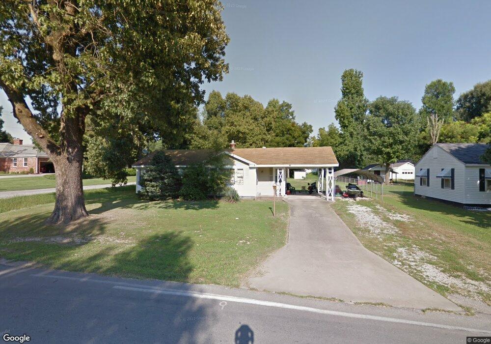
685 N Scurlock Ave Piggott, AR 72454
Estimated Value: $108,000 - $142,000
2
Beds
1
Bath
1,559
Sq Ft
$83/Sq Ft
Est. Value
About This Home
This home is located at 685 N Scurlock Ave, Piggott, AR 72454 and is currently estimated at $129,980, approximately $83 per square foot. 685 N Scurlock Ave is a home located in Clay County with nearby schools including Piggott Elementary School and Piggott High School.
Ownership History
Date
Name
Owned For
Owner Type
Purchase Details
Closed on
Dec 7, 2020
Bought by
Wright Herbert
Current Estimated Value
Purchase Details
Closed on
Jun 4, 2007
Sold by
Crews Norman
Bought by
Wright Herbert
Home Financials for this Owner
Home Financials are based on the most recent Mortgage that was taken out on this home.
Original Mortgage
$55,000
Interest Rate
6.15%
Mortgage Type
Purchase Money Mortgage
Purchase Details
Closed on
Feb 24, 1998
Bought by
Crews
Purchase Details
Closed on
Sep 1, 1996
Bought by
Wiley
Purchase Details
Closed on
Aug 1, 1996
Bought by
Gossett
Create a Home Valuation Report for This Property
The Home Valuation Report is an in-depth analysis detailing your home's value as well as a comparison with similar homes in the area
Home Values in the Area
Average Home Value in this Area
Purchase History
| Date | Buyer | Sale Price | Title Company |
|---|---|---|---|
| Wright Herbert | $5,000 | -- | |
| Wright Herbert | -- | -- | |
| Crews | $46,000 | -- | |
| Wiley | $11,000 | -- | |
| Gossett | $6,000 | -- |
Source: Public Records
Mortgage History
| Date | Status | Borrower | Loan Amount |
|---|---|---|---|
| Previous Owner | Wright Herbert | $55,000 |
Source: Public Records
Tax History Compared to Growth
Tax History
| Year | Tax Paid | Tax Assessment Tax Assessment Total Assessment is a certain percentage of the fair market value that is determined by local assessors to be the total taxable value of land and additions on the property. | Land | Improvement |
|---|---|---|---|---|
| 2024 | $313 | $17,760 | $1,000 | $16,760 |
| 2023 | $351 | $17,760 | $1,000 | $16,760 |
| 2022 | $364 | $14,650 | $750 | $13,900 |
| 2021 | $364 | $14,720 | $820 | $13,900 |
| 2020 | $367 | $14,720 | $820 | $13,900 |
| 2019 | $367 | $14,720 | $820 | $13,900 |
| 2018 | $392 | $14,720 | $820 | $13,900 |
| 2017 | $728 | $14,530 | $1,980 | $12,550 |
| 2016 | -- | $14,530 | $1,980 | $12,550 |
| 2015 | -- | $12,350 | $1,980 | $10,370 |
| 2014 | -- | $11,810 | $1,980 | $9,830 |
| 2013 | -- | $11,810 | $1,980 | $9,830 |
Source: Public Records
Map
Nearby Homes
- 728 N 5th Ave
- 516 N Scurlock Ave
- 582 N 4th Ave
- 452 Pine Tree Ln
- 378 Lamb Dr
- 320 N 5th Ave
- 323 Lamb Dr
- 865 N 2nd Ave
- 792 N Royal Ave
- 756 N Royal Ave
- 305 N 8th Ave
- 937 Homecrest Dr
- 908 Dogwood Dr
- 980 Homecrest Dr
- 1017 Homecrest Dr
- 491 W Main St
- 506 N Thornton Ave
- 141 S 6th Ave
- 1252 N 4th Ave
- 763 W Court St
- 661 N Scurlock Ave
- 301 N 6th Ave
- Lots 3&4 N 6th Ave
- 0 N 6th Ave
- 631 N Scurlock Ave
- 658 N 5th Ave
- 721 N 6th Ave
- 690 N Scurlock Ave
- 660 N Scurlock Ave
- 622 N 5th Ave
- 726 N 6th Ave
- 605 N Scurlock Ave
- 602 N Scurlock Ave
- 604 N 5th Ave
- 577 N Scurlock Ave
- 594 N 5th Ave
- 728 N 6th Ave
- 754 N 5th Ave
- 689 N 5th Ave
- 0 Country Club Rd