
Seller's Agent in 2025
Marcie Kiernan
Tropical Realty & Inv. of Brev
(321) 431-2858
3 in this area
41 Total Sales
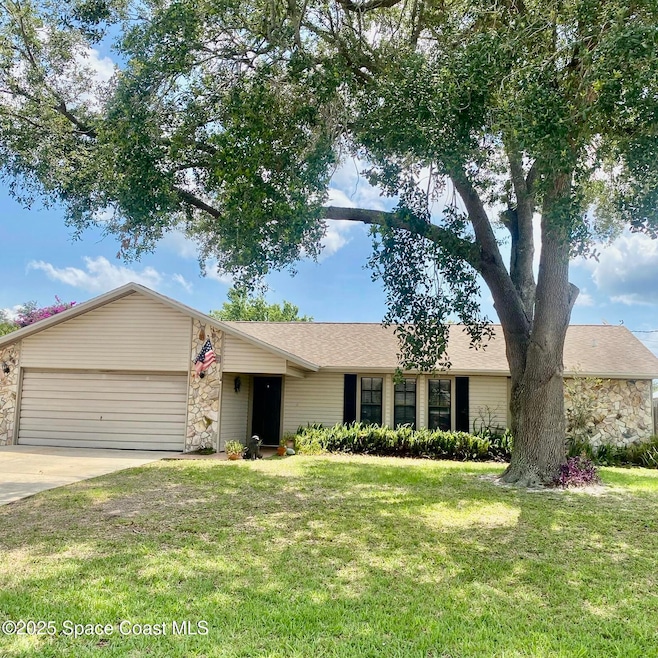
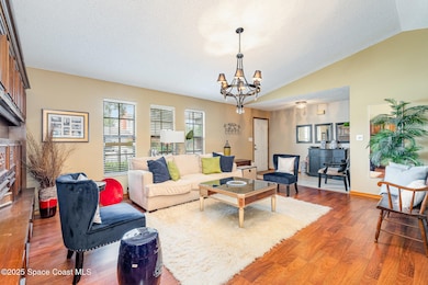
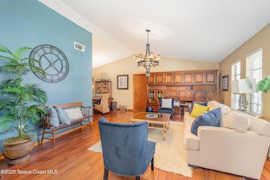
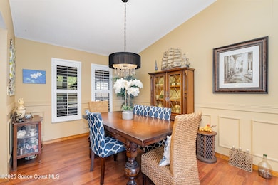
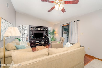
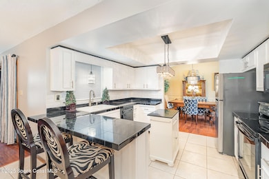
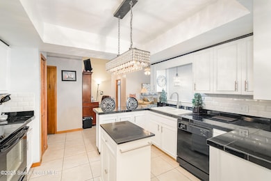
BACKUPS WELCOME. Ideal family home. Meticulously kept 3 bed 2 bath split plan. 2 car garage. Excellent open and welcoming floor plan with 1698 sq. ft. plus 150 sq. ft. bonus room. Ideal for play room or office. Home features laminate flooring, plantation shutters in dining room & family room, vaulted ceilings. Well appointed remodeled kitchen is designed for ease of use. Granite counters, white cabinets, white tile back splash. Center island with drawers. Utility room under air. A/C installed 2022, recent water heater, roof 2017. Septic located in backyard (south side). Fenced backyard with plenty of room for a pool. 2 storage sheds. Location is nestled in the heart of Port St. John, close to shopping, restaurants, boat ramp, and lovely Indian River.
Last Agent to Sell the Property
Tropical Realty & Inv. of Brev License #482720 Listed on: 05/20/2025
| Date | Type | Sale Price | Title Company |
|---|---|---|---|
| Warranty Deed | $333,000 | Title Solutions | |
| Warranty Deed | $333,000 | Title Solutions | |
| Interfamily Deed Transfer | -- | None Available |
| Date | Status | Loan Amount | Loan Type |
|---|---|---|---|
| Open | $326,968 | FHA | |
| Closed | $326,968 | FHA |
| Date | Event | Price | List to Sale | Price per Sq Ft |
|---|---|---|---|---|
| 07/08/2025 07/08/25 | Sold | $333,000 | 0.0% | $196 / Sq Ft |
| 05/20/2025 05/20/25 | For Sale | $333,000 | -- | $196 / Sq Ft |
| Year | Tax Paid | Tax Assessment Tax Assessment Total Assessment is a certain percentage of the fair market value that is determined by local assessors to be the total taxable value of land and additions on the property. | Land | Improvement |
|---|---|---|---|---|
| 2025 | $1,171 | $88,150 | -- | -- |
| 2024 | $1,133 | $85,670 | -- | -- |
| 2023 | $1,133 | $83,180 | $0 | $0 |
| 2022 | $1,108 | $80,760 | $0 | $0 |
| 2021 | $1,095 | $78,410 | $0 | $0 |
| 2020 | $1,037 | $77,330 | $0 | $0 |
| 2019 | $970 | $75,600 | $0 | $0 |
| 2018 | $966 | $74,200 | $0 | $0 |
| 2017 | $966 | $72,680 | $0 | $0 |
| 2016 | $976 | $71,190 | $18,000 | $53,190 |
| 2015 | $985 | $70,700 | $15,000 | $55,700 |
| 2014 | $990 | $70,140 | $11,000 | $59,140 |
Seller's Agent in 2025
Marcie Kiernan
Tropical Realty & Inv. of Brev
(321) 431-2858
3 in this area
41 Total Sales
Buyer's Agent in 2025
Douglas Kunz
In The Home Zone Realty
(321) 427-6102
33 in this area
182 Total Sales
Source: Space Coast MLS (Space Coast Association of REALTORS®)
MLS Number: 1046735
APN: 23-35-15-JY-00263.0-0005.00
Disclaimer: Certain information contained herein is derived from information provided by parties other than Homes.com. All information provided is deemed reliable, but is not guaranteed to be accurate and should be independently verified.
![]() IDX information is provided exclusively for personal, non-commercial use, and may not be used for any purpose other than to identify prospective properties consumers may be interested in purchasing.
IDX information is provided exclusively for personal, non-commercial use, and may not be used for any purpose other than to identify prospective properties consumers may be interested in purchasing.
Information is deemed reliable but not guaranteed.