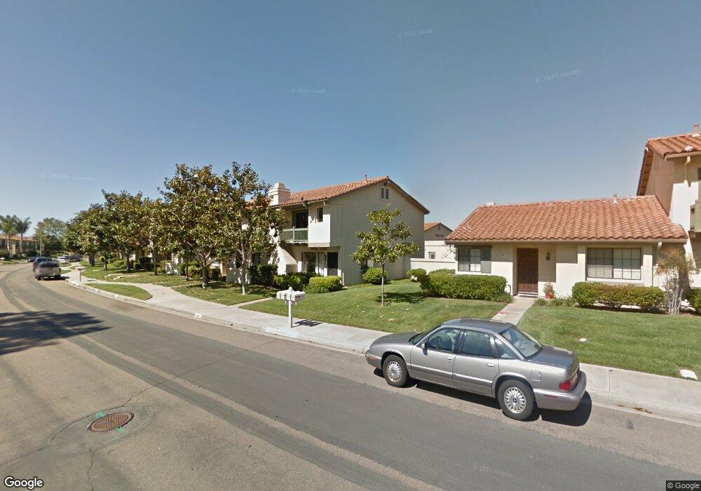
6864 Pear Tree Dr Carlsbad, CA 92011
Poinsettia NeighborhoodEstimated Value: $1,053,000 - $1,163,000
3
Beds
3
Baths
1,438
Sq Ft
$763/Sq Ft
Est. Value
About This Home
This home is located at 6864 Pear Tree Dr, Carlsbad, CA 92011 and is currently estimated at $1,096,805, approximately $762 per square foot. 6864 Pear Tree Dr is a home located in San Diego County with nearby schools including Pacific Rim Elementary, Aviara Oaks Middle, and Sage Creek High.
Ownership History
Date
Name
Owned For
Owner Type
Purchase Details
Closed on
Aug 3, 2022
Sold by
Mcclain Robert E and Mcclain Maria L
Bought by
Mcclain Revocable Living Trust and Mcclain
Current Estimated Value
Purchase Details
Closed on
Oct 25, 2012
Sold by
Howard Donald A and Howard Elizabeth A
Bought by
Mclain Robert E and Mcclain Maria L
Home Financials for this Owner
Home Financials are based on the most recent Mortgage that was taken out on this home.
Original Mortgage
$259,000
Interest Rate
3.33%
Mortgage Type
New Conventional
Purchase Details
Closed on
Jul 17, 1986
Create a Home Valuation Report for This Property
The Home Valuation Report is an in-depth analysis detailing your home's value as well as a comparison with similar homes in the area
Home Values in the Area
Average Home Value in this Area
Purchase History
| Date | Buyer | Sale Price | Title Company |
|---|---|---|---|
| Mcclain Revocable Living Trust | -- | None Listed On Document | |
| Mclain Robert E | $399,000 | First American Title | |
| -- | $109,000 | -- |
Source: Public Records
Mortgage History
| Date | Status | Borrower | Loan Amount |
|---|---|---|---|
| Previous Owner | Mclain Robert E | $259,000 |
Source: Public Records
Tax History Compared to Growth
Tax History
| Year | Tax Paid | Tax Assessment Tax Assessment Total Assessment is a certain percentage of the fair market value that is determined by local assessors to be the total taxable value of land and additions on the property. | Land | Improvement |
|---|---|---|---|---|
| 2025 | $5,186 | $491,327 | $135,336 | $355,991 |
| 2024 | $5,186 | $481,694 | $132,683 | $349,011 |
| 2023 | $5,160 | $472,250 | $130,082 | $342,168 |
| 2022 | $5,080 | $462,991 | $127,532 | $335,459 |
| 2021 | $5,042 | $453,914 | $125,032 | $328,882 |
| 2020 | $5,009 | $449,260 | $123,750 | $325,510 |
| 2019 | $4,919 | $440,452 | $121,324 | $319,128 |
| 2018 | $4,712 | $431,817 | $118,946 | $312,871 |
| 2017 | $4,634 | $423,351 | $116,614 | $306,737 |
| 2016 | $4,448 | $415,051 | $114,328 | $300,723 |
| 2015 | $4,431 | $408,817 | $112,611 | $296,206 |
| 2014 | $4,357 | $400,810 | $110,406 | $290,404 |
Source: Public Records
Map
Nearby Homes
- 6915 Pear Tree Dr
- 6777 Lonicera St
- 874 Marigold Ct
- 7030 Lantana Terrace
- 7013 Lavender Way
- 6951 Quiet Cove Dr
- 839 Skysail Ave
- 6557 Coneflower Dr
- 802 Spindrift Ln
- 907 Caminito Estrada Unit E
- 803 Skysail Ave
- 909 Caminito Madrigal Unit B
- 6497 Wayfinders Ct
- 7219 Linden Terrace
- 6925 Waters End Dr
- 6462 Camino Del Parque
- 811 Caminito Del Sol
- 7089 Tatler Rd
- 6548 Camino Del Parque
- 609 Saltgrass Ave
- 6862 Pear Tree Dr
- 6866 Pear Tree Dr
- 6868 Pear Tree Dr
- 6860 Pear Tree Dr
- 6870 Pear Tree Dr
- 6856 Pear Tree Dr
- 6854 Pear Tree Dr
- 6857 Batiquitos Dr
- 6859 Batiquitos Dr
- 6865 Batiquitos Dr
- 6855 Batiquitos Dr
- 6867 Batiquitos Dr
- 6853 Batiquitos Dr
- 6852 Pear Tree Dr Unit 5
- 6865 Pear Tree Dr
- 6851 Batiquitos Dr
- 6869 Batiquitos Dr Unit 5
- 6863 Pear Tree Dr
- 6861 Pear Tree Dr
- 6872 Alderwood Dr