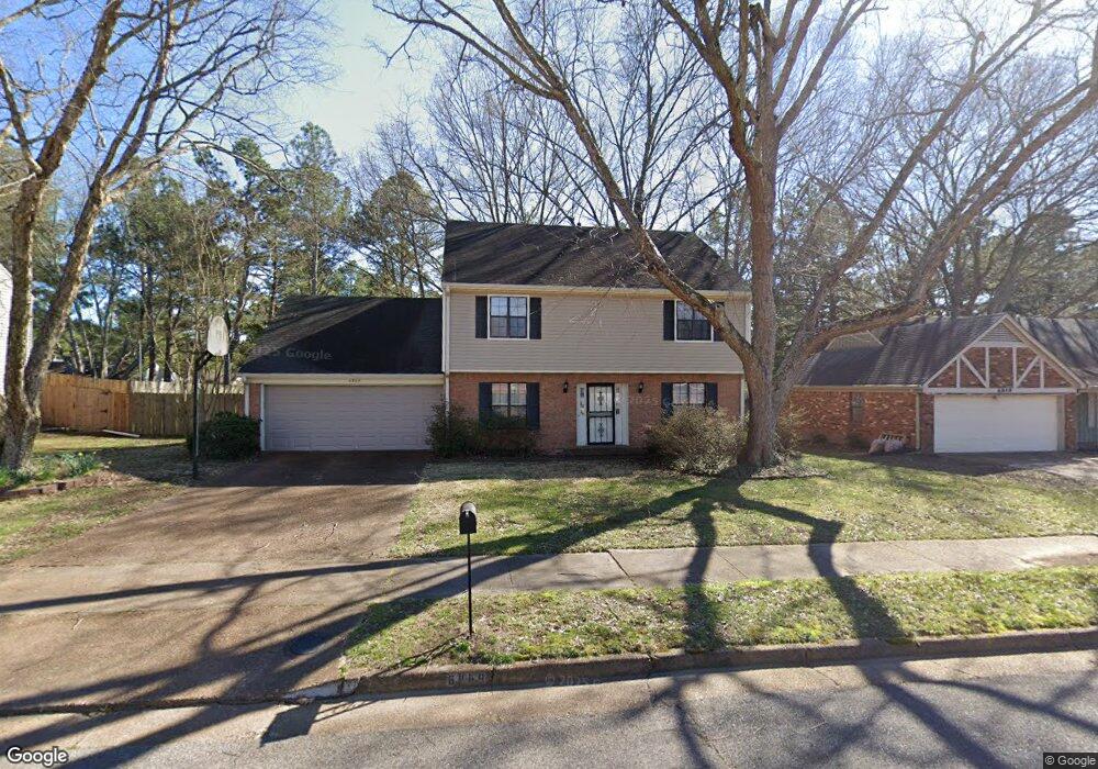
6869 Bainbridge Dr Memphis, TN 38119
Shady Grove NeighborhoodEstimated Value: $230,000 - $256,000
4
Beds
3
Baths
2,159
Sq Ft
$113/Sq Ft
Est. Value
About This Home
This home is located at 6869 Bainbridge Dr, Memphis, TN 38119 and is currently estimated at $244,973, approximately $113 per square foot. 6869 Bainbridge Dr is a home located in Shelby County with nearby schools including Oak Forest Elementary, Ridgeway Middle School, and Ridgeway High School.
Ownership History
Date
Name
Owned For
Owner Type
Purchase Details
Closed on
Jul 30, 1998
Sold by
Mitchell David S and Mitchell Tina D
Bought by
Nwobilor Loveday and Smith Terra L
Current Estimated Value
Home Financials for this Owner
Home Financials are based on the most recent Mortgage that was taken out on this home.
Original Mortgage
$98,950
Outstanding Balance
$19,641
Interest Rate
6.96%
Estimated Equity
$225,332
Purchase Details
Closed on
Dec 5, 1994
Bought by
Mitchell David S and Mitchell Tina D
Create a Home Valuation Report for This Property
The Home Valuation Report is an in-depth analysis detailing your home's value as well as a comparison with similar homes in the area
Home Values in the Area
Average Home Value in this Area
Purchase History
| Date | Buyer | Sale Price | Title Company |
|---|---|---|---|
| Nwobilor Loveday | $123,700 | -- | |
| Nwobilor Loveday | $123,700 | -- | |
| Mitchell David S | $99,000 | -- |
Source: Public Records
Mortgage History
| Date | Status | Borrower | Loan Amount |
|---|---|---|---|
| Open | Nwobilor Loveday | $98,950 | |
| Closed | Nwobilor Loveday | $98,950 |
Source: Public Records
Tax History
| Year | Tax Paid | Tax Assessment Tax Assessment Total Assessment is a certain percentage of the fair market value that is determined by local assessors to be the total taxable value of land and additions on the property. | Land | Improvement |
|---|---|---|---|---|
| 2025 | $1,368 | $57,825 | $8,500 | $49,325 |
| 2024 | $1,368 | $40,350 | $7,650 | $32,700 |
| 2023 | $2,458 | $40,350 | $7,650 | $32,700 |
| 2022 | $2,458 | $40,350 | $7,650 | $32,700 |
| 2021 | $2,487 | $40,350 | $7,650 | $32,700 |
| 2020 | $2,429 | $33,525 | $6,450 | $27,075 |
| 2019 | $2,429 | $33,525 | $6,450 | $27,075 |
| 2018 | $2,429 | $33,525 | $6,450 | $27,075 |
| 2017 | $1,378 | $33,525 | $6,450 | $27,075 |
| 2016 | $1,332 | $30,475 | $0 | $0 |
| 2014 | $1,332 | $30,475 | $0 | $0 |
Source: Public Records
Map
Nearby Homes
- 2819 McVay Trail Dr
- 6736 Kirby Trace Cove
- 6725 Kirby Trace Cove
- 6758 Racquet Club Dr
- 7038 Baintree Cove
- 2945 Millers Pond Dr
- 2677 Tangbourne Dr
- 2660 Stout Cove
- 2961 Jib Cove Unit 30
- 6683 Kirby Oaks Ln
- 6830 Monan Cove
- 6765 Kirby Lawn Cove
- 6985 Wittenham Cove
- 2587 Mcvay Rd
- 2997 Riverdale Rd
- 6878 Norhan Cove
- 2618 Abercorn Cove
- 6531 Kirby Gate Cove
- 3142 Belsfield Cove
- 6691 Vinings Creek Cove W
- 6877 Bainbridge Dr
- 6859 Bainbridge Dr
- 6870 Bainbridge Dr
- 6851 Bainbridge Dr
- 6887 Bainbridge Dr
- 6860 Bainbridge Dr
- 6878 Bainbridge Dr
- 6852 Bainbridge Dr
- 6888 Bainbridge Dr
- 6841 Bainbridge Dr
- 6899 Bainbridge Dr
- 6869 Amersham Dr
- 6842 Bainbridge Dr
- 6861 Amersham Dr
- 6853 Amersham Dr
- 6889 Amersham Dr
- 6833 Bainbridge Dr
- 6834 Bainbridge Dr
- 6843 Amersham Dr
- 6901 Amersham Dr
Your Personal Tour Guide
Ask me questions while you tour the home.