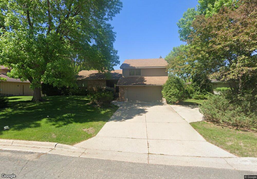
687 Apache Ln Saint Paul, MN 55120
Estimated Value: $739,000 - $825,000
3
Beds
4
Baths
4,592
Sq Ft
$168/Sq Ft
Est. Value
About This Home
This home is located at 687 Apache Ln, Saint Paul, MN 55120 and is currently estimated at $772,377, approximately $168 per square foot. 687 Apache Ln is a home located in Dakota County with nearby schools including Mendota Elementary School, Friendly Hills Middle School, and Two Rivers High School.
Ownership History
Date
Name
Owned For
Owner Type
Purchase Details
Closed on
Oct 13, 2015
Sold by
Skoglund Judy P and Skoglund Darrell E
Bought by
Tschann Gregory P and Tschann Suphala U
Current Estimated Value
Home Financials for this Owner
Home Financials are based on the most recent Mortgage that was taken out on this home.
Original Mortgage
$325,000
Outstanding Balance
$255,707
Interest Rate
3.88%
Mortgage Type
New Conventional
Estimated Equity
$516,670
Create a Home Valuation Report for This Property
The Home Valuation Report is an in-depth analysis detailing your home's value as well as a comparison with similar homes in the area
Home Values in the Area
Average Home Value in this Area
Purchase History
| Date | Buyer | Sale Price | Title Company |
|---|---|---|---|
| Tschann Gregory P | $445,000 | Burnet Title |
Source: Public Records
Mortgage History
| Date | Status | Borrower | Loan Amount |
|---|---|---|---|
| Open | Tschann Gregory P | $325,000 |
Source: Public Records
Tax History
| Year | Tax Paid | Tax Assessment Tax Assessment Total Assessment is a certain percentage of the fair market value that is determined by local assessors to be the total taxable value of land and additions on the property. | Land | Improvement |
|---|---|---|---|---|
| 2024 | $7,424 | $730,500 | $183,400 | $547,100 |
| 2023 | $7,424 | $747,900 | $179,300 | $568,600 |
| 2022 | $6,482 | $727,300 | $178,800 | $548,500 |
| 2021 | $6,340 | $622,400 | $155,500 | $466,900 |
| 2020 | $6,190 | $603,600 | $148,100 | $455,500 |
| 2019 | $5,876 | $573,200 | $141,100 | $432,100 |
| 2018 | $5,422 | $525,200 | $131,800 | $393,400 |
| 2017 | $5,129 | $506,600 | $125,500 | $381,100 |
| 2016 | $4,982 | $464,200 | $119,500 | $344,700 |
| 2015 | $5,079 | $454,800 | $119,500 | $335,300 |
| 2014 | -- | $446,800 | $112,800 | $334,000 |
| 2013 | -- | $411,622 | $109,453 | $302,169 |
Source: Public Records
Map
Nearby Homes
- 750 Mohican Ln
- 2300 Pagel Rd
- 2545 Concord Way Unit 115
- 2572 Lockwood Dr Unit 68
- 2571 Bedford Ct
- 2556 Lockwood Dr Unit 59
- 809 Wagon Wheel Trail
- 2498 Pond Cir E
- 901 Cheri Ln
- 2194 Charlton Rd
- 2158 Charlton Rd
- 240 Salem Church Rd
- 260 Salem Church Rd
- 708 Linden St
- 585 High Ridge Cir
- 631 Callahan Place
- 1850 Eagle Ridge Dr Unit E205
- 679 Marie Ave W
- 1925 Walsh Ln
- 1871 Chardel Ct
Your Personal Tour Guide
Ask me questions while you tour the home.