Estimated Value: $486,000 - $601,000
5
Beds
3
Baths
2,547
Sq Ft
$213/Sq Ft
Est. Value
About This Home
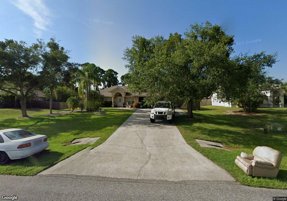
This home is located at 6870 Hundred Acre Dr, Cocoa, FL 32927 and is currently estimated at $543,402, approximately $213 per square foot. 6870 Hundred Acre Dr is a home located in Brevard County with nearby schools including Enterprise Elementary School, Space Coast Junior/Senior High School, and East Atlantic Prep of Brevard County.
Ownership History
Date
Name
Owned For
Owner Type
Purchase Details
Closed on
Jul 9, 1996
Sold by
Mercedes Homes Inc
Bought by
Witters Grant D and Witters Belinda A
Current Estimated Value
Home Financials for this Owner
Home Financials are based on the most recent Mortgage that was taken out on this home.
Original Mortgage
$121,600
Outstanding Balance
$8,596
Interest Rate
7.99%
Estimated Equity
$534,806
Purchase Details
Closed on
May 1, 1996
Sold by
Romar Homes Inc
Bought by
Mercedes Homes Inc
Create a Home Valuation Report for This Property
The Home Valuation Report is an in-depth analysis detailing your home's value as well as a comparison with similar homes in the area
Home Values in the Area
Average Home Value in this Area
Purchase History
| Date | Buyer | Sale Price | Title Company |
|---|---|---|---|
| Witters Grant D | $128,000 | -- | |
| Mercedes Homes Inc | $21,000 | -- |
Source: Public Records
Mortgage History
| Date | Status | Borrower | Loan Amount |
|---|---|---|---|
| Open | Witters Grant D | $121,600 |
Source: Public Records
Tax History Compared to Growth
Tax History
| Year | Tax Paid | Tax Assessment Tax Assessment Total Assessment is a certain percentage of the fair market value that is determined by local assessors to be the total taxable value of land and additions on the property. | Land | Improvement |
|---|---|---|---|---|
| 2025 | $2,730 | $201,330 | -- | -- |
| 2024 | $2,684 | $195,660 | -- | -- |
| 2023 | $2,684 | $189,970 | $0 | $0 |
| 2022 | $2,517 | $184,440 | $0 | $0 |
| 2021 | $2,560 | $179,070 | $0 | $0 |
| 2020 | $2,482 | $176,600 | $0 | $0 |
| 2019 | $2,428 | $172,630 | $0 | $0 |
| 2018 | $2,432 | $169,420 | $0 | $0 |
| 2017 | $2,449 | $165,940 | $0 | $0 |
| 2016 | $2,479 | $162,530 | $32,000 | $130,530 |
| 2015 | $2,540 | $161,410 | $32,000 | $129,410 |
| 2014 | $2,553 | $160,130 | $32,000 | $128,130 |
Source: Public Records
Map
Nearby Homes
- 6643 Emil Ave
- 7065 Hundred Acre Dr
- 6581 Bancroft Ave
- TBD Freeport Rd
- 6665 Addie Ave
- 5575 Curtis Blvd
- 6615 Dock Ave
- 5715 Fairbridge St
- 4650 N Highway 1 Hwy
- 5730 Friendly St
- 6105 Banyan St
- 7230 Venus Ave
- 6545 Addie Ave
- 7358 Crepe Myrtle Ct
- 5155 Mayflower St
- 7635 Fringe Place
- 6115 Allmont St
- 23-35-21-JX-B-2 Aruin St
- 6365 Homestead Ave
- 5090 Market St
- 6860 Hundred Acre Dr
- 6880 Hundred Acre Dr
- 5695 Brandon St
- 5705 Brandon St
- 5685 Brandon St
- 6850 Hundred Acre Dr
- 6890 Hundred Acre Dr
- 5715 Brandon St
- 6865 Hundred Acre Dr
- 5725 Brandon St
- 6900 Hundred Acre Dr
- 6875 Hundred Acre Dr
- 6855 Hundred Acre Dr
- 5665 Brandon St
- 5690 Brandon St
- 6840 Hundred Acre Dr
- 6885 Hundred Acre Dr
- 5700 Brandon St
- 5680 Brandon St
- 6845 Hundred Acre Dr