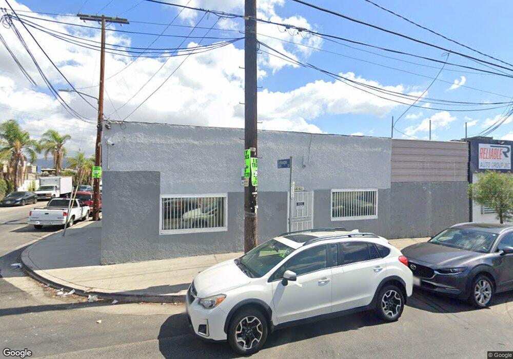
6880 Lankershim Blvd Los Angeles, CA 91605
North Hollywood NeighborhoodEstimated Value: $1,584,436
--
Bed
--
Bath
4,248
Sq Ft
$373/Sq Ft
Est. Value
About This Home
This home is located at 6880 Lankershim Blvd, Los Angeles, CA 91605 and is currently estimated at $1,584,436, approximately $372 per square foot. 6880 Lankershim Blvd is a home located in Los Angeles County with nearby schools including Fair Avenue Elementary School, Roy Romer Middle School, and North Hollywood Senior High School.
Ownership History
Date
Name
Owned For
Owner Type
Purchase Details
Closed on
Jul 28, 2010
Sold by
Delia Fabian
Bought by
Riboc Ar Llc
Current Estimated Value
Purchase Details
Closed on
Mar 27, 2008
Sold by
Delia Marina
Bought by
Delia Fabian
Purchase Details
Closed on
May 15, 2002
Sold by
Bilbasoo Goorgiz
Bought by
Delia Fabian and Delia Marina
Home Financials for this Owner
Home Financials are based on the most recent Mortgage that was taken out on this home.
Original Mortgage
$414,000
Interest Rate
7.13%
Mortgage Type
Commercial
Create a Home Valuation Report for This Property
The Home Valuation Report is an in-depth analysis detailing your home's value as well as a comparison with similar homes in the area
Home Values in the Area
Average Home Value in this Area
Purchase History
| Date | Buyer | Sale Price | Title Company |
|---|---|---|---|
| Riboc Ar Llc | -- | None Available | |
| Delia Fabian | -- | Southland Title Corporation | |
| Delia Fabian | $460,000 | Old Republic Title Company |
Source: Public Records
Mortgage History
| Date | Status | Borrower | Loan Amount |
|---|---|---|---|
| Previous Owner | Delia Fabian | $414,000 |
Source: Public Records
Tax History Compared to Growth
Tax History
| Year | Tax Paid | Tax Assessment Tax Assessment Total Assessment is a certain percentage of the fair market value that is determined by local assessors to be the total taxable value of land and additions on the property. | Land | Improvement |
|---|---|---|---|---|
| 2025 | $8,279 | $646,981 | $388,191 | $258,790 |
| 2024 | $8,279 | $634,296 | $380,580 | $253,716 |
| 2023 | $8,128 | $621,860 | $373,118 | $248,742 |
| 2022 | $7,766 | $609,667 | $365,802 | $243,865 |
| 2021 | $7,652 | $597,714 | $358,630 | $239,084 |
| 2019 | $7,433 | $579,988 | $347,994 | $231,994 |
| 2018 | $7,233 | $568,617 | $341,171 | $227,446 |
| 2016 | $6,878 | $546,539 | $327,924 | $218,615 |
| 2015 | $6,782 | $538,331 | $322,999 | $215,332 |
| 2014 | $6,814 | $527,786 | $316,672 | $211,114 |
Source: Public Records
Map
Nearby Homes
- 6945 Hinds Ave
- 11837 Hart St
- 6904 Radford Ave Unit 1
- 6928 Gentry Ave
- 11936 Hart St
- 6623 Troost Ave
- 6923 Ben Ave
- 12012 Hart St
- 6732 Farmdale Ave
- 11852 Lemay St
- 6651 Farmdale Ave
- 11554 Kittridge St
- 6640 Farmdale Ave
- 6938 Laurel Canyon Blvd Unit 310
- 6938 Laurel Canyon Blvd Unit 212
- 6822 Vantage Ave
- 6843 Vantage Ave
- 6417 Troost Ave
- 6449 Radford Ave
- 11220 Lyon Ln
- 6910 Simpson Ave
- 6900 Simpson Ave
- 6926 Lankershim Blvd
- 6930 Simpson Ave
- 6947 Lankershim Blvd
- 6932 Simpson Ave
- 6845 Lankershim Blvd
- 6852 Simpson Ave
- 6938 Simpson Ave
- 6837 Lankershim Blvd
- 6848 Simpson Ave
- 6940 Simpson Ave
- 6842 Simpson Ave
- 6953 Lankershim Blvd
- 6946 Simpson Ave
- 6838 Simpson Ave
- 6907 Simpson Ave
- 6901 Simpson Ave
- 6950 Simpson Ave
- 6829 Lankershim Blvd