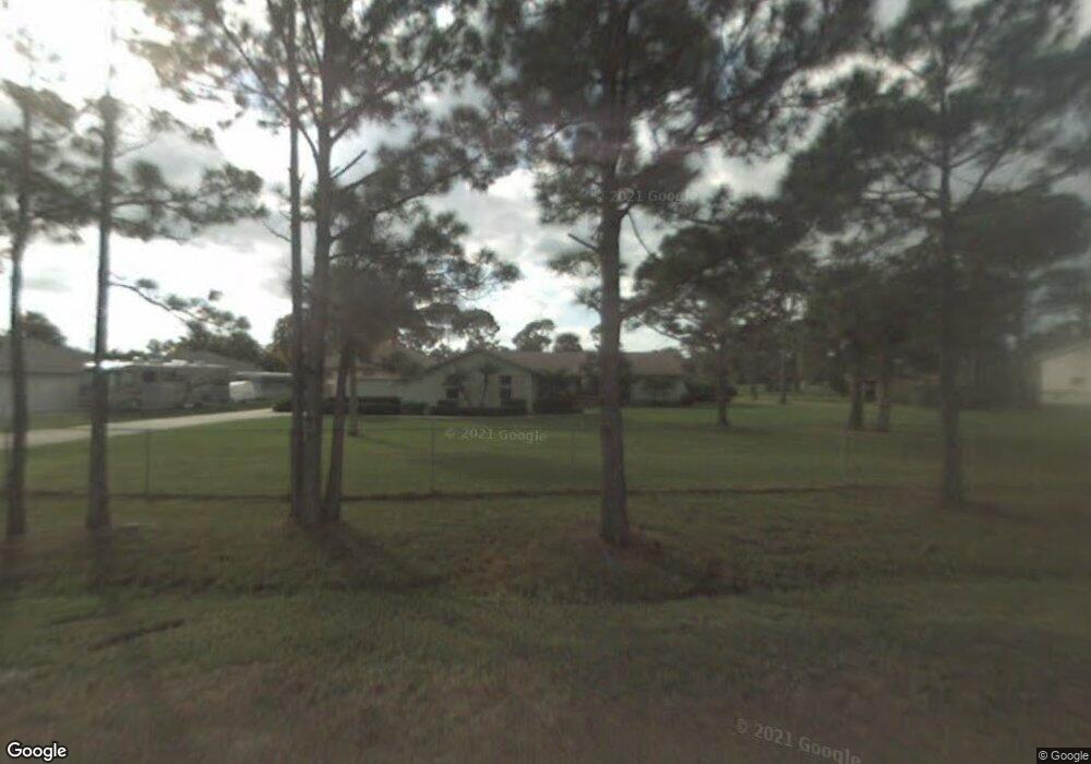
6884 152nd Dr N West Palm Beach, FL 33418
Palm Beach Country Estates NeighborhoodEstimated Value: $744,708 - $859,000
--
Bed
3
Baths
1,718
Sq Ft
$465/Sq Ft
Est. Value
About This Home
This home is located at 6884 152nd Dr N, West Palm Beach, FL 33418 and is currently estimated at $799,427, approximately $465 per square foot. 6884 152nd Dr N is a home located in Palm Beach County with nearby schools including William T. Dwyer High School, Marsh Pointe Elementary School, and Independence Middle School.
Ownership History
Date
Name
Owned For
Owner Type
Purchase Details
Closed on
May 9, 2000
Sold by
Henderson Anthony R and Henderson Donna C
Bought by
Stevens James
Current Estimated Value
Purchase Details
Closed on
Feb 24, 2000
Sold by
Davison Samuel P
Bought by
Henderson Anthony R
Home Financials for this Owner
Home Financials are based on the most recent Mortgage that was taken out on this home.
Original Mortgage
$272,000
Interest Rate
8.21%
Mortgage Type
New Conventional
Create a Home Valuation Report for This Property
The Home Valuation Report is an in-depth analysis detailing your home's value as well as a comparison with similar homes in the area
Home Values in the Area
Average Home Value in this Area
Purchase History
| Date | Buyer | Sale Price | Title Company |
|---|---|---|---|
| Stevens James | $177,500 | -- | |
| Henderson Anthony R | $275,000 | -- |
Source: Public Records
Mortgage History
| Date | Status | Borrower | Loan Amount |
|---|---|---|---|
| Previous Owner | Henderson Anthony R | $272,000 |
Source: Public Records
Tax History Compared to Growth
Tax History
| Year | Tax Paid | Tax Assessment Tax Assessment Total Assessment is a certain percentage of the fair market value that is determined by local assessors to be the total taxable value of land and additions on the property. | Land | Improvement |
|---|---|---|---|---|
| 2024 | $2,698 | $239,387 | -- | -- |
| 2023 | $5,195 | $232,415 | $0 | $0 |
| 2022 | $5,157 | $225,646 | $0 | $0 |
| 2021 | $5,070 | $219,074 | $0 | $0 |
| 2020 | $5,044 | $216,049 | $0 | $0 |
| 2019 | $5,038 | $211,192 | $0 | $0 |
| 2018 | $4,996 | $207,254 | $0 | $0 |
| 2017 | $4,484 | $202,991 | $0 | $0 |
| 2016 | $2,232 | $198,816 | $0 | $0 |
| 2015 | $4,546 | $197,434 | $0 | $0 |
| 2014 | $4,166 | $195,867 | $0 | $0 |
Source: Public Records
Map
Nearby Homes
- 6945 150th Place N
- 15314 70th Trail N
- 6395 Barbara St
- 7170 155th Place N
- 6354 Barbara St
- 6442 Drake St
- 474 Otter Ln S
- 6334 Foster St
- 403 Mangrove Point
- 7360 150th Ct N
- 412 Meadowlark Dr
- 15094 74th Ave N
- 6285 Mullin St
- 1175 Egret Cir S
- 495 Pelican Ln S
- 15268 75th Ave N
- 6242 Barbara St
- 496 Peacock Ln N
- 7480 150th Ct N
- 265 Swallowtail Ln
- 15230 69th Dr N
- 6885 152nd Dr N
- 6943 151st Ct N
- 6834 152nd Dr N
- 6927 152nd Dr N
- 6921 151st Ct N
- 6835 152nd Dr N
- 15338 69th Dr N
- 0 69th Trail N
- 15229 69th Dr N
- 6905 151st Ct N
- 6944 151st Ct N
- 6926 153rd Ct N
- 6922 151st Ct N
- 15277 69th Dr N
- 6886 153rd Ct N
- 6964 151st Ct N
- 15181 69th Dr N
- 15290 69th Trail N
- 15242 69th Trail N