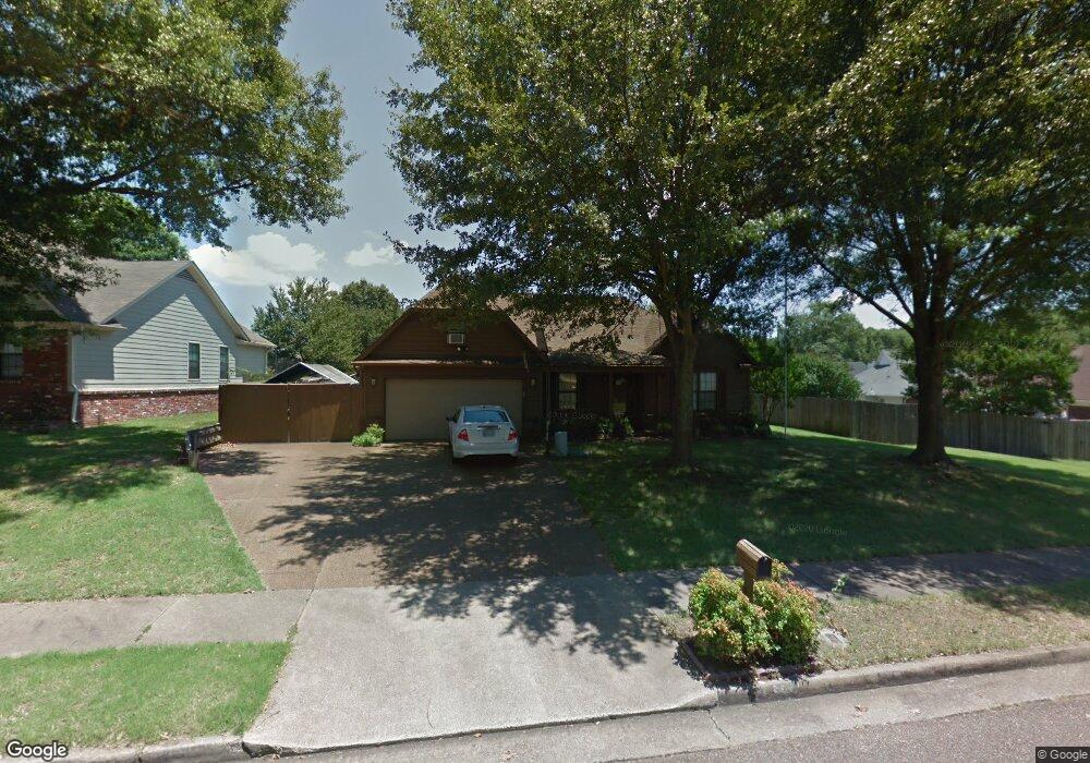
6885 Andrews Rd Memphis, TN 38135
Estimated Value: $268,000 - $304,000
3
Beds
2
Baths
2,054
Sq Ft
$142/Sq Ft
Est. Value
About This Home
This home is located at 6885 Andrews Rd, Memphis, TN 38135 and is currently estimated at $290,717, approximately $141 per square foot. 6885 Andrews Rd is a home located in Shelby County with nearby schools including Oak Elementary School, Appling Middle School, and Bartlett High School.
Ownership History
Date
Name
Owned For
Owner Type
Purchase Details
Closed on
Mar 31, 2006
Sold by
Simpson Lynda Joyce and Massengill Beverly Ann S
Bought by
Churchill Lester L and Churchill Carolyn M
Current Estimated Value
Home Financials for this Owner
Home Financials are based on the most recent Mortgage that was taken out on this home.
Original Mortgage
$103,000
Interest Rate
6.29%
Mortgage Type
Fannie Mae Freddie Mac
Purchase Details
Closed on
Mar 28, 1996
Bought by
Northam Brian T and Northam Leslie P
Create a Home Valuation Report for This Property
The Home Valuation Report is an in-depth analysis detailing your home's value as well as a comparison with similar homes in the area
Home Values in the Area
Average Home Value in this Area
Purchase History
| Date | Buyer | Sale Price | Title Company |
|---|---|---|---|
| Churchill Lester L | $141,000 | Grace Title & Escrow Llc | |
| Northam Brian T | $105,500 | -- |
Source: Public Records
Mortgage History
| Date | Status | Borrower | Loan Amount |
|---|---|---|---|
| Open | Northam Brian T | $121,800 | |
| Closed | Churchill Lester L | $103,000 |
Source: Public Records
Tax History Compared to Growth
Tax History
| Year | Tax Paid | Tax Assessment Tax Assessment Total Assessment is a certain percentage of the fair market value that is determined by local assessors to be the total taxable value of land and additions on the property. | Land | Improvement |
|---|---|---|---|---|
| 2025 | $1,709 | $72,050 | $14,500 | $57,550 |
| 2024 | $1,709 | $50,425 | $9,750 | $40,675 |
| 2023 | $2,582 | $50,425 | $9,750 | $40,675 |
| 2022 | $2,582 | $50,425 | $9,750 | $40,675 |
| 2021 | $2,622 | $50,425 | $9,750 | $40,675 |
| 2020 | $2,256 | $38,375 | $7,500 | $30,875 |
| 2019 | $2,256 | $38,375 | $7,500 | $30,875 |
| 2018 | $2,256 | $38,375 | $7,500 | $30,875 |
| 2017 | $1,577 | $38,375 | $7,500 | $30,875 |
| 2016 | $1,510 | $34,550 | $0 | $0 |
| 2014 | $1,510 | $34,550 | $0 | $0 |
Source: Public Records
Map
Nearby Homes
- 6950 Dovefield Ln
- 00 Yale Rd
- 6870 Deerfield Rd
- 3659 Stonetrace Cir
- 6806 Briarfield Ln
- 6759 Oakmoor Cir S
- 6680 Cedarshade Cove
- 3334 Oak Rd
- 6894 Hedgewood Ln
- 7185 Deerfield Rd
- 6579 Sungate Dr S
- 3610 Greenleaf Rd
- 3148 Hill Lake Dr
- Webster Plan at Union Depot
- Asher Plan at Union Depot
- Glenmore Plan at Union Depot
- Manning Plan at Union Depot
- Lewis Plan at Union Depot
- Emerson Plan at Union Depot
- Chapman Plan at Union Depot
- 6892 Doefield Trail
- 6925 Meadowlands Place
- 6900 Doefield Trail
- 6901 Andrews Rd
- 6884 Andrews Rd
- 6910 Doefield Trail
- 6890 Andrews Rd
- 6930 Meadowlands Place
- 3494 Tiffany Oaks Ln
- 6931 Meadowlands Place
- 6913 Andrews Rd
- 6896 Andrews Rd
- 6918 Doefield Trail
- 6902 Andrews Rd
- 6859 Andrews Rd
- 3510 Tiffany Oaks Ln
- 6926 Doefield Trail
- 6923 Andrews Rd
- 6937 Meadowlands Place
- 6936 Meadowlands Place