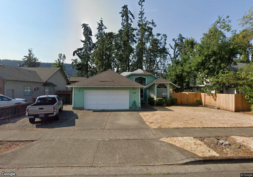
6885 C St Springfield, OR 97478
Thurston NeighborhoodEstimated Value: $387,000 - $442,000
3
Beds
2
Baths
1,301
Sq Ft
$314/Sq Ft
Est. Value
About This Home
This home is located at 6885 C St, Springfield, OR 97478 and is currently estimated at $408,440, approximately $313 per square foot. 6885 C St is a home located in Lane County with nearby schools including Ridgeview Elementary School, Thurston Middle School, and Thurston High School.
Ownership History
Date
Name
Owned For
Owner Type
Purchase Details
Closed on
Nov 13, 2024
Sold by
Gloria Ann Hull Irrevocable Trust and Robinson Jeremy
Bought by
Kilpatrick Craig Vincent
Current Estimated Value
Home Financials for this Owner
Home Financials are based on the most recent Mortgage that was taken out on this home.
Original Mortgage
$285,000
Outstanding Balance
$281,871
Interest Rate
6.12%
Mortgage Type
New Conventional
Estimated Equity
$126,569
Purchase Details
Closed on
Aug 23, 2016
Sold by
Cramer Lois I
Bought by
Robinson Stephen C
Create a Home Valuation Report for This Property
The Home Valuation Report is an in-depth analysis detailing your home's value as well as a comparison with similar homes in the area
Home Values in the Area
Average Home Value in this Area
Purchase History
| Date | Buyer | Sale Price | Title Company |
|---|---|---|---|
| Kilpatrick Craig Vincent | $300,000 | Western Title | |
| Kilpatrick Craig Vincent | $300,000 | Western Title | |
| Robinson Stephen C | $205,000 | First American Title |
Source: Public Records
Mortgage History
| Date | Status | Borrower | Loan Amount |
|---|---|---|---|
| Open | Kilpatrick Craig Vincent | $285,000 | |
| Closed | Kilpatrick Craig Vincent | $285,000 |
Source: Public Records
Tax History Compared to Growth
Tax History
| Year | Tax Paid | Tax Assessment Tax Assessment Total Assessment is a certain percentage of the fair market value that is determined by local assessors to be the total taxable value of land and additions on the property. | Land | Improvement |
|---|---|---|---|---|
| 2025 | $4,184 | $228,183 | -- | -- |
| 2024 | $4,117 | $221,537 | -- | -- |
| 2023 | $4,117 | $215,085 | $0 | $0 |
| 2022 | $3,813 | $208,821 | $0 | $0 |
| 2021 | $3,744 | $202,739 | $0 | $0 |
| 2020 | $3,635 | $196,834 | $0 | $0 |
| 2019 | $3,526 | $191,101 | $0 | $0 |
| 2018 | $3,323 | $180,131 | $0 | $0 |
| 2017 | $3,196 | $180,131 | $0 | $0 |
| 2016 | $2,696 | $174,884 | $0 | $0 |
| 2015 | $2,619 | $169,790 | $0 | $0 |
| 2014 | $2,579 | $164,845 | $0 | $0 |
Source: Public Records
Map
Nearby Homes
- 250 68th St
- 482 Laksonen Loop
- 6968 A St
- 515 70th St
- 0 71st St
- 296 S 68th Ct
- 6964 Bluebelle Way
- 353 72nd St
- 0 Omlid Dr Unit 1 706471345
- 0 Omlid Dr Unit 27 796722689
- 0 Omlid Dr Unit 26 256458253
- 0 Omlid Dr Unit 3 154724851
- 0 Omlid Dr Unit 2 312357104
- 0 S 67th St Unit 693960327
- 296 65th St
- 6445 B St
- 7080 Thurston Rd Unit 2
- 595 S 68th Place
- 289 73rd Place
- 0 S 69th Place