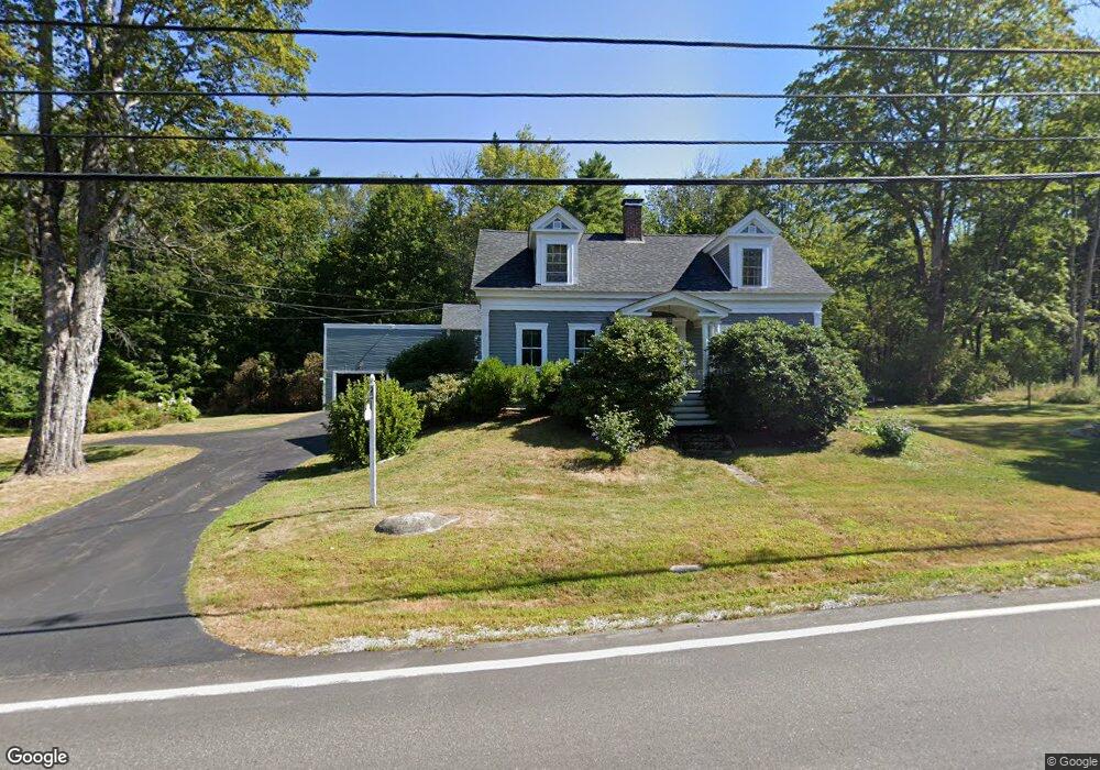
689 N Main St Wolfeboro, NH 03894
Estimated Value: $586,158 - $763,000
3
Beds
2
Baths
3,263
Sq Ft
$207/Sq Ft
Est. Value
About This Home
This home is located at 689 N Main St, Wolfeboro, NH 03894 and is currently estimated at $674,290, approximately $206 per square foot. 689 N Main St is a home located in Carroll County with nearby schools including Carpenter Elementary School, Crescent Lake School, and Kingswood Regional Middle School.
Ownership History
Date
Name
Owned For
Owner Type
Purchase Details
Closed on
Nov 20, 2017
Sold by
Hodder Michael and Hodder Patricia
Bought by
Hodder T
Current Estimated Value
Purchase Details
Closed on
Jan 22, 2013
Sold by
Patricia Anne Hodder R
Bought by
Hodder Michael and Hodder Patricia
Create a Home Valuation Report for This Property
The Home Valuation Report is an in-depth analysis detailing your home's value as well as a comparison with similar homes in the area
Home Values in the Area
Average Home Value in this Area
Purchase History
| Date | Buyer | Sale Price | Title Company |
|---|---|---|---|
| Hodder T | -- | -- | |
| Hodder Michael | -- | -- |
Source: Public Records
Tax History
| Year | Tax Paid | Tax Assessment Tax Assessment Total Assessment is a certain percentage of the fair market value that is determined by local assessors to be the total taxable value of land and additions on the property. | Land | Improvement |
|---|---|---|---|---|
| 2024 | $4,314 | $271,300 | $63,000 | $208,300 |
| 2023 | $3,985 | $271,300 | $63,000 | $208,300 |
| 2022 | $3,587 | $271,300 | $63,000 | $208,300 |
| 2021 | $3,709 | $271,300 | $63,000 | $208,300 |
| 2020 | $3,543 | $272,300 | $63,000 | $209,300 |
| 2019 | $4,034 | $254,700 | $63,000 | $191,700 |
| 2018 | $4,024 | $254,700 | $63,000 | $191,700 |
| 2017 | $3,815 | $254,700 | $63,000 | $191,700 |
| 2016 | $3,638 | $248,700 | $63,000 | $185,700 |
| 2015 | $3,469 | $248,700 | $63,000 | $185,700 |
| 2014 | $3,043 | $233,900 | $61,600 | $172,300 |
| 2013 | $3,001 | $233,900 | $61,600 | $172,300 |
Source: Public Records
Map
Nearby Homes
- 6 Governor Wentworth Hwy
- 40 Harbor Way Unit 24
- 39 Harbor Way Unit 19
- 19 Governor Wentworth Hwy
- 17 Waumbeck Rd
- 2 Jordan Way
- 86 Governor Wentworth Hwy
- 185 Ambrose Way
- 4 Mulberry Ct
- 12 Highland Terrace
- 290 Pine Hill Rd
- 00 Beach Pond Rd Unit 35
- 222 N Main St
- 35 Rocky Shore Rd
- 1 Ians Way
- 107 Middle Rd
- 0 Fieldstone Rd Unit 33
- 33 Endicott St Unit 7
- 156 Trotting Track Rd
- 7 Bayberry Ln
- 00 Governor Wentworth Hwy
- 1 Robin Acres Dr
- 681 N Main St
- 5 Robin Acres Dr
- 704 N Main St
- 0 Governor Wentworth Hwy Unit Map 167,Lot 8
- 0 Governor Wentworth Hwy
- 0 N Main St
- 0 Governor Wentworth Hwy Unit 4480127
- 7 Dove St
- 673 N Main St
- 5 Dove St
- 680 N Main St Unit 24
- 680 N Main St Unit 23
- 680 N Main St Unit 22
- 680 N Main St Unit 21
- 680 N Main St Unit 20
- 680 N Main St Unit 19
- 680 N Main St Unit 18
- 680 N Main St Unit 17
Your Personal Tour Guide
Ask me questions while you tour the home.