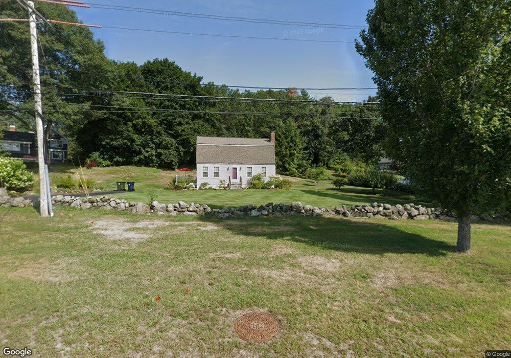
69 Andover St Andover, MA 01810
West Andover NeighborhoodEstimated Value: $700,000 - $835,000
2
Beds
2
Baths
1,591
Sq Ft
$473/Sq Ft
Est. Value
About This Home
This home is located at 69 Andover St, Andover, MA 01810 and is currently estimated at $753,092, approximately $473 per square foot. 69 Andover St is a home located in Essex County with nearby schools including West Elementary School, Andover West Middle School, and Andover High School.
Create a Home Valuation Report for This Property
The Home Valuation Report is an in-depth analysis detailing your home's value as well as a comparison with similar homes in the area
Home Values in the Area
Average Home Value in this Area
Tax History
| Year | Tax Paid | Tax Assessment Tax Assessment Total Assessment is a certain percentage of the fair market value that is determined by local assessors to be the total taxable value of land and additions on the property. | Land | Improvement |
|---|---|---|---|---|
| 2024 | $8,959 | $695,600 | $410,900 | $284,700 |
| 2023 | $8,583 | $628,300 | $370,000 | $258,300 |
| 2022 | $8,156 | $558,600 | $327,600 | $231,000 |
| 2021 | $7,810 | $510,800 | $297,800 | $213,000 |
| 2020 | $7,511 | $500,400 | $290,700 | $209,700 |
| 2019 | $7,339 | $480,600 | $274,000 | $206,600 |
| 2018 | $7,032 | $449,600 | $258,600 | $191,000 |
| 2017 | $6,738 | $443,900 | $253,400 | $190,500 |
| 2016 | $6,361 | $429,200 | $237,200 | $192,000 |
| 2015 | $6,135 | $409,800 | $228,000 | $181,800 |
Source: Public Records
Map
Nearby Homes
- 1 Delisio Dr
- 11 Rennie Dr
- 105 Central St
- 18 Dale St Unit 9D
- 3 Torr St
- 31 Porter Rd
- 3 West Hollow
- 4 Hammond Way
- 16 Porter Rd
- 241 Lowell St Unit 3
- 2 Garfield Ln W
- 11 Cuba St
- 72 Tewksbury St
- 154 Main St
- 100.5 Main St Unit Q
- 96 N Main St Unit 3
- 56 Sunset Rock Rd
- 3 Caileigh Ct
- 11 Wyncrest Cir
- 33 Chestnut St Unit 2
Your Personal Tour Guide
Ask me questions while you tour the home.