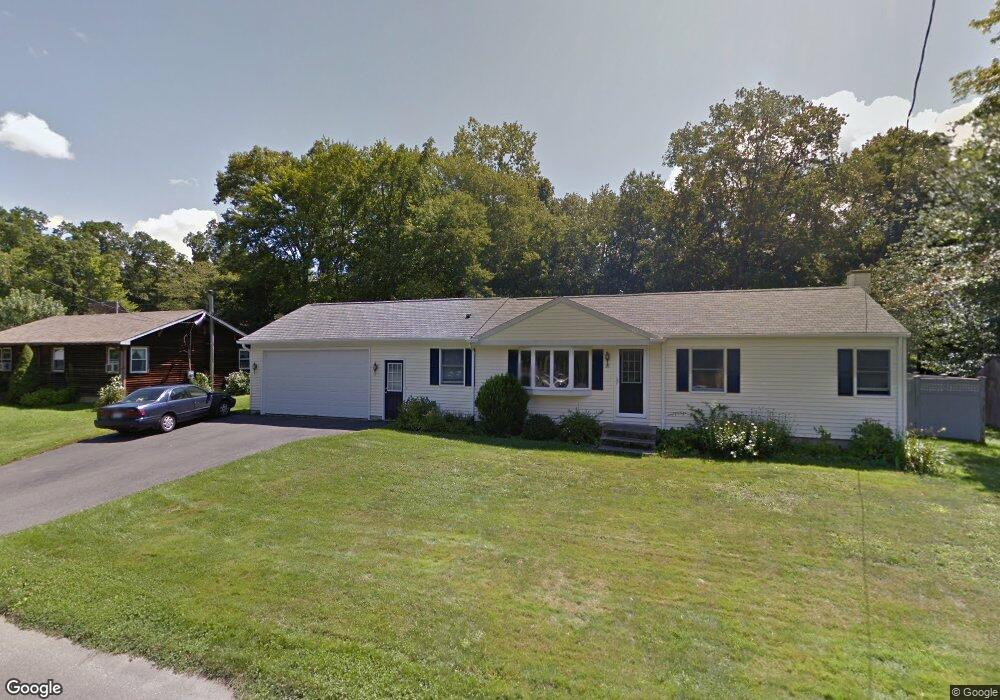
69 Austin Cir Florence, MA 01062
Florence NeighborhoodEstimated Value: $398,000 - $447,000
3
Beds
2
Baths
1,512
Sq Ft
$281/Sq Ft
Est. Value
About This Home
This home is located at 69 Austin Cir, Florence, MA 01062 and is currently estimated at $424,870, approximately $280 per square foot. 69 Austin Cir is a home located in Hampshire County with nearby schools including Northampton High School and Lander Grinspoon Academy.
Ownership History
Date
Name
Owned For
Owner Type
Purchase Details
Closed on
Aug 16, 2011
Sold by
Power Jane M
Bought by
Keith Daniel T
Current Estimated Value
Home Financials for this Owner
Home Financials are based on the most recent Mortgage that was taken out on this home.
Original Mortgage
$96,000
Outstanding Balance
$66,283
Interest Rate
4.51%
Mortgage Type
Purchase Money Mortgage
Estimated Equity
$358,587
Purchase Details
Closed on
Aug 30, 2006
Sold by
Weston Kathleen C and Weston Roderick J
Bought by
Keith Daniel T and Power Jane M
Create a Home Valuation Report for This Property
The Home Valuation Report is an in-depth analysis detailing your home's value as well as a comparison with similar homes in the area
Home Values in the Area
Average Home Value in this Area
Purchase History
| Date | Buyer | Sale Price | Title Company |
|---|---|---|---|
| Keith Daniel T | -- | -- | |
| Keith Daniel T | $261,500 | -- |
Source: Public Records
Mortgage History
| Date | Status | Borrower | Loan Amount |
|---|---|---|---|
| Open | Keith Daniel T | $96,000 |
Source: Public Records
Tax History Compared to Growth
Tax History
| Year | Tax Paid | Tax Assessment Tax Assessment Total Assessment is a certain percentage of the fair market value that is determined by local assessors to be the total taxable value of land and additions on the property. | Land | Improvement |
|---|---|---|---|---|
| 2025 | $4,930 | $353,900 | $132,500 | $221,400 |
| 2024 | $5,190 | $341,700 | $126,300 | $215,400 |
| 2023 | $4,774 | $301,400 | $114,800 | $186,600 |
| 2022 | $4,222 | $236,000 | $107,500 | $128,500 |
| 2021 | $4,270 | $245,800 | $102,500 | $143,300 |
| 2020 | $4,129 | $245,800 | $102,500 | $143,300 |
| 2019 | $4,025 | $231,700 | $87,500 | $144,200 |
| 2018 | $3,936 | $231,000 | $87,500 | $143,500 |
| 2017 | $3,855 | $231,000 | $87,500 | $143,500 |
| 2016 | $3,733 | $231,000 | $87,500 | $143,500 |
| 2015 | $3,655 | $231,300 | $87,500 | $143,800 |
| 2014 | $3,560 | $231,300 | $87,500 | $143,800 |
Source: Public Records
Map
Nearby Homes
- 138 Overlook Dr
- 447 Ryan Rd
- 8 Tara Cir
- 39 Matthew Dr
- 815 Burts Pit Rd
- 269 Ryan Rd
- 634 Burts Pit Rd
- 100 Emerson Way
- 137 Emerson Way
- 133 Cardinal Way
- 167 Emerson Way
- 7 Pine Valley Rd
- 383 Westhampton Rd
- 48 Dunphy Dr
- 225 Nonotuck St Unit C
- 37 Landy Ave
- 36 Landy Ave
- 325 Riverside Dr
- 321 Riverside Dr
- 95 Autumn Dr
- 61 Austin Cir
- 79 Austin Cir
- 227 Acrebrook Dr
- 235 Acrebrook Dr
- 103 Austin Cir
- 53 Austin Cir
- 219 Acrebrook Dr
- 72 Austin Cir
- 64 Austin Cir
- 243 Acrebrook Dr
- 80 Austin Cir
- 211 Acrebrook Dr
- 56 Austin Cir
- 45 Austin Cir
- 251 Acrebrook Dr
- 48 Austin Cir
- 88 Austin Cir
- 102 Austin Cir
- 228 Acrebrook Dr
- 236 Acrebrook Dr