
Seller's Agent in 2018
Peter Powell
Peter W. Powell Real Estate
(603) 731-9145
15 in this area
46 Total Sales


Estimated Value: $534,569 - $671,000
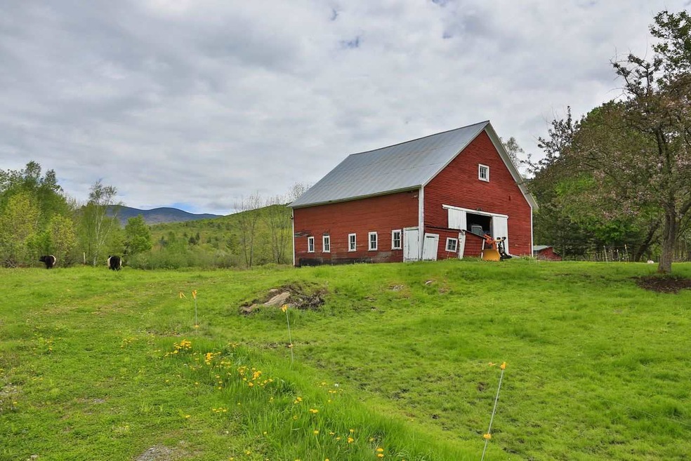
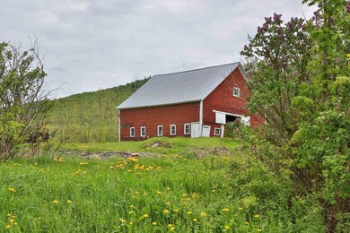
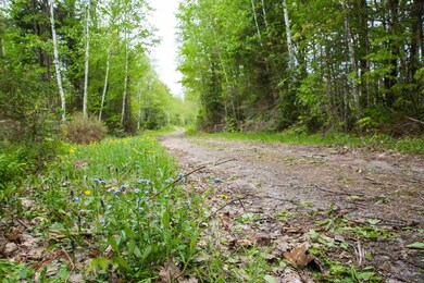
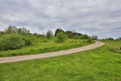
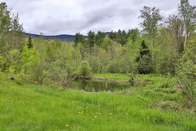
LANCASTER: 121 acres, once an active “hillside” farm and with the original barn, open fields, pasture and woodland. It's character unfolds as one walks past the barn into a rolling meadow with views of Mt. Lafayette and Cannon to the south, and the Pilot and Pliny Ranges to the east, with MT. Cabot, Starr King, the WM Nat'l Forest and more. There is a farm pond, a fast flowing mountain stream, and special home sites with great solar potential. This is a wonderful family property, one to keep for generations. The price has been reduced as incentive for sale: $299,000
Last Agent to Sell the Property
Peter W. Powell Real Estate License #081.0001674 Listed on: 04/16/2018
Last Buyer's Agent
Peter W. Powell Real Estate License #081.0001674 Listed on: 04/16/2018
| Date | Event | Price | List to Sale | Price per Sq Ft | Prior Sale |
|---|---|---|---|---|---|
| 10/10/2018 10/10/18 | Sold | $287,000 | -4.0% | $100 / Sq Ft | |
| 09/20/2018 09/20/18 | Pending | -- | -- | -- | |
| 07/11/2018 07/11/18 | Price Changed | $299,000 | -6.3% | $105 / Sq Ft | |
| 04/16/2018 04/16/18 | For Sale | $319,000 | +18.1% | $112 / Sq Ft | |
| 05/07/2015 05/07/15 | Sold | $270,000 | -8.7% | $74 / Sq Ft | View Prior Sale |
| 12/04/2014 12/04/14 | Pending | -- | -- | -- | |
| 07/28/2014 07/28/14 | For Sale | $295,740 | -- | $81 / Sq Ft |
| Year | Tax Paid | Tax Assessment Tax Assessment Total Assessment is a certain percentage of the fair market value that is determined by local assessors to be the total taxable value of land and additions on the property. | Land | Improvement |
|---|---|---|---|---|
| 2025 | $2,295 | $108,936 | $94,736 | $14,200 |
| 2024 | $2,108 | $109,904 | $95,704 | $14,200 |
| 2023 | $1,902 | $109,904 | $95,704 | $14,200 |
| 2022 | $1,973 | $81,236 | $70,836 | $10,400 |
| 2021 | $2,128 | $81,266 | $70,866 | $10,400 |
| 2020 | $2,011 | $81,266 | $70,866 | $10,400 |
| 2019 | $2,025 | $81,343 | $70,943 | $10,400 |
| 2018 | $2,120 | $81,058 | $70,658 | $10,400 |
| 2017 | $1,960 | $74,418 | $64,618 | $9,800 |
| 2016 | $1,911 | $74,637 | $64,837 | $9,800 |
| 2015 | $5,592 | $203,437 | $63,737 | $139,700 |
| 2014 | $4,754 | $203,163 | $73,263 | $129,900 |
| 2013 | $4,762 | $203,937 | $74,037 | $129,900 |
Seller's Agent in 2018
Peter Powell
Peter W. Powell Real Estate
(603) 731-9145
15 in this area
46 Total Sales
R
Seller's Agent in 2015
Richard Mcginnis
Peter W. Powell Real Estate
Source: PrimeMLS
MLS Number: 4686565
APN: LNCS-000019R-000000-000013
Disclaimer: Certain information contained herein is derived from information provided by parties other than Homes.com. All information provided is deemed reliable, but is not guaranteed to be accurate and should be independently verified.
![]() Copyright 2026 PrimeMLS, Inc. All rights reserved. This information is deemed reliable, but not guaranteed. The data relating to real estate displayed on this display comes in part from the IDX Program of PrimeMLS. The information being provided is for consumers’ personal, non-commercial use and may not be used for any purpose other than to identify prospective properties consumers may be interested in purchasing.
Copyright 2026 PrimeMLS, Inc. All rights reserved. This information is deemed reliable, but not guaranteed. The data relating to real estate displayed on this display comes in part from the IDX Program of PrimeMLS. The information being provided is for consumers’ personal, non-commercial use and may not be used for any purpose other than to identify prospective properties consumers may be interested in purchasing.
Ask me questions while you tour the home.