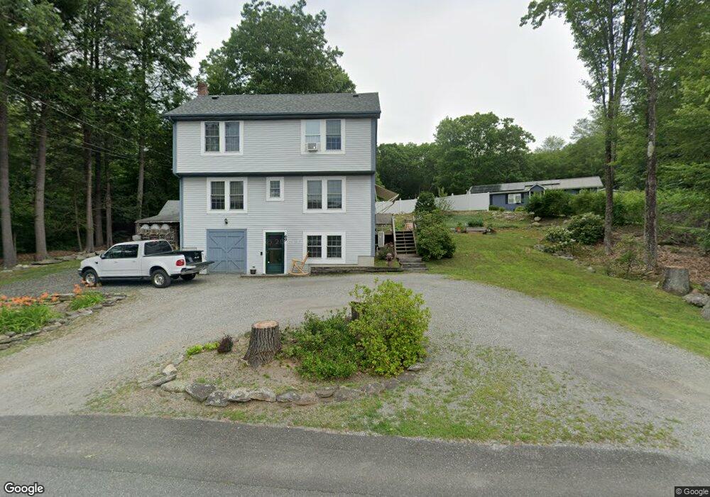
69 High St Erving, MA 01344
Estimated Value: $348,518 - $403,000
3
Beds
2
Baths
1,894
Sq Ft
$193/Sq Ft
Est. Value
About This Home
This home is located at 69 High St, Erving, MA 01344 and is currently estimated at $365,630, approximately $193 per square foot. 69 High St is a home located in Franklin County with nearby schools including Erving Elementary School and Kemsley Academy.
Create a Home Valuation Report for This Property
The Home Valuation Report is an in-depth analysis detailing your home's value as well as a comparison with similar homes in the area
Home Values in the Area
Average Home Value in this Area
Tax History
| Year | Tax Paid | Tax Assessment Tax Assessment Total Assessment is a certain percentage of the fair market value that is determined by local assessors to be the total taxable value of land and additions on the property. | Land | Improvement |
|---|---|---|---|---|
| 2025 | $2,923 | $314,000 | $65,500 | $248,500 |
| 2024 | $2,530 | $274,400 | $65,500 | $208,900 |
| 2023 | $2,187 | $273,400 | $65,500 | $207,900 |
| 2022 | $1,853 | $234,600 | $65,500 | $169,100 |
| 2021 | $1,712 | $225,600 | $65,500 | $160,100 |
| 2020 | $1,521 | $201,700 | $41,600 | $160,100 |
| 2019 | $1,490 | $202,700 | $41,600 | $161,100 |
| 2018 | $1,481 | $207,100 | $43,300 | $163,800 |
| 2017 | $1,441 | $207,100 | $43,300 | $163,800 |
| 2016 | $1,400 | $207,100 | $43,300 | $163,800 |
| 2015 | $1,792 | $207,900 | $45,000 | $162,900 |
Source: Public Records
Map
Nearby Homes
- 10 E Prospect St
- 0 State Rd Lot 0
- 10 W Main St
- 62 E Main St
- 0 Old Farley Rd
- 44 Moss Brook Rd
- 270 Wendell Depot Rd
- 13 Maple Ave
- 0 State Rd
- 351 Farley Rd
- 0 Wendell Depot Rd
- 30 Stone Valley Rd
- 0 Four Mile Brook Rd Unit 73462497
- 216 Holtshire Rd
- 222 W River St
- 56 Shelter St
- 166-168 W Main St
- 30 Cottage St
- 246 Holtshire Rd Unit Lot 3
- 28 Morse Village Rd
Your Personal Tour Guide
Ask me questions while you tour the home.