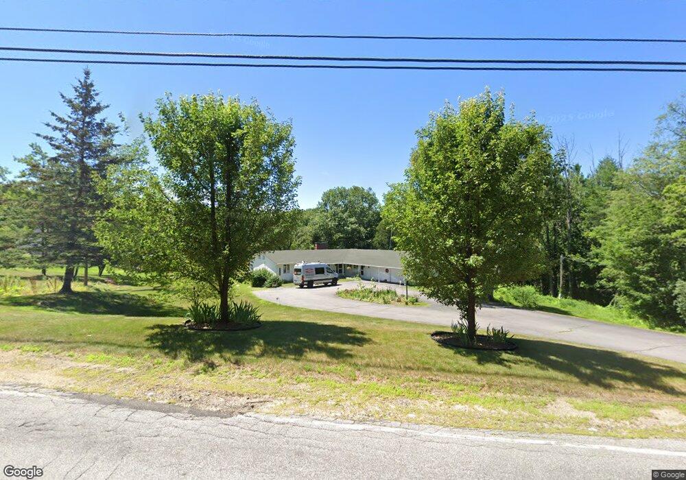
69 Meredith Neck Rd Meredith, NH 03253
Estimated Value: $623,000 - $1,192,000
3
Beds
3
Baths
2,395
Sq Ft
$328/Sq Ft
Est. Value
About This Home
This home is located at 69 Meredith Neck Rd, Meredith, NH 03253 and is currently estimated at $785,700, approximately $328 per square foot. 69 Meredith Neck Rd is a home with nearby schools including Inter-Lakes Elementary School, Sandwich Central School, and Inter-Lakes Middle High School.
Ownership History
Date
Name
Owned For
Owner Type
Purchase Details
Closed on
Sep 10, 2012
Sold by
Morah James S
Bought by
Morash James S and Morash Carol M
Current Estimated Value
Purchase Details
Closed on
Apr 26, 1996
Sold by
Steady Barbara Ann
Bought by
Morash James S
Home Financials for this Owner
Home Financials are based on the most recent Mortgage that was taken out on this home.
Original Mortgage
$132,000
Interest Rate
7.81%
Create a Home Valuation Report for This Property
The Home Valuation Report is an in-depth analysis detailing your home's value as well as a comparison with similar homes in the area
Home Values in the Area
Average Home Value in this Area
Purchase History
| Date | Buyer | Sale Price | Title Company |
|---|---|---|---|
| Morash James S | -- | -- | |
| Morash James S | $165,000 | -- |
Source: Public Records
Mortgage History
| Date | Status | Borrower | Loan Amount |
|---|---|---|---|
| Previous Owner | Morash James S | $130,000 | |
| Previous Owner | Morash James S | $132,000 |
Source: Public Records
Tax History Compared to Growth
Tax History
| Year | Tax Paid | Tax Assessment Tax Assessment Total Assessment is a certain percentage of the fair market value that is determined by local assessors to be the total taxable value of land and additions on the property. | Land | Improvement |
|---|---|---|---|---|
| 2024 | $5,270 | $513,600 | $183,000 | $330,600 |
| 2023 | $5,080 | $513,600 | $183,000 | $330,600 |
| 2022 | $4,746 | $339,700 | $85,600 | $254,100 |
| 2021 | $4,557 | $339,300 | $85,600 | $253,700 |
| 2020 | $4,757 | $339,300 | $85,600 | $253,700 |
| 2019 | $4,807 | $302,500 | $69,300 | $233,200 |
| 2018 | $4,725 | $302,500 | $69,300 | $233,200 |
| 2016 | $4,407 | $282,700 | $67,200 | $215,500 |
| 2015 | $4,195 | $276,000 | $67,200 | $208,800 |
| 2014 | $4,093 | $276,000 | $67,200 | $208,800 |
| 2013 | $3,977 | $276,000 | $67,200 | $208,800 |
Source: Public Records
Map
Nearby Homes
- 103 Meredith Neck Rd
- 39 Lake Country Rd
- 70 Pinnacle Park Rd
- 85 Blueberry Hill Rd
- 113-117 Pinnacle Park Rd
- 21 S Watch Rd
- 16 Bay Ridge Dr
- 21 Pleasant St
- 4 Mountain Ridge Dr
- 11 Morrison Ave
- 2 Bayshore Dr
- 24 Stonedam Island Rd
- 142 Nh Route 25
- 11 Quimby Rd
- 21 Upper Ladd Hill Rd Unit A
- 21 Upper Ladd Hill Rd Unit E
- 21 Upper Ladd Hill Rd Unit D
- 21 Upper Ladd Hill Rd Unit C
- 21 Upper Ladd Hill Rd Unit B
- 8 Water St Unit 2
- 73 Meredith Neck Rd
- 76 Meredith Neck Rd
- 76 Meredith Neck Rd Unit 1
- 76 Meredith Neck Rd Unit 2
- 77 Meredith Neck Rd
- 59 Meredith Neck Rd
- 64 Meredith Neck Rd
- 80 Meredith Neck Rd
- 0 Lake Country Rd Unit 6 4634903
- 0 Lake Country Rd Unit S10 / 1 / B 4803392
- 0 Lake Country Rd Unit 2766319
- 81 Meredith Neck Rd
- 84 Meredith Neck Rd
- 12 Pinnacle Park Rd
- 00 Pinnacle Park Rd Unit U20-2
- 00 Pinnacle Park Rd
- 0 Pinnacle Park Rd Unit 2735281
- 0 Pinnacle Park Rd Unit 3B 4462647
- 00 Blueberry Hill Rd
- 1 Blueberry Hill Rd