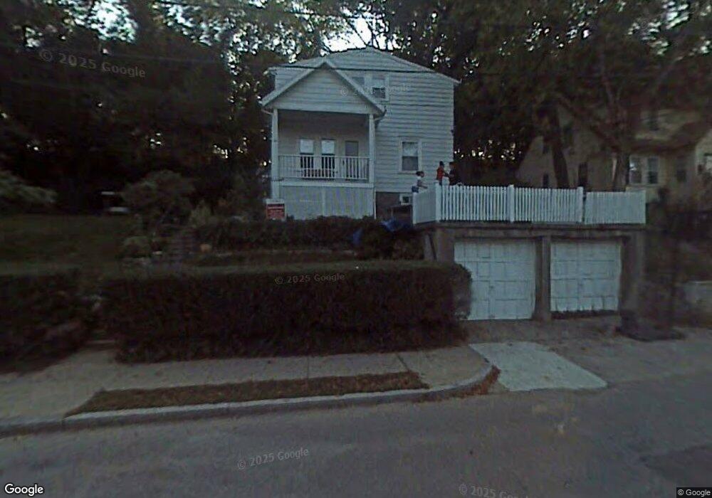
69 Whitford St Roslindale, MA 02131
Roslindale NeighborhoodEstimated Value: $723,000 - $886,000
4
Beds
3
Baths
1,534
Sq Ft
$542/Sq Ft
Est. Value
About This Home
This home is located at 69 Whitford St, Roslindale, MA 02131 and is currently estimated at $831,548, approximately $542 per square foot. 69 Whitford St is a home located in Suffolk County with nearby schools including Brooke Charter School Roslindale, Sacred Heart STEM School, and St. Clare High School.
Ownership History
Date
Name
Owned For
Owner Type
Purchase Details
Closed on
May 28, 2014
Sold by
Fernandez Gildardo T
Bought by
Fernandez Ann M
Current Estimated Value
Purchase Details
Closed on
Mar 26, 1997
Sold by
Noonan Patrick P
Bought by
Fernandez Ann M and Fernandez Gildardo
Home Financials for this Owner
Home Financials are based on the most recent Mortgage that was taken out on this home.
Original Mortgage
$123,300
Interest Rate
7.59%
Mortgage Type
Purchase Money Mortgage
Purchase Details
Closed on
Sep 1, 1994
Sold by
Ortendahl Jens A Est and Engdahl Carol I
Bought by
Noonan Patrick F
Home Financials for this Owner
Home Financials are based on the most recent Mortgage that was taken out on this home.
Original Mortgage
$77,900
Interest Rate
8.44%
Mortgage Type
Purchase Money Mortgage
Create a Home Valuation Report for This Property
The Home Valuation Report is an in-depth analysis detailing your home's value as well as a comparison with similar homes in the area
Home Values in the Area
Average Home Value in this Area
Purchase History
| Date | Buyer | Sale Price | Title Company |
|---|---|---|---|
| Fernandez Ann M | -- | -- | |
| Fernandez Ann M | $137,000 | -- | |
| Noonan Patrick F | $82,000 | -- |
Source: Public Records
Mortgage History
| Date | Status | Borrower | Loan Amount |
|---|---|---|---|
| Previous Owner | Noonan Patrick F | $153,000 | |
| Previous Owner | Noonan Patrick F | $123,300 | |
| Previous Owner | Noonan Patrick F | $77,900 |
Source: Public Records
Tax History Compared to Growth
Tax History
| Year | Tax Paid | Tax Assessment Tax Assessment Total Assessment is a certain percentage of the fair market value that is determined by local assessors to be the total taxable value of land and additions on the property. | Land | Improvement |
|---|---|---|---|---|
| 2025 | $8,479 | $732,200 | $313,700 | $418,500 |
| 2024 | $7,831 | $718,400 | $289,000 | $429,400 |
| 2023 | $7,208 | $671,100 | $270,000 | $401,100 |
| 2022 | $6,762 | $621,500 | $250,000 | $371,500 |
| 2021 | $6,259 | $586,600 | $240,400 | $346,200 |
| 2020 | $6,040 | $572,000 | $233,000 | $339,000 |
| 2019 | $5,738 | $544,400 | $189,200 | $355,200 |
| 2018 | $5,432 | $518,300 | $189,200 | $329,100 |
| 2017 | $5,511 | $520,400 | $197,900 | $322,500 |
| 2016 | $5,251 | $477,400 | $197,900 | $279,500 |
| 2015 | $5,206 | $429,900 | $178,500 | $251,400 |
| 2014 | $4,912 | $390,500 | $178,500 | $212,000 |
Source: Public Records
Map
Nearby Homes
- 25 Crandall St
- 142 Metropolitan Ave Unit A
- 250 Poplar St Unit 1
- 16 Hilburn Place
- 69 Metropolitan Ave
- 415 Poplar St
- 55 Metropolitan Ave
- 5 7 Hemman St
- 417 Poplar St
- 273 Metropolitan Ave Unit 2
- 67 Cummins Hwy Unit 101
- 295 Kittredge St
- 89 Glendower Rd
- 75 Glendower Rd
- 25 Pinedale Rd Unit 1
- 124 Glendower Rd Unit 2
- 142 Birch St
- 142 Birch St Unit 1
- 142 Birch St Unit 2
- 34 Averton St
- 65 Whitford St
- LOT 0 Whitford St
- 77 Whitford St
- 70 Whitford St
- 74 Whitford St
- 57 Whitford St
- 64 Whitford St Unit 66
- 47 Delano Park
- 13 Hillview Ave
- 1 Hillview Ave
- 1-3 Hillview Ave Unit 2
- 1-3 Hillview Ave Unit 3
- 1-3 Hillview Ave Unit 1
- 1-3 Hillview Ave
- 53 Whitford St
- 5 Hillview Ave
- 39 Delano Park
- 7 Hillview Ave
- 9 Hillview Ave Unit 9A
- 49 Whitford St