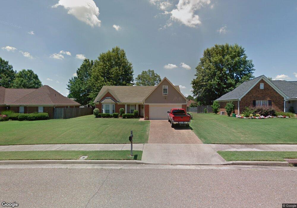
6902 Andrews Rd Memphis, TN 38135
Estimated Value: $280,000 - $307,000
3
Beds
2
Baths
1,992
Sq Ft
$148/Sq Ft
Est. Value
About This Home
This home is located at 6902 Andrews Rd, Memphis, TN 38135 and is currently estimated at $295,696, approximately $148 per square foot. 6902 Andrews Rd is a home located in Shelby County with nearby schools including Oak Elementary School, Appling Middle School, and Bartlett High School.
Ownership History
Date
Name
Owned For
Owner Type
Purchase Details
Closed on
Sep 24, 1999
Sold by
Watkins Robert B and Watkins Marjorie L
Bought by
Nick Charles K and Nick Gwyn W
Current Estimated Value
Home Financials for this Owner
Home Financials are based on the most recent Mortgage that was taken out on this home.
Original Mortgage
$114,650
Outstanding Balance
$33,911
Interest Rate
7.79%
Estimated Equity
$261,785
Create a Home Valuation Report for This Property
The Home Valuation Report is an in-depth analysis detailing your home's value as well as a comparison with similar homes in the area
Home Values in the Area
Average Home Value in this Area
Purchase History
| Date | Buyer | Sale Price | Title Company |
|---|---|---|---|
| Nick Charles K | $134,900 | -- |
Source: Public Records
Mortgage History
| Date | Status | Borrower | Loan Amount |
|---|---|---|---|
| Open | Nick Charles K | $114,650 |
Source: Public Records
Tax History Compared to Growth
Tax History
| Year | Tax Paid | Tax Assessment Tax Assessment Total Assessment is a certain percentage of the fair market value that is determined by local assessors to be the total taxable value of land and additions on the property. | Land | Improvement |
|---|---|---|---|---|
| 2025 | -- | $72,300 | $14,500 | $57,800 |
| 2024 | $1,714 | $50,550 | $9,750 | $40,800 |
| 2023 | $2,588 | $50,550 | $9,750 | $40,800 |
| 2022 | $1,714 | $50,550 | $9,750 | $40,800 |
| 2021 | $1,744 | $50,550 | $9,750 | $40,800 |
| 2020 | $2,245 | $38,175 | $7,500 | $30,675 |
| 2019 | $2,245 | $38,175 | $7,500 | $30,675 |
| 2018 | $2,245 | $38,175 | $7,500 | $30,675 |
| 2017 | $1,569 | $38,175 | $7,500 | $30,675 |
| 2016 | $1,497 | $34,250 | $0 | $0 |
| 2014 | $1,497 | $34,250 | $0 | $0 |
Source: Public Records
Map
Nearby Homes
- 6950 Dovefield Ln
- 6870 Deerfield Rd
- 00 Yale Rd
- 3659 Stonetrace Cir
- 6759 Oakmoor Cir S
- 6680 Cedarshade Cove
- 6806 Briarfield Ln
- 3334 Oak Rd
- 7185 Deerfield Rd
- 6894 Hedgewood Ln
- 3610 Greenleaf Rd
- 6579 Sungate Dr S
- 6963 Fairhill Ln
- 3589 Broadway Rd
- 3148 Hill Lake Dr
- Webster Plan at Union Depot
- Asher Plan at Union Depot
- Glenmore Plan at Union Depot
- Manning Plan at Union Depot
- Lewis Plan at Union Depot
- 6910 Andrews Rd
- 6896 Andrews Rd
- 6875 Tiffany Oaks Cove
- 6885 Tiffany Oaks Cove
- 6865 Tiffany Oaks Cove
- 6890 Andrews Rd
- 6920 Andrews Rd
- 6895 Tiffany Oaks Cove
- 6901 Andrews Rd
- 6913 Andrews Rd
- 6855 Tiffany Oaks Cove
- 6905 Tiffany Oaks Cove
- 6884 Andrews Rd
- 6926 Andrews Rd
- 6923 Andrews Rd
- 6885 Andrews Rd
- 6930 Meadowlands Place
- 3557 Yvonne Cove
- 6913 Tiffany Oaks Cove
- 3560 Yvonne Cove