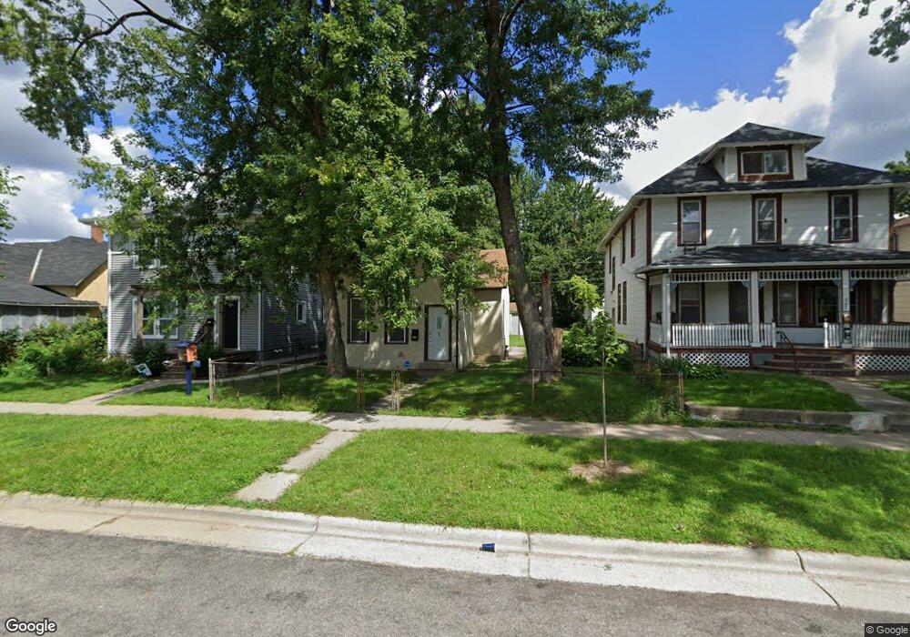
691 Lafond Ave Saint Paul, MN 55104
Frogtown NeighborhoodEstimated Value: $191,000 - $229,000
2
Beds
1
Bath
912
Sq Ft
$233/Sq Ft
Est. Value
About This Home
This home is located at 691 Lafond Ave, Saint Paul, MN 55104 and is currently estimated at $212,662, approximately $233 per square foot. 691 Lafond Ave is a home located in Ramsey County with nearby schools including Maxfield Magnet Elementary School, Hidden River Middle School, and Central Senior High School.
Ownership History
Date
Name
Owned For
Owner Type
Purchase Details
Closed on
Nov 24, 2015
Sold by
5-6 Hls Llc
Bought by
Petkov Kiril
Current Estimated Value
Home Financials for this Owner
Home Financials are based on the most recent Mortgage that was taken out on this home.
Original Mortgage
$72,400
Outstanding Balance
$56,869
Interest Rate
3.75%
Mortgage Type
New Conventional
Estimated Equity
$155,793
Purchase Details
Closed on
May 28, 2014
Sold by
Nguyen Margaret
Bought by
5-6 Hls Llc
Purchase Details
Closed on
May 28, 1999
Sold by
Transamerica Financial Svs
Bought by
Nguyn Hung T
Create a Home Valuation Report for This Property
The Home Valuation Report is an in-depth analysis detailing your home's value as well as a comparison with similar homes in the area
Home Values in the Area
Average Home Value in this Area
Purchase History
| Date | Buyer | Sale Price | Title Company |
|---|---|---|---|
| Petkov Kiril | $90,500 | Title One Inc | |
| 5-6 Hls Llc | $25,757 | Minnesota Abstract & Title C | |
| -- | $25,000 | -- | |
| Nguyn Hung T | $20,000 | -- |
Source: Public Records
Mortgage History
| Date | Status | Borrower | Loan Amount |
|---|---|---|---|
| Open | Petkov Kiril | $72,400 |
Source: Public Records
Tax History Compared to Growth
Tax History
| Year | Tax Paid | Tax Assessment Tax Assessment Total Assessment is a certain percentage of the fair market value that is determined by local assessors to be the total taxable value of land and additions on the property. | Land | Improvement |
|---|---|---|---|---|
| 2025 | $2,912 | $207,000 | $25,000 | $182,000 |
| 2023 | $2,912 | $192,300 | $20,000 | $172,300 |
| 2022 | $2,192 | $176,100 | $20,000 | $156,100 |
| 2021 | $2,102 | $152,400 | $20,000 | $132,400 |
| 2020 | $1,910 | $151,800 | $11,200 | $140,600 |
| 2019 | $1,644 | $132,700 | $11,200 | $121,500 |
| 2018 | $1,312 | $116,400 | $11,200 | $105,200 |
| 2017 | $1,206 | $101,100 | $11,200 | $89,900 |
| 2016 | $416 | $0 | $0 | $0 |
| 2015 | $652 | $34,700 | $11,200 | $23,500 |
| 2014 | $1,068 | $0 | $0 | $0 |
Source: Public Records
Map
Nearby Homes
- 710 Lafond Ave
- 653 Thomas Ave
- 646 Van Buren Ave
- 679 Edmund Ave
- 631 Van Buren Ave
- 751 Van Buren Ave
- 730 Edmund Ave
- 679 Charles Ave
- 723 Charles Ave
- 639 Sherburne Ave
- 610 Charles Ave
- 566 Edmund Ave
- 553 Blair Ave
- 816 Edmund Ave
- 594 Charles Ave
- 818 Edmund Ave
- 547 Blair Ave
- 534 Thomas Ave
- 553 Charles Ave
- 852 Edmund Ave
- 687 Lafond Ave
- 695 Lafond Ave
- 683 Lafond Ave
- 699 Lafond Ave
- 701 Lafond Ave
- 690 Blair Ave
- 686 Blair Ave
- 694 Blair Ave
- 705 Lafond Ave
- 682 Blair Ave
- 698 Blair Ave
- 677 Lafond Ave
- 692 Lafond Ave
- 702 Blair Ave
- 690 Lafond Ave
- 709 Lafond Ave
- 700 Lafond Ave
- 619 Saint Albans St N
- 698 Lafond Ave
- 675 Lafond Ave