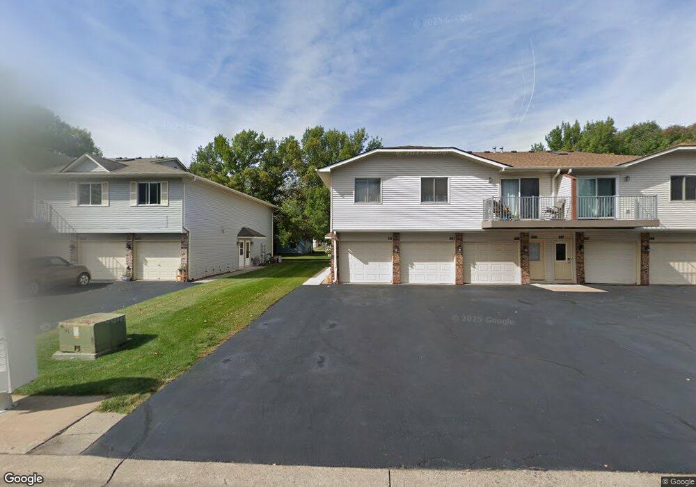
691 Parkside Dr Unit 691F Saint Paul, MN 55127
Estimated Value: $202,000 - $224,000
2
Beds
1
Bath
1,104
Sq Ft
$194/Sq Ft
Est. Value
About This Home
This home is located at 691 Parkside Dr Unit 691F, Saint Paul, MN 55127 and is currently estimated at $214,604, approximately $194 per square foot. 691 Parkside Dr Unit 691F is a home located in Ramsey County with nearby schools including Vadnais Heights Elementary School, Sunrise Park Middle School, and AFSA High School.
Ownership History
Date
Name
Owned For
Owner Type
Purchase Details
Closed on
Mar 15, 2022
Sold by
Morrick Joseph O
Bought by
Wheaton Kelly
Current Estimated Value
Home Financials for this Owner
Home Financials are based on the most recent Mortgage that was taken out on this home.
Original Mortgage
$187,150
Outstanding Balance
$174,114
Interest Rate
3.55%
Mortgage Type
New Conventional
Estimated Equity
$40,491
Purchase Details
Closed on
Jul 2, 1999
Sold by
Schnagl Mary J
Bought by
Morrick Joseph O
Create a Home Valuation Report for This Property
The Home Valuation Report is an in-depth analysis detailing your home's value as well as a comparison with similar homes in the area
Home Values in the Area
Average Home Value in this Area
Purchase History
| Date | Buyer | Sale Price | Title Company |
|---|---|---|---|
| Wheaton Kelly | $202,000 | None Listed On Document | |
| Morrick Joseph O | $79,900 | -- |
Source: Public Records
Mortgage History
| Date | Status | Borrower | Loan Amount |
|---|---|---|---|
| Open | Wheaton Kelly | $187,150 |
Source: Public Records
Tax History Compared to Growth
Tax History
| Year | Tax Paid | Tax Assessment Tax Assessment Total Assessment is a certain percentage of the fair market value that is determined by local assessors to be the total taxable value of land and additions on the property. | Land | Improvement |
|---|---|---|---|---|
| 2025 | $2,468 | $226,100 | $1,000 | $225,100 |
| 2023 | $2,468 | $202,700 | $1,000 | $201,700 |
| 2022 | $2,002 | $156,400 | $1,000 | $155,400 |
| 2021 | $1,844 | $143,700 | $1,000 | $142,700 |
| 2020 | $1,862 | $136,500 | $1,000 | $135,500 |
| 2019 | $1,576 | $127,900 | $1,000 | $126,900 |
| 2018 | $1,512 | $115,800 | $1,000 | $114,800 |
| 2017 | $1,290 | $112,000 | $1,000 | $111,000 |
| 2016 | $1,288 | $0 | $0 | $0 |
| 2015 | $1,190 | $87,900 | $13,200 | $74,700 |
| 2014 | $1,070 | $0 | $0 | $0 |
Source: Public Records
Map
Nearby Homes
- 697 Parkside Dr Unit 697H
- 3300 Greenbrier St Unit 3300C
- 3329 Greenbrier St
- 696 Monn Ave
- 731 Berwood Ave
- 832 Woodgate Dr Unit 107
- 3230 Edgerton St
- 3120 Greenbrier St
- 963 E Berwood Ave
- 3028 Edgerton St
- 3000 Ontario Rd
- 3003 Greenbrier St
- 3015 Basswood St
- Revere Plan at Pioneer Commons - Colonial Manor Collection
- Franklin Plan at Pioneer Commons - Colonial Manor Collection
- Raleigh Plan at Pioneer Commons - Liberty Collection
- St.Clair Plan at Pioneer Commons - Liberty Collection
- 3092 Vanderbie St
- 3309 Nathaniel Ct
- 441 Mario Dr
- 687 Parkside Dr Unit 687G
- 685 Parkside Dr Unit 685H
- 681 Parkside Dr Unit 681G
- 683 Parkside Dr Unit 683H
- 701 Parkside Dr Unit 701F
- 699 Parkside Dr Unit 699G
- 693 Parkside Dr Unit 693G
- 689 Parkside Dr Unit 689F
- 679 Parkside Dr Unit 679F
- 683 Parkside Dr Unit 231
- 687 687 Parkside-Drive-
- 687 687 Parkside Dr
- 683 683 Parkside Dr
- 697 697 Parkside Dr
- 699 699 Parkside Dr
- 701 701 Parkside Dr
- 703 703 Parkside-Drive-
- 3270 Greenbrier St Unit 3270B
- 3260 Greenbrier St Unit 3260B
- 3266 Greenbrier St Unit 3266A