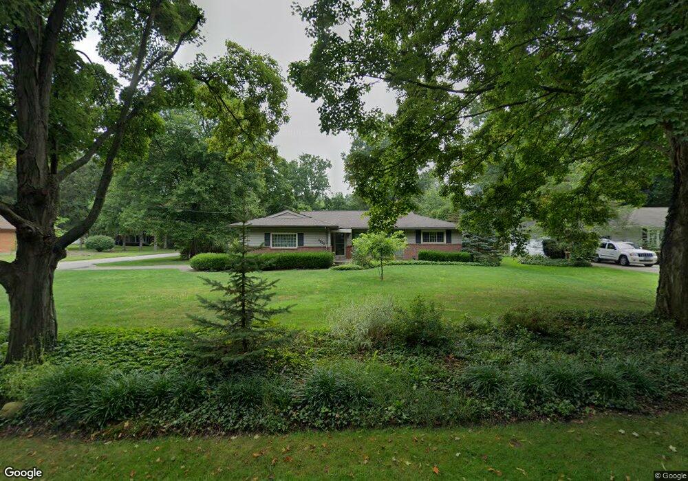
6913 Ronjoy Place Youngstown, OH 44512
Estimated Value: $245,023 - $269,000
3
Beds
2
Baths
1,542
Sq Ft
$164/Sq Ft
Est. Value
About This Home
This home is located at 6913 Ronjoy Place, Youngstown, OH 44512 and is currently estimated at $253,506, approximately $164 per square foot. 6913 Ronjoy Place is a home located in Mahoning County with nearby schools including West Boulevard Elementary School, Boardman Center Middle School, and Boardman High School.
Ownership History
Date
Name
Owned For
Owner Type
Purchase Details
Closed on
Jan 2, 2024
Sold by
Beraduce Linda
Bought by
Dicola Katie L and Dicola Lauren M
Current Estimated Value
Purchase Details
Closed on
Aug 2, 2002
Sold by
Butler Denise and Butler Patrick
Bought by
Beraduce Linda
Purchase Details
Closed on
Jul 15, 1993
Bought by
Butler Denise
Create a Home Valuation Report for This Property
The Home Valuation Report is an in-depth analysis detailing your home's value as well as a comparison with similar homes in the area
Home Values in the Area
Average Home Value in this Area
Purchase History
| Date | Buyer | Sale Price | Title Company |
|---|---|---|---|
| Dicola Katie L | -- | None Listed On Document | |
| Dicola Katie L | -- | None Listed On Document | |
| Beraduce Linda | -- | -- | |
| Butler Denise | -- | -- |
Source: Public Records
Tax History
| Year | Tax Paid | Tax Assessment Tax Assessment Total Assessment is a certain percentage of the fair market value that is determined by local assessors to be the total taxable value of land and additions on the property. | Land | Improvement |
|---|---|---|---|---|
| 2025 | $3,880 | $77,880 | $10,350 | $67,530 |
| 2024 | $3,970 | $77,880 | $10,350 | $67,530 |
| 2023 | $3,917 | $77,880 | $10,350 | $67,530 |
| 2022 | $2,868 | $52,060 | $10,330 | $41,730 |
| 2021 | $2,870 | $52,060 | $10,330 | $41,730 |
| 2020 | $2,885 | $52,060 | $10,330 | $41,730 |
| 2019 | $2,910 | $47,330 | $9,390 | $37,940 |
| 2018 | $2,519 | $47,330 | $9,390 | $37,940 |
| 2017 | $2,116 | $47,330 | $9,390 | $37,940 |
| 2016 | $3,014 | $45,400 | $10,430 | $34,970 |
| 2015 | $2,956 | $45,400 | $10,430 | $34,970 |
| 2014 | $2,966 | $45,400 | $10,430 | $34,970 |
| 2013 | $2,931 | $45,400 | $10,430 | $34,970 |
Source: Public Records
Map
Nearby Homes
- 6624 Ronjoy Place
- 804 Brookfield Ave
- 886 Ewing Rd
- 409 Melbourne Ave
- 477 Wildwood Dr
- 354 Ewing Rd
- 6180 Northlawn Ave
- 5810 West Blvd
- 242 Oakley Ave
- 7120-7122 Glendale Ave
- 7367 Oregon Trail
- 7619 Red Fox Dr
- 6511 Pembrooke Place
- 1133 Red Tail Hawk Ct Unit 6
- 96 Aylesboro Ave
- 7110 Amherst Ave
- 547 Squirrel Hill Dr
- 6960 Lockwood Blvd
- 1424 Turnberry Dr
- 1183 Red Tail Hawk Dr Unit 5
- 6921 Ronjoy Place
- 6685 Ronjoy Place
- 6914 Ron Park Place
- 6929 Ronjoy Place
- 6926 Ron Park Place
- 6684 Ron Park Place
- 6920 Ronjoy Place
- 6675 Ronjoy Place
- 6955 Ronjoy Place
- 832 Stuart Ave
- 6936 Ronjoy Place
- 6674 Ron Park Place
- 6960 Ron Park Place
- 838 Stuart Ave
- 6972 Ronjoy Place
- 6665 Ronjoy Place
- 6945 Ronjoy Place
- 851 Stuart Ave
- 6664 Ron Park Place
- 6972 Ron Park Place
Your Personal Tour Guide
Ask me questions while you tour the home.