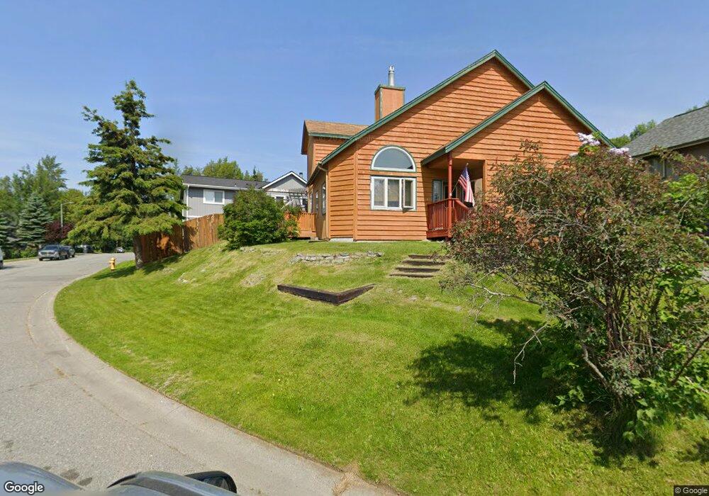
6921 Serenity Cir Anchorage, AK 99502
Sand Lake NeighborhoodEstimated Value: $190,000 - $516,000
3
Beds
3
Baths
1,400
Sq Ft
$263/Sq Ft
Est. Value
About This Home
This home is located at 6921 Serenity Cir, Anchorage, AK 99502 and is currently estimated at $367,887, approximately $262 per square foot. 6921 Serenity Cir is a home located in Anchorage Municipality with nearby schools including Kincaid Elementary, Mears Middle School, and Dimond High School.
Ownership History
Date
Name
Owned For
Owner Type
Purchase Details
Closed on
Apr 4, 2024
Sold by
Williams Leslie D
Bought by
Leslie D Williams Family Trust and Williams
Current Estimated Value
Purchase Details
Closed on
Jul 30, 1998
Sold by
Lockert Jon R and Kleinfeld Leslie A
Bought by
Williams Leslie D
Purchase Details
Closed on
Jun 29, 1993
Sold by
Harter Daniel S and Harter Sarina L
Bought by
Lockert Jon R
Home Financials for this Owner
Home Financials are based on the most recent Mortgage that was taken out on this home.
Original Mortgage
$124,527
Interest Rate
7.51%
Mortgage Type
FHA
Create a Home Valuation Report for This Property
The Home Valuation Report is an in-depth analysis detailing your home's value as well as a comparison with similar homes in the area
Home Values in the Area
Average Home Value in this Area
Purchase History
| Date | Buyer | Sale Price | Title Company |
|---|---|---|---|
| Leslie D Williams Family Trust | -- | None Listed On Document | |
| Leslie D Williams Family Trust | -- | None Listed On Document | |
| Williams Leslie D | -- | -- | |
| Williams Leslie D | -- | -- | |
| Lockert Jon R | -- | -- |
Source: Public Records
Mortgage History
| Date | Status | Borrower | Loan Amount |
|---|---|---|---|
| Previous Owner | Lockert Jon R | $124,527 | |
| Closed | Williams Leslie D | $0 |
Source: Public Records
Tax History Compared to Growth
Tax History
| Year | Tax Paid | Tax Assessment Tax Assessment Total Assessment is a certain percentage of the fair market value that is determined by local assessors to be the total taxable value of land and additions on the property. | Land | Improvement |
|---|---|---|---|---|
| 2025 | $2,030 | $360,500 | $88,100 | $272,400 |
| 2024 | $2,030 | $351,100 | $88,100 | $263,000 |
| 2023 | $1,546 | $315,800 | $88,100 | $227,700 |
| 2022 | $1,804 | $307,100 | $88,100 | $219,000 |
| 2021 | $5,246 | $291,100 | $88,100 | $203,000 |
| 2020 | $4,777 | $281,000 | $88,100 | $192,900 |
| 2019 | $4,641 | $283,700 | $88,100 | $195,600 |
| 2018 | $1,237 | $275,400 | $83,000 | $192,400 |
| 2017 | $1,672 | $276,800 | $83,000 | $193,800 |
| 2016 | $3,471 | $270,700 | $79,500 | $191,200 |
| 2015 | $3,471 | $272,800 | $87,400 | $185,400 |
| 2014 | $3,471 | $256,100 | $81,600 | $174,500 |
Source: Public Records
Map
Nearby Homes
- 6440/6460 Quiet Cir
- 5810 Muirwood Dr
- 6440 Quiet Cir
- 6321 Wooded Cir
- 6460 Quiet Cir
- 5767 Cobbler Dr
- 5785 Kenai Fjords Loop
- 7865 Crane Cir
- 5376 Sandhill Loop
- 5729 Grand Teton Loop
- 5372 Sandhill Loop
- L11 B2 Beck's View Cir
- 6841 Caravelle Dr
- 8840 Becks View Cir
- 8698 Dry Creek Loop Unit 61A
- 6057 Jan Marie Dr
- 8803 Chalk Hill Loop
- 8833 Chalk Hill Loop
- 8868 Chalk Hill Loop
- 8869 Chalk Hill Loop
- 6931 Serenity Cir
- 6917 Serenity Dr
- L4 B2 Serenity Cir
- 6913 Serenity Dr
- 6941 Serenity Cir
- 6909 Serenity Dr
- 6920 Serenity Cir
- 6910 Serenity Cir
- 6951 Serenity Cir
- 6940 Serenity Cir
- 6930 Serenity Cir
- 6950 Serenity Cir
- 6960 Serenity Cir
- 6907 Serenity Dr
- 7000 Serenity Cir
- 6961 Serenity Cir
- 6841 Serenity Cir
- 6842 Serenity Dr
- 7001 Serenity Cir
- 7020 Serenity Cir