Estimated Value: $375,000 - $424,733
4
Beds
3
Baths
2,284
Sq Ft
$177/Sq Ft
Est. Value
About This Home
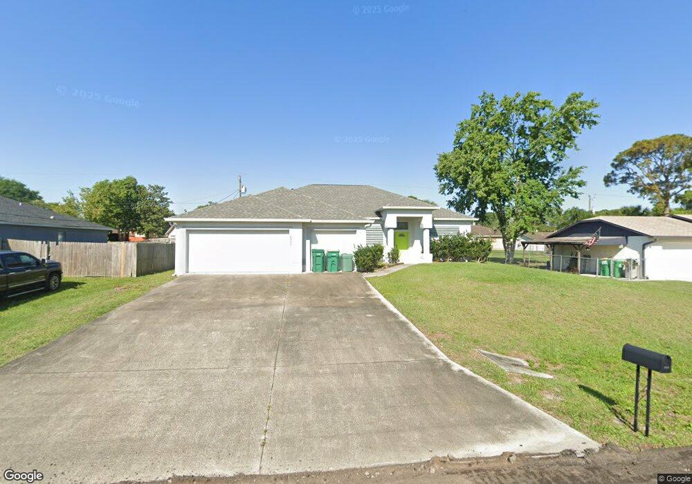
This home is located at 6930 Cairo Rd, Cocoa, FL 32927 and is currently estimated at $403,933, approximately $176 per square foot. 6930 Cairo Rd is a home located in Brevard County with nearby schools including Enterprise Elementary School, Space Coast Junior/Senior High School, and Sculptor Charter School.
Ownership History
Date
Name
Owned For
Owner Type
Purchase Details
Closed on
Feb 15, 2005
Sold by
Perez Rosa M and Perez Euclides E
Bought by
Perez Euclides E and Perez Michelle M
Current Estimated Value
Home Financials for this Owner
Home Financials are based on the most recent Mortgage that was taken out on this home.
Original Mortgage
$196,800
Interest Rate
5.6%
Create a Home Valuation Report for This Property
The Home Valuation Report is an in-depth analysis detailing your home's value as well as a comparison with similar homes in the area
Home Values in the Area
Average Home Value in this Area
Purchase History
| Date | Buyer | Sale Price | Title Company |
|---|---|---|---|
| Perez Euclides E | -- | State Title Partners Llp |
Source: Public Records
Mortgage History
| Date | Status | Borrower | Loan Amount |
|---|---|---|---|
| Closed | Perez Euclides E | $196,800 |
Source: Public Records
Tax History
| Year | Tax Paid | Tax Assessment Tax Assessment Total Assessment is a certain percentage of the fair market value that is determined by local assessors to be the total taxable value of land and additions on the property. | Land | Improvement |
|---|---|---|---|---|
| 2025 | $2,230 | $158,670 | -- | -- |
| 2024 | $2,186 | $154,200 | -- | -- |
| 2023 | $2,186 | $149,710 | $0 | $0 |
| 2022 | $2,049 | $145,350 | $0 | $0 |
| 2021 | $3,149 | $141,120 | $0 | $0 |
| 2020 | $3,065 | $139,180 | $0 | $0 |
| 2019 | $1,920 | $136,060 | $0 | $0 |
| 2018 | $1,917 | $133,530 | $0 | $0 |
| 2017 | $1,928 | $130,790 | $0 | $0 |
| 2016 | $1,945 | $128,100 | $18,000 | $110,100 |
| 2015 | $1,982 | $127,210 | $15,000 | $112,210 |
| 2014 | $1,989 | $126,200 | $11,000 | $115,200 |
Source: Public Records
Map
Nearby Homes
- 6815 Bryant Rd
- 7065 Hundred Acre Dr
- 6990 Bryant Rd
- 5155 Mayflower St
- 6760 Cairo Rd
- 5165 Patricia St
- 5555 Brandon St
- 5075 Carter St
- 5080 Mayflower St
- 7230 Venus Ave
- 6615 Dock Ave
- 5200 Frisco St
- 5680 Brandon St
- 7155 Export Ave
- 7200 Oakwood Ave
- 7045 Grissom Pkwy
- 5150 Melody St
- 7635 Fringe Place
- 6581 Bancroft Ave
- 6620 Grissom Pkwy
Your Personal Tour Guide
Ask me questions while you tour the home.