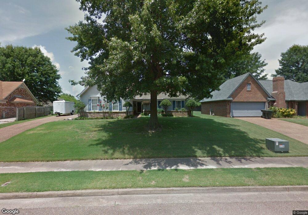
6932 Andrews Rd Memphis, TN 38135
Estimated Value: $284,000 - $295,000
3
Beds
2
Baths
1,459
Sq Ft
$197/Sq Ft
Est. Value
About This Home
This home is located at 6932 Andrews Rd, Memphis, TN 38135 and is currently estimated at $287,593, approximately $197 per square foot. 6932 Andrews Rd is a home located in Shelby County with nearby schools including Oak Elementary School, Appling Middle School, and Bartlett High School.
Ownership History
Date
Name
Owned For
Owner Type
Purchase Details
Closed on
Aug 27, 2007
Sold by
Calamis Michael A
Bought by
Doolittle Gordon R and Doolittle Joyce M
Current Estimated Value
Home Financials for this Owner
Home Financials are based on the most recent Mortgage that was taken out on this home.
Original Mortgage
$136,500
Outstanding Balance
$86,644
Interest Rate
6.62%
Mortgage Type
Unknown
Estimated Equity
$200,949
Purchase Details
Closed on
Jan 22, 2003
Sold by
Neal Charles A and Neal Rebecca B
Bought by
Calamis Michael A
Home Financials for this Owner
Home Financials are based on the most recent Mortgage that was taken out on this home.
Original Mortgage
$127,200
Interest Rate
5.95%
Create a Home Valuation Report for This Property
The Home Valuation Report is an in-depth analysis detailing your home's value as well as a comparison with similar homes in the area
Home Values in the Area
Average Home Value in this Area
Purchase History
| Date | Buyer | Sale Price | Title Company |
|---|---|---|---|
| Doolittle Gordon R | $152,000 | Realty Title | |
| Calamis Michael A | $133,900 | -- |
Source: Public Records
Mortgage History
| Date | Status | Borrower | Loan Amount |
|---|---|---|---|
| Open | Doolittle Gordon R | $136,500 | |
| Previous Owner | Calamis Michael A | $127,200 |
Source: Public Records
Tax History Compared to Growth
Tax History
| Year | Tax Paid | Tax Assessment Tax Assessment Total Assessment is a certain percentage of the fair market value that is determined by local assessors to be the total taxable value of land and additions on the property. | Land | Improvement |
|---|---|---|---|---|
| 2025 | $1,650 | $69,875 | $14,500 | $55,375 |
| 2024 | $1,650 | $48,675 | $9,750 | $38,925 |
| 2023 | $2,492 | $48,675 | $9,750 | $38,925 |
| 2022 | $2,492 | $48,675 | $9,750 | $38,925 |
| 2021 | $2,531 | $48,675 | $9,750 | $38,925 |
| 2020 | $2,196 | $37,350 | $7,500 | $29,850 |
| 2019 | $2,196 | $37,350 | $7,500 | $29,850 |
| 2018 | $2,196 | $37,350 | $7,500 | $29,850 |
| 2017 | $1,535 | $37,350 | $7,500 | $29,850 |
| 2016 | $1,437 | $32,875 | $0 | $0 |
| 2014 | $1,437 | $32,875 | $0 | $0 |
Source: Public Records
Map
Nearby Homes
- 6950 Dovefield Ln
- 6870 Deerfield Rd
- 00 Yale Rd
- 3659 Stonetrace Cir
- 6759 Oakmoor Cir S
- 7185 Deerfield Rd
- 6680 Cedarshade Cove
- 3334 Oak Rd
- 3610 Greenleaf Rd
- 6963 Fairhill Ln
- 6806 Briarfield Ln
- 6894 Hedgewood Ln
- 3589 Broadway Rd
- 6579 Sungate Dr S
- 3889 Oak Trace Cove
- 7540 Highway 70 E
- 3956 Laurelhill Ln
- Webster Plan at Union Depot
- Asher Plan at Union Depot
- Glenmore Plan at Union Depot
- 6940 Andrews Rd
- 6926 Andrews Rd
- 6921 Tiffany Oaks Cove
- 3563 Kelli Nicole Cove
- 6948 Andrews Rd
- 6920 Andrews Rd
- 6913 Tiffany Oaks Cove
- 6937 Andrews Rd
- 3560 Kelli Nicole Cove
- 6923 Andrews Rd
- 6905 Tiffany Oaks Cove
- 6956 Andrews Rd
- 6910 Andrews Rd
- 6913 Andrews Rd
- 6925 Tiffany Oaks Cove
- 6895 Tiffany Oaks Cove
- 3564 Kelli Nicole Cove
- 6936 Meadowlands Place
- 6957 Andrews Rd
- 6964 Andrews Rd