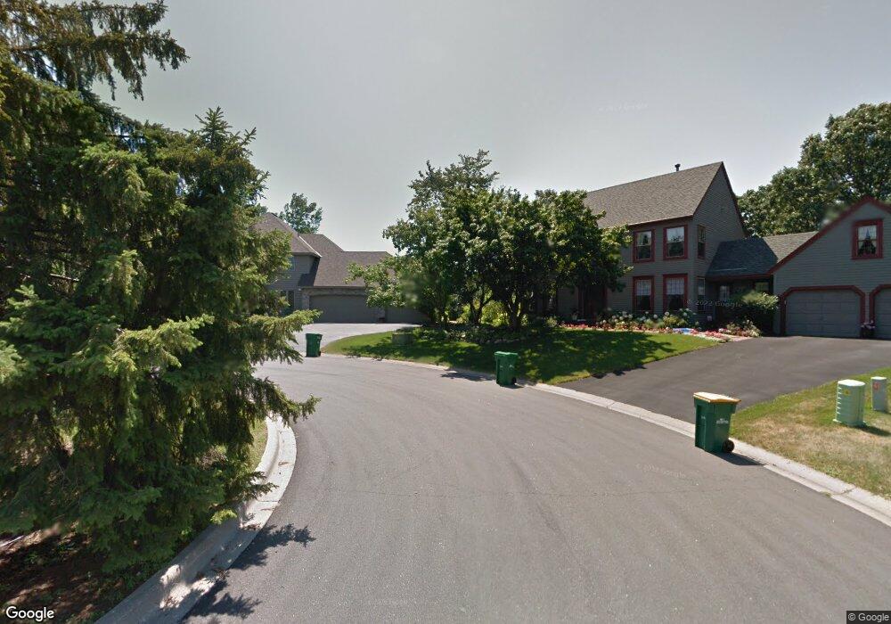
694 Bridle Ridge Rd Saint Paul, MN 55123
Estimated Value: $649,000 - $676,407
6
Beds
4
Baths
2,560
Sq Ft
$257/Sq Ft
Est. Value
About This Home
This home is located at 694 Bridle Ridge Rd, Saint Paul, MN 55123 and is currently estimated at $657,352, approximately $256 per square foot. 694 Bridle Ridge Rd is a home located in Dakota County with nearby schools including Pinewood Elementary School, Dakota Hills Middle School, and Eagan Senior High School.
Ownership History
Date
Name
Owned For
Owner Type
Purchase Details
Closed on
Jul 30, 2019
Sold by
Mattson James K and Mattson Liane B
Bought by
Sundry Evan David
Current Estimated Value
Home Financials for this Owner
Home Financials are based on the most recent Mortgage that was taken out on this home.
Original Mortgage
$436,500
Interest Rate
3.6%
Mortgage Type
New Conventional
Create a Home Valuation Report for This Property
The Home Valuation Report is an in-depth analysis detailing your home's value as well as a comparison with similar homes in the area
Home Values in the Area
Average Home Value in this Area
Purchase History
| Date | Buyer | Sale Price | Title Company |
|---|---|---|---|
| Sundry Evan David | $485,000 | Sellers Title Llc | |
| Sundry Evan David | $485,000 | Sellers Title Llc |
Source: Public Records
Mortgage History
| Date | Status | Borrower | Loan Amount |
|---|---|---|---|
| Previous Owner | Sundry Evan David | $436,500 |
Source: Public Records
Tax History Compared to Growth
Tax History
| Year | Tax Paid | Tax Assessment Tax Assessment Total Assessment is a certain percentage of the fair market value that is determined by local assessors to be the total taxable value of land and additions on the property. | Land | Improvement |
|---|---|---|---|---|
| 2024 | $7,020 | $658,600 | $162,400 | $496,200 |
| 2023 | $7,020 | $624,000 | $162,900 | $461,100 |
| 2022 | $6,244 | $602,600 | $162,500 | $440,100 |
| 2021 | $5,806 | $546,900 | $141,300 | $405,600 |
| 2020 | $5,766 | $503,300 | $134,600 | $368,700 |
| 2019 | $5,266 | $487,000 | $128,100 | $358,900 |
| 2018 | $4,867 | $468,300 | $122,000 | $346,300 |
| 2017 | $4,949 | $418,600 | $116,200 | $302,400 |
| 2016 | $5,017 | $406,100 | $110,700 | $295,400 |
| 2015 | $5,164 | $407,480 | $110,559 | $296,921 |
| 2014 | -- | $426,600 | $107,700 | $318,900 |
| 2013 | -- | $369,875 | $96,752 | $273,123 |
Source: Public Records
Map
Nearby Homes
- 680 Brockton Curve
- 711 Stonebridge Cir
- 4001 Haven Woods Ct
- 3998 Haven Woods Ct
- 4072 Prairie Ridge Rd
- 785 Canter Glen Cir
- 3806 Bridgewater Dr
- 593 Coventry Pkwy
- 4080 Camberwell Dr N
- 826 Hidden Meadow Trail
- 9151 Tyne Ln
- 4027 Camberwell Dr N
- 9451 Esk Ln
- 9258 Tyne Ln
- 591 Autumn Oaks Ct
- 4124 New York Ave
- 790 Summerbrooke Ct
- 782 Summerbrooke Ct
- 4125 Pennsylvania Ave
- 3675 Woodland Trail
- 696 Bridle Ridge Rd
- 692 Bridle Ridge Rd
- 700 Brockton Cir
- 698 Bridle Ridge Rd
- 690 Bridle Ridge Rd
- 696 Brockton Cir
- 697 Brockton Cir
- 686 Bridle Ridge Rd
- 3985 Stonebridge Dr N
- 695 Bridle Ridge Rd
- 691 Bridle Ridge Rd
- 692 Brockton Cir
- 687 Bridle Ridge Rd
- 693 Brockton Cir
- 702 Bridle Ridge Rd
- 3989 Stonebridge Dr N
- 3989 3989 Stonebridge-Drive-n
- 3961 Stonebridge Dr N
- 699 Bridle Ridge Rd
- 3957 Stonebridge Dr N