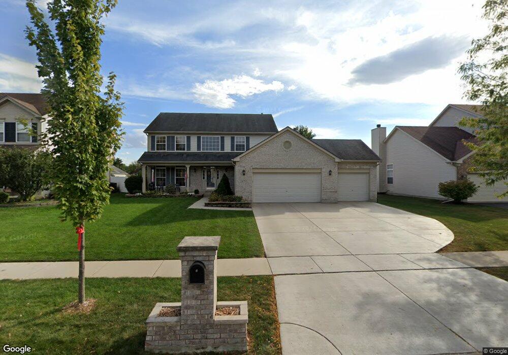
694 Manhattan Cir Unit 2 Oswego, IL 60543
Northwest Oswego NeighborhoodEstimated Value: $446,000 - $478,998
4
Beds
3
Baths
2,755
Sq Ft
$167/Sq Ft
Est. Value
About This Home
This home is located at 694 Manhattan Cir Unit 2, Oswego, IL 60543 and is currently estimated at $460,250, approximately $167 per square foot. 694 Manhattan Cir Unit 2 is a home located in Kendall County with nearby schools including Fox Chase Elementary School, Traughber Junior High School, and Oswego High School.
Ownership History
Date
Name
Owned For
Owner Type
Purchase Details
Closed on
Dec 17, 2004
Sold by
Richard Smykal Inc
Bought by
Hahn Jeffrey A and Hahn Kristin A
Current Estimated Value
Home Financials for this Owner
Home Financials are based on the most recent Mortgage that was taken out on this home.
Original Mortgage
$252,900
Outstanding Balance
$127,579
Interest Rate
5.84%
Mortgage Type
Purchase Money Mortgage
Estimated Equity
$332,671
Create a Home Valuation Report for This Property
The Home Valuation Report is an in-depth analysis detailing your home's value as well as a comparison with similar homes in the area
Home Values in the Area
Average Home Value in this Area
Purchase History
| Date | Buyer | Sale Price | Title Company |
|---|---|---|---|
| Hahn Jeffrey A | $316,500 | Chicago Title Insurance Co |
Source: Public Records
Mortgage History
| Date | Status | Borrower | Loan Amount |
|---|---|---|---|
| Open | Hahn Jeffrey A | $252,900 |
Source: Public Records
Tax History Compared to Growth
Tax History
| Year | Tax Paid | Tax Assessment Tax Assessment Total Assessment is a certain percentage of the fair market value that is determined by local assessors to be the total taxable value of land and additions on the property. | Land | Improvement |
|---|---|---|---|---|
| 2024 | $10,525 | $136,793 | $25,312 | $111,481 |
| 2023 | $9,487 | $121,056 | $22,400 | $98,656 |
| 2022 | $9,487 | $111,060 | $20,550 | $90,510 |
| 2021 | $9,430 | $106,789 | $19,760 | $87,029 |
| 2020 | $9,135 | $102,682 | $19,000 | $83,682 |
| 2019 | $8,972 | $99,464 | $19,000 | $80,464 |
| 2018 | $8,973 | $98,760 | $25,664 | $73,096 |
| 2017 | $8,673 | $90,606 | $23,545 | $67,061 |
| 2016 | $8,525 | $87,967 | $22,859 | $65,108 |
| 2015 | $8,398 | $82,988 | $21,565 | $61,423 |
| 2014 | -- | $78,290 | $20,344 | $57,946 |
| 2013 | -- | $79,080 | $20,549 | $58,531 |
Source: Public Records
Map
Nearby Homes
- 409 Fawn Dr
- 435 Fawn Dr
- 805 Cougar Ln
- 107 Kristine St
- 458 Greenview Ln
- 602 Clearwater Ct Unit 2
- 608 Clearwater Ct
- 338 Millstream Ln Unit 1
- 2100 Light Rd Unit 109
- 238 Willowwood Dr
- 2300 Light Rd Unit 209
- 2600 Light Rd Unit 210
- 1415 State Route 31
- 505 Parkland Ct
- 514 Bentson St
- 125 Presidential Blvd Unit 3248
- 7.43 Acres Vacant La State Route 31
- 11-13 W Anchor Rd
- 141 River Mist Dr
- 2110 State Route 31
- 696 Manhattan Cir
- 692 Manhattan Cir Unit 2
- 407 Fawn Dr
- 405 Fawn Dr
- 698 Manhattan Cir Unit 2
- 690 Manhattan Cir Unit 2
- 403 Fawn Dr
- 695 Manhattan Cir Unit 2
- 693 Manhattan Cir Unit 2
- 697 Manhattan Cir
- 688 Manhattan Cir Unit 2
- 411 Fawn Dr
- 401 Fawn Dr
- 699 Manhattan Cir
- 689 Manhattan Cir
- 413 Fawn Dr Unit 6
- 701 Manhattan Cir Unit 2
- 702 Manhattan Cir Unit 2
- 686 Manhattan Cir
- 687 Manhattan Cir