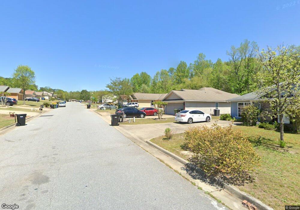
694 Upland Ct Columbus, GA 31907
Eastern Columbus NeighborhoodEstimated Value: $171,680 - $188,000
3
Beds
2
Baths
1,346
Sq Ft
$135/Sq Ft
Est. Value
About This Home
This home is located at 694 Upland Ct, Columbus, GA 31907 and is currently estimated at $181,170, approximately $134 per square foot. 694 Upland Ct is a home located in Muscogee County with nearby schools including Georgetown Elementary School, East Columbus Magnet Academy, and Kendrick High School.
Ownership History
Date
Name
Owned For
Owner Type
Purchase Details
Closed on
Mar 13, 2020
Sold by
Windsong Bonacre Llc
Bought by
Hewell Sherwood
Current Estimated Value
Home Financials for this Owner
Home Financials are based on the most recent Mortgage that was taken out on this home.
Original Mortgage
$94,627
Outstanding Balance
$83,598
Interest Rate
3.37%
Mortgage Type
FHA
Estimated Equity
$97,572
Purchase Details
Closed on
May 6, 2011
Sold by
Erickson David B
Bought by
Windsong Bonacre Llc
Purchase Details
Closed on
Dec 30, 2009
Sold by
Grayhawk Homes Inc
Bought by
Erickson David B
Create a Home Valuation Report for This Property
The Home Valuation Report is an in-depth analysis detailing your home's value as well as a comparison with similar homes in the area
Home Values in the Area
Average Home Value in this Area
Purchase History
| Date | Buyer | Sale Price | Title Company |
|---|---|---|---|
| Hewell Sherwood | $104,900 | -- | |
| Windsong Bonacre Llc | $2,520,000 | -- | |
| Erickson David B | $96,500 | None Available |
Source: Public Records
Mortgage History
| Date | Status | Borrower | Loan Amount |
|---|---|---|---|
| Open | Hewell Sherwood | $94,627 |
Source: Public Records
Tax History Compared to Growth
Tax History
| Year | Tax Paid | Tax Assessment Tax Assessment Total Assessment is a certain percentage of the fair market value that is determined by local assessors to be the total taxable value of land and additions on the property. | Land | Improvement |
|---|---|---|---|---|
| 2025 | $1,126 | $52,860 | $13,160 | $39,700 |
| 2024 | $1,125 | $52,860 | $13,160 | $39,700 |
| 2023 | $438 | $52,860 | $13,160 | $39,700 |
| 2022 | $1,173 | $44,888 | $13,160 | $31,728 |
| 2021 | $1,167 | $41,960 | $11,960 | $30,000 |
| 2020 | $1,886 | $46,168 | $13,160 | $33,008 |
| 2019 | $1,892 | $46,168 | $13,160 | $33,008 |
| 2018 | $1,892 | $46,168 | $13,160 | $33,008 |
| 2017 | $1,898 | $46,168 | $13,160 | $33,008 |
| 2016 | $1,999 | $48,456 | $12,400 | $36,056 |
| 2015 | $2,001 | $48,456 | $12,400 | $36,056 |
| 2014 | $2,004 | $48,456 | $12,400 | $36,056 |
| 2013 | -- | $48,456 | $12,400 | $36,056 |
Source: Public Records
Map
Nearby Homes
- 650 Upland Ct
- 752 Wilder Dr
- 719 Wilder Dr
- 727 Wilder Dr
- 908 Arlington Dr
- 736 Belvedere Dr
- 5532 Buena Vista Rd
- 754 Red Oak Dr
- 5526 Buena Vista Rd
- 5828 Georgetown Dr
- 6416 Sandy Bottom Dr
- 5235 Vincent Dr
- 5833 Bunche St
- 5529 Pollman St
- 1252 School House Dr
- 822 Reaper Ln
- 6223 Georgetown Dr
- 4722 Pollman St
- 5542 Teresa St
- 1111 Richland Dr
- 690 Upland Ct
- 698 Upland Ct
- 686 Upland Ct
- 0 Upland Ct Unit 7604260
- 0 Upland Ct Unit 7578341
- 0 Upland Ct Unit 7569067
- 0 Upland Ct Unit 8413977
- 0 Upland Ct Unit 8037578
- 689 Upland Ct
- 682 Upland Ct
- 685 Upland Ct
- 693 Upland Ct
- 681 Upland Ct
- 700 Upland Ct Unit 1
- 700 Upland Ct
- 697 Upland Ct
- 678 Upland Ct
- 677 Upland Ct
- 701 Upland Ct
- 633 Asa Dr