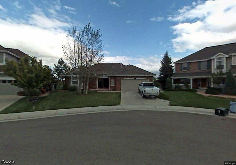
6942 Hampton Ct Castle Pines, CO 80108
Estimated Value: $757,295 - $867,000
3
Beds
2
Baths
2,130
Sq Ft
$380/Sq Ft
Est. Value
About This Home
This home is located at 6942 Hampton Ct, Castle Pines, CO 80108 and is currently estimated at $809,074, approximately $379 per square foot. 6942 Hampton Ct is a home located in Douglas County with nearby schools including Buffalo Ridge Elementary School, Rocky Heights Middle School, and Rock Canyon High School.
Ownership History
Date
Name
Owned For
Owner Type
Purchase Details
Closed on
Dec 30, 1999
Sold by
Phillips Joel R and Phillips Andrea A
Bought by
Martin Johnney E and Martin Kathy S
Current Estimated Value
Home Financials for this Owner
Home Financials are based on the most recent Mortgage that was taken out on this home.
Original Mortgage
$243,600
Outstanding Balance
$73,210
Interest Rate
7.12%
Estimated Equity
$735,864
Purchase Details
Closed on
Jan 31, 1996
Sold by
The Writer Corp
Bought by
Phillips Joel R and Phillips Andrea A
Create a Home Valuation Report for This Property
The Home Valuation Report is an in-depth analysis detailing your home's value as well as a comparison with similar homes in the area
Home Values in the Area
Average Home Value in this Area
Purchase History
| Date | Buyer | Sale Price | Title Company |
|---|---|---|---|
| Martin Johnney E | $304,500 | Land Title | |
| Phillips Joel R | $262,109 | Land Title |
Source: Public Records
Mortgage History
| Date | Status | Borrower | Loan Amount |
|---|---|---|---|
| Open | Martin Johnney E | $243,600 |
Source: Public Records
Tax History Compared to Growth
Tax History
| Year | Tax Paid | Tax Assessment Tax Assessment Total Assessment is a certain percentage of the fair market value that is determined by local assessors to be the total taxable value of land and additions on the property. | Land | Improvement |
|---|---|---|---|---|
| 2024 | $4,702 | $57,840 | $13,770 | $44,070 |
| 2023 | $4,747 | $57,840 | $13,770 | $44,070 |
| 2022 | $3,375 | $41,910 | $9,540 | $32,370 |
| 2021 | $3,508 | $41,910 | $9,540 | $32,370 |
| 2020 | $3,396 | $40,740 | $9,210 | $31,530 |
| 2019 | $3,407 | $40,740 | $9,210 | $31,530 |
| 2018 | $2,955 | $35,910 | $9,710 | $26,200 |
| 2017 | $2,776 | $35,910 | $9,710 | $26,200 |
| 2016 | $3,016 | $35,350 | $9,610 | $25,740 |
| 2015 | $3,351 | $35,350 | $9,610 | $25,740 |
| 2014 | $2,915 | $30,680 | $8,700 | $21,980 |
Source: Public Records
Map
Nearby Homes
- 252 Huntley Ct
- 7207 Shoreham Dr
- 6810 Brendon Place
- 7218 Campden Place
- 7263 Wembley Place
- 18 Brixham Ct
- 166 Green Fee Cir
- 6456 Kenzie Cir
- 154 Back Nine Dr
- 6488 Kenzie Cir
- 6299 Ellingwood Point Place
- 7412 Berkeley Ct
- 6371 Kenzie Cir
- 6488 Braylin Ln
- 7369 Norfolk Place
- 100 Stinson Place
- 577 Clarendon Loop
- 6280 Oxford Peak Place
- 6111 Huron Place
- 7153 Othello St
- 6952 Hampton Ct
- 6932 Hampton Ct
- 6962 Hampton Ct
- 6922 Hampton Ct
- 6921 Hampton Ct
- 6912 Hampton Ct
- 6911 Hampton Ct
- 250 Shoreham Cir
- 6981 Hampton Ct
- 6902 Hampton Ct
- 6982 Hampton Ct
- 259 Hardwick Ct
- 260 Shoreham Cir
- 212 Durham Ct
- 269 Hardwick Ct
- 6992 Hampton Ct
- 201 Durham Ct
- 270 Shoreham Cir
- 6970 Welford Place
- 224 Durham Ct