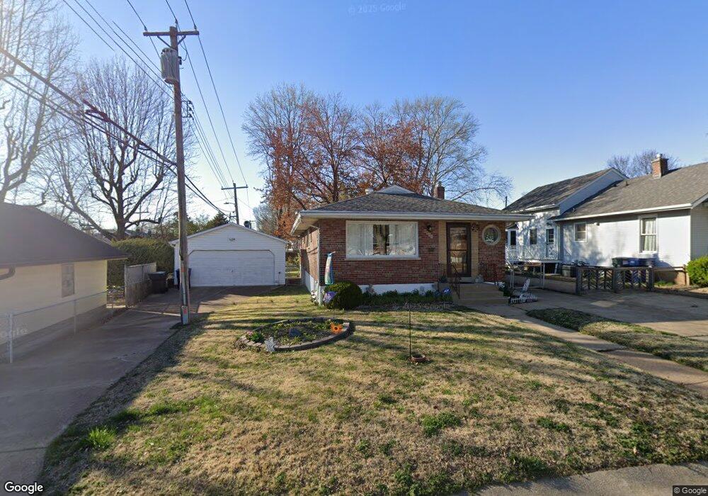
6945 Sharp Ave Saint Louis, MO 63116
Boulevard Heights NeighborhoodEstimated Value: $169,808 - $228,000
Studio
1
Bath
1,920
Sq Ft
$106/Sq Ft
Est. Value
About This Home
This home is located at 6945 Sharp Ave, Saint Louis, MO 63116 and is currently estimated at $203,702, approximately $106 per square foot. 6945 Sharp Ave is a home located in St. Louis City with nearby schools including Woerner Elementary School, Long International Middle School, and Roosevelt High School.
Create a Home Valuation Report for This Property
The Home Valuation Report is an in-depth analysis detailing your home's value as well as a comparison with similar homes in the area
Home Values in the Area
Average Home Value in this Area
Tax History
| Year | Tax Paid | Tax Assessment Tax Assessment Total Assessment is a certain percentage of the fair market value that is determined by local assessors to be the total taxable value of land and additions on the property. | Land | Improvement |
|---|---|---|---|---|
| 2025 | $2,775 | $37,420 | $3,170 | $34,250 |
| 2024 | $2,651 | $32,950 | $3,170 | $29,780 |
| 2023 | $2,651 | $32,950 | $3,170 | $29,780 |
| 2022 | $2,468 | $29,520 | $3,170 | $26,350 |
| 2021 | $2,465 | $29,520 | $3,170 | $26,350 |
| 2020 | $2,250 | $27,130 | $3,170 | $23,960 |
| 2019 | $2,242 | $27,130 | $3,170 | $23,960 |
| 2018 | $2,095 | $24,550 | $2,830 | $21,720 |
| 2017 | $2,060 | $24,550 | $2,830 | $21,720 |
| 2016 | $1,999 | $23,520 | $2,830 | $20,690 |
| 2015 | $1,813 | $23,520 | $2,830 | $20,690 |
| 2014 | $1,763 | $23,520 | $2,830 | $20,690 |
| 2013 | -- | $22,880 | $2,830 | $20,050 |
Source: Public Records
Map
Nearby Homes
- 4028 Blow St
- 4050 Quincy St
- 4056 Quincy St
- 7119 Trainor Place
- 7123 Trainor Place
- 7316 Sharp Ave
- 6623 Leona St
- 7337 Sharp Ave
- 4153 Loughborough Ave
- 3761 Blow St
- 4317 Alma Ave
- 6149 Marwinette Ave
- 7320 Eugene Ave
- 4301 Holly Hills Blvd
- 6462 Wanda Ave
- 5321 Tesson Ct
- 6135 Newport Ave
- 6136 Adkins Ave
- 3839 Federer Place
- 3619 Steins St
Your Personal Tour Guide
Ask me questions while you tour the home.