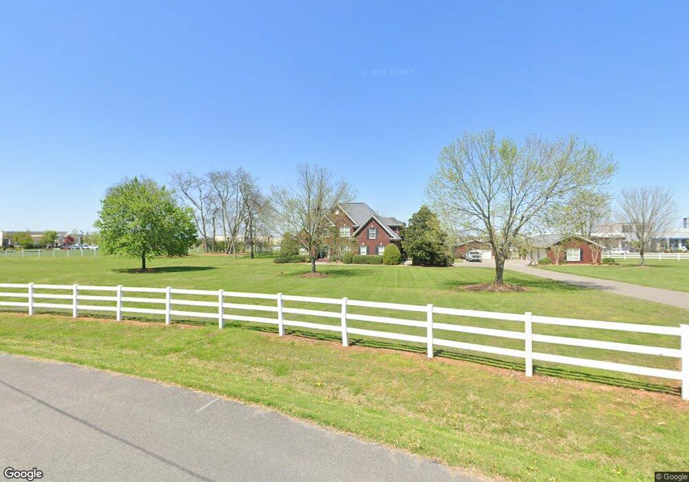
696 Spike Trail Murfreesboro, TN 37129
Estimated Value: $2,132,000
--
Bed
2
Baths
18,008
Sq Ft
$118/Sq Ft
Est. Value
About This Home
This home is located at 696 Spike Trail, Murfreesboro, TN 37129 and is currently priced at $2,132,000, approximately $118 per square foot. 696 Spike Trail is a home located in Rutherford County with nearby schools including Blackman Elementary School, Blackman Middle School, and Blackman High School.
Ownership History
Date
Name
Owned For
Owner Type
Purchase Details
Closed on
Oct 19, 2016
Sold by
Smith Clarissa D and Smith Janice H
Bought by
Murfreesboro Hospitality Llc
Current Estimated Value
Purchase Details
Closed on
Jul 11, 2016
Sold by
Twin B Farm L P
Bought by
Smith Clarissa D
Purchase Details
Closed on
Jun 3, 2016
Sold by
Twin B Farm Lp
Bought by
Fortress Blvd Holdings Llc
Purchase Details
Closed on
May 9, 2016
Sold by
Smith Clarissa D
Bought by
Tt Of Gm Murfreesboro Property Llc
Purchase Details
Closed on
Jun 28, 2013
Sold by
Smith Clarissa D
Bought by
Tt Of Gm Murfreesboro Property
Purchase Details
Closed on
Mar 21, 2003
Sold by
Smith Charles B
Bought by
Twin B Farm Lp
Create a Home Valuation Report for This Property
The Home Valuation Report is an in-depth analysis detailing your home's value as well as a comparison with similar homes in the area
Home Values in the Area
Average Home Value in this Area
Purchase History
| Date | Buyer | Sale Price | Title Company |
|---|---|---|---|
| Murfreesboro Hospitality Llc | $1,518,015 | None Available | |
| Smith Clarissa D | -- | None Available | |
| Fortress Blvd Holdings Llc | $862,794 | -- | |
| Tt Of Gm Murfreesboro Property Llc | -- | -- | |
| Tt Of Gm Murfreesboro Property | $2,790,018 | -- | |
| Twin B Farm Lp | -- | -- |
Source: Public Records
Tax History Compared to Growth
Tax History
| Year | Tax Paid | Tax Assessment Tax Assessment Total Assessment is a certain percentage of the fair market value that is determined by local assessors to be the total taxable value of land and additions on the property. | Land | Improvement |
|---|---|---|---|---|
| 2025 | -- | $4,400,000 | $730,920 | $3,669,080 |
| 2024 | -- | $4,400,000 | $730,920 | $3,669,080 |
| 2023 | $82,553 | $4,400,000 | $730,920 | $3,669,080 |
| 2022 | $71,113 | $4,400,000 | $730,920 | $3,669,080 |
| 2021 | $26,011 | $609,120 | $609,120 | $0 |
| 2020 | $13,519 | $609,120 | $609,120 | $0 |
| 2019 | $8,449 | $380,700 | $380,700 | $0 |
Source: Public Records
Map
Nearby Homes
- 3750 Chippewa Place
- 1036 Wolves Den Place
- 1022 Sitting Bull Crossing
- 621 Buck Ln
- 3718 Red Willow Ct
- 1028 Shaman Crossing
- 928 Sitting Bull Crossing
- 924 Sitting Bull Crossing
- 3726 Selina Dr
- 913 Battleview Place
- 3927 Cannonsgate Ln
- 4010 Cannonsgate Ln
- 3741 Southbend Dr
- 917 Round Dr
- 2842 Grange Place
- 478 Deerfield Dr
- 2747 Brookrun Rd
- 920 Manson Crossing Dr
- 929 Manson Crossing Dr
- 411 Campfire Dr
- 701 Spike Trail
- 670 Spike Trail
- 705 Spike Trail
- 707 Spike Trail
- 664 Spike Trail
- 663 Spike Trail
- 1120 Fortress Blvd
- 713 Spike Trail
- 712 Spike Trail
- 660 Spike Trail
- 960 John Rice Blvd Unit 72
- 720 Spike Trail
- 653 Spike Trail
- 719 Spike Trail
- 658 Spike Trail
- 724 Spike Trail
- 645 Spike Trail
- 725 Spike Trail
- 793 Rack Ct
- 621 Doe Dr