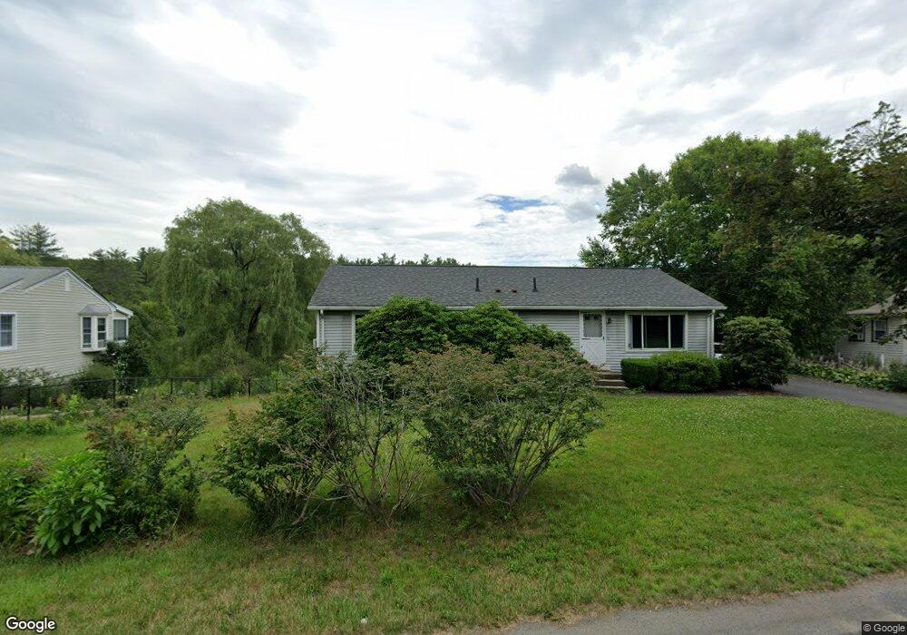
697 Bernardston Rd Greenfield, MA 01301
Estimated Value: $337,000 - $387,288
3
Beds
2
Baths
1,344
Sq Ft
$266/Sq Ft
Est. Value
About This Home
This home is located at 697 Bernardston Rd, Greenfield, MA 01301 and is currently estimated at $357,822, approximately $266 per square foot. 697 Bernardston Rd is a home located in Franklin County with nearby schools including Greenfield Center School, Cornerstone Christian School, and Holy Trinity School.
Ownership History
Date
Name
Owned For
Owner Type
Purchase Details
Closed on
Nov 18, 1999
Sold by
Mastrototaro Mauro and Mastrototaro Antonina
Bought by
Karieva Kent and Macewan-Karieva Debra
Current Estimated Value
Home Financials for this Owner
Home Financials are based on the most recent Mortgage that was taken out on this home.
Original Mortgage
$103,824
Interest Rate
7.76%
Mortgage Type
Purchase Money Mortgage
Purchase Details
Closed on
Sep 17, 1997
Sold by
Misiek-Rudolph Joy A
Bought by
Mastrototaro Mauro and Mastrototaro Antonina
Purchase Details
Closed on
Apr 15, 1992
Sold by
Renfrew Fred R and Renfrew Helen K
Bought by
Rudolph Joseph A and Rudolph Joy A M
Create a Home Valuation Report for This Property
The Home Valuation Report is an in-depth analysis detailing your home's value as well as a comparison with similar homes in the area
Home Values in the Area
Average Home Value in this Area
Purchase History
| Date | Buyer | Sale Price | Title Company |
|---|---|---|---|
| Karieva Kent | $112,000 | -- | |
| Karieva Kent V | $112,000 | -- | |
| Mastrototaro Mauro | $110,000 | -- | |
| Mastrototaro Mauro | $110,000 | -- | |
| Rudolph Joseph A | $130,000 | -- | |
| Rudolph Joseph A | $130,000 | -- |
Source: Public Records
Mortgage History
| Date | Status | Borrower | Loan Amount |
|---|---|---|---|
| Open | Rudolph Joseph A | $152,000 | |
| Closed | Rudolph Joseph A | $101,600 | |
| Closed | Rudolph Joseph A | $103,824 |
Source: Public Records
Tax History Compared to Growth
Tax History
| Year | Tax Paid | Tax Assessment Tax Assessment Total Assessment is a certain percentage of the fair market value that is determined by local assessors to be the total taxable value of land and additions on the property. | Land | Improvement |
|---|---|---|---|---|
| 2025 | $5,553 | $283,900 | $93,400 | $190,500 |
| 2024 | $5,677 | $278,400 | $84,800 | $193,600 |
| 2023 | $5,168 | $263,000 | $84,800 | $178,200 |
| 2022 | $5,154 | $230,900 | $80,700 | $150,200 |
| 2021 | $5,006 | $215,600 | $78,400 | $137,200 |
| 2020 | $4,664 | $203,400 | $78,400 | $125,000 |
| 2019 | $4,349 | $194,500 | $68,300 | $126,200 |
| 2018 | $4,322 | $192,700 | $66,800 | $125,900 |
| 2017 | $4,187 | $192,700 | $66,800 | $125,900 |
| 2016 | $4,196 | $192,400 | $65,700 | $126,700 |
| 2015 | $4,032 | $179,100 | $63,800 | $115,300 |
| 2014 | $3,681 | $179,300 | $63,800 | $115,500 |
Source: Public Records
Map
Nearby Homes
- 695 Bernardston Rd
- 703 Bernardston Rd
- 696 Bernardston Rd
- 687 Bernardston Rd
- 717 Bernardston Rd
- 10 Meadowood Dr
- 686 Bernardston Rd
- 712 Bernardston Rd
- 675 Bernardston Rd
- 723 Bernardston Rd
- 676 Bernardston Rd
- 720 Bernardston Rd
- 671 Bernardston Rd
- 729 Bernardston Rd
- 680 Bernardston Rd
- 678 Bernardston Rd
- 731 Bernardston Rd
- 668 Bernardston Rd
- 735 Bernardston Rd
- 661 Bernardston Rd